Jennings Topo Map Louisiana
To zoom in, hover over the map of Jennings
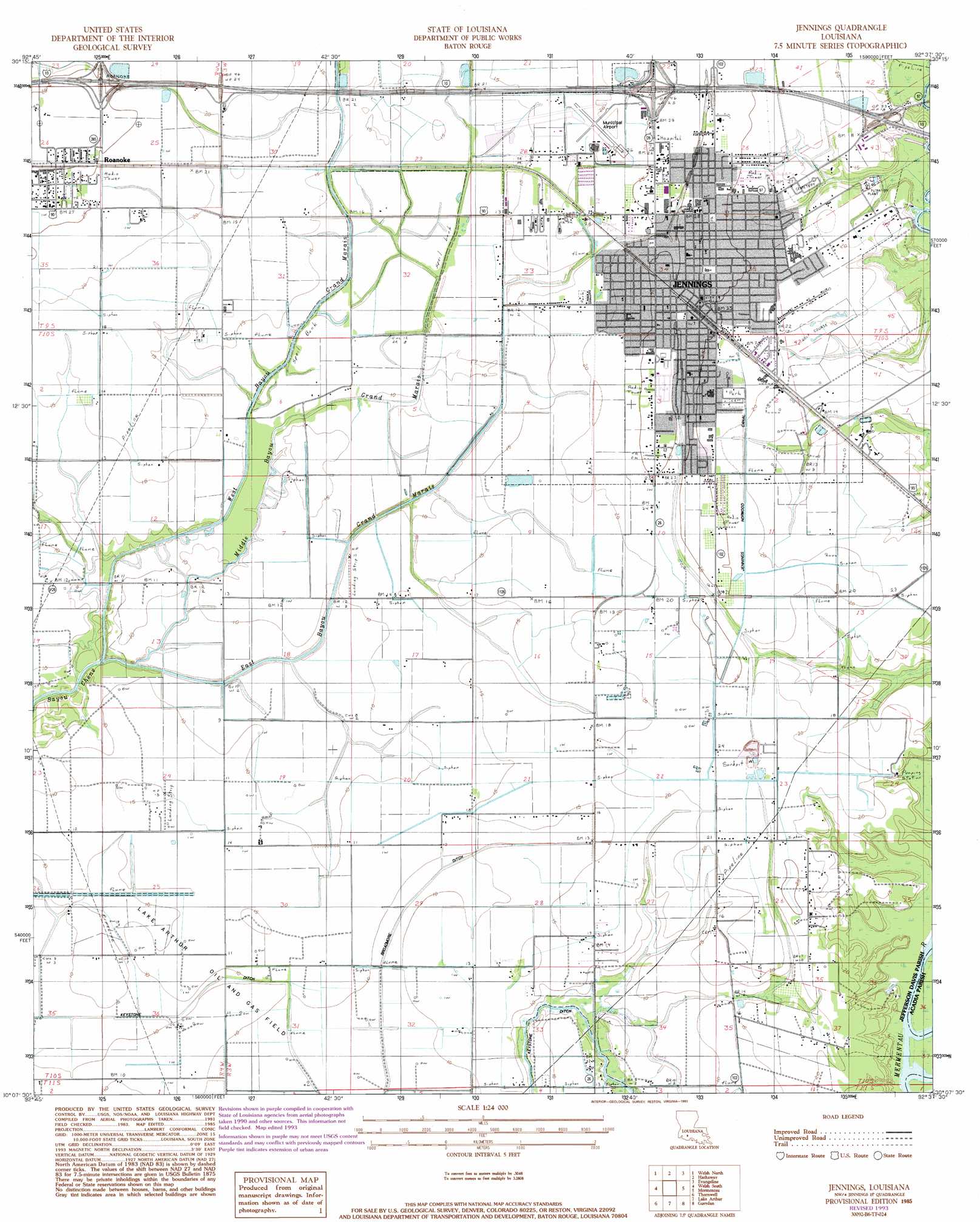
USGS Topo Quad 30092b6 - 1:24,000 scale
| Topo Map Name: | Jennings |
| USGS Topo Quad ID: | 30092b6 |
| Print Size: | ca. 21 1/4" wide x 27" high |
| Southeast Coordinates: | 30.125° N latitude / 92.625° W longitude |
| Map Center Coordinates: | 30.1875° N latitude / 92.6875° W longitude |
| U.S. State: | LA |
| Filename: | o30092b6.jpg |
| Download Map JPG Image: | Jennings topo map 1:24,000 scale |
| Map Type: | Topographic |
| Topo Series: | 7.5´ |
| Map Scale: | 1:24,000 |
| Source of Map Images: | United States Geological Survey (USGS) |
| Alternate Map Versions: |
Jennings LA 1985, updated 1985 Download PDF Buy paper map Jennings LA 1985, updated 1993 Download PDF Buy paper map Jennings LA 2012 Download PDF Buy paper map Jennings LA 2015 Download PDF Buy paper map |
1:24,000 Topo Quads surrounding Jennings
Indian Village |
Kinder |
Elton |
Basile |
Eunice South |
Fenton |
Welsh North |
Hathaway |
Evangeline |
Iota |
Lacassine |
Welsh South |
Jennings |
Mermentau |
Crowley West |
Hayes |
Thornwell |
Lake Arthur |
Gueydan |
Wright |
Lake Misere |
Latania Lake |
Mallard Bay |
Latanier Bayou |
Forked Island Nw |
> Back to 30092a1 at 1:100,000 scale
> Back to 30092a1 at 1:250,000 scale
> Back to U.S. Topo Maps home
Jennings topo map: Gazetteer
Jennings: Airports
Jennings Airport elevation 5m 16′Jennings: Canals
Broadmore Ditch elevation 2m 6′Jennings Norwood Canal elevation 6m 19′
Keystone Ditch elevation 2m 6′
Sturdivant Canal elevation 2m 6′
Tiptop Canal elevation 6m 19′
West Grand Marais Ditch elevation 2m 6′
Jennings: Crossings
Interchange 59 elevation 8m 26′Interchange 64 elevation 8m 26′
Interchange 65 elevation 5m 16′
Jennings: Oilfields
East Lake Arthur Gas Field elevation 5m 16′Lake Arthur Oil and Gas Field elevation 2m 6′
South Jennings Oil and Gas Field elevation 6m 19′
Jennings: Parks
North Cutting Park elevation 8m 26′Oil and Gas Park elevation 7m 22′
Peters Street Playground elevation 6m 19′
War Memorial Park elevation 7m 22′
West End Park elevation 5m 16′
Jennings: Populated Places
Jennings elevation 8m 26′Roanoke elevation 8m 26′
Jennings: Post Offices
Jennings Post Office elevation 8m 26′Roanoke Post Office elevation 8m 26′
Jennings: Streams
East Bayou Grand Marais elevation 3m 9′Middle Bayou Grand Marais elevation 1m 3′
West Bayou Grand Marais elevation 2m 6′
Jennings digital topo map on disk
Buy this Jennings topo map showing relief, roads, GPS coordinates and other geographical features, as a high-resolution digital map file on DVD: