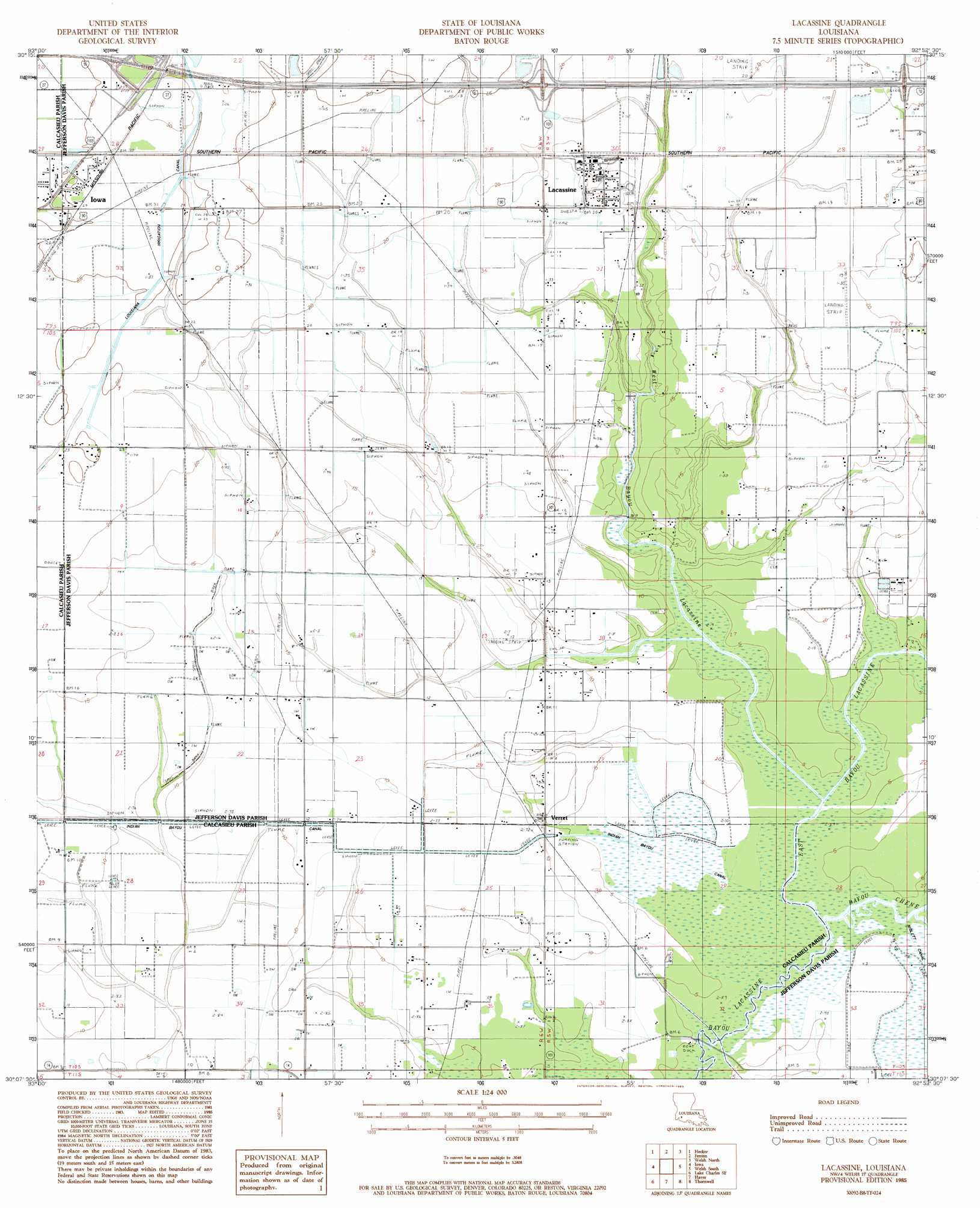
Lacassine Topo Map Louisiana
To zoom in, hover over the map of Lacassine
USGS Topo Quad 30092b8 - 1:24,000 scale
| Topo Map Name: | Lacassine |
| USGS Topo Quad ID: | 30092b8 |
| Print Size: | ca. 21 1/4" wide x 27" high |
| Southeast Coordinates: | 30.125° N latitude / 92.875° W longitude |
| Map Center Coordinates: | 30.1875° N latitude / 92.9375° W longitude |
| U.S. State: | LA |
| Filename: | o30092b8.jpg |
| Download Map JPG Image: | Lacassine topo map 1:24,000 scale |
| Map Type: | Topographic |
| Topo Series: | 7.5´ |
| Map Scale: | 1:24,000 |
| Source of Map Images: | United States Geological Survey (USGS) |
| Alternate Map Versions: |
Lacassine LA 1985, updated 1985 Download PDF Buy paper map Lacassine LA 1985, updated 1985 Download PDF Buy paper map Lacassine LA 2012 Download PDF Buy paper map Lacassine LA 2015 Download PDF Buy paper map |
1:24,000 Topo Quads surrounding Lacassine
Gaytine |
Topsy |
Indian Village |
Kinder |
Elton |
Moss Bluff |
Hecker |
Fenton |
Welsh North |
Hathaway |
Lake Charles |
Iowa |
Lacassine |
Welsh South |
Jennings |
Lake Charles Sw |
Lake Charles Se |
Hayes |
Thornwell |
Lake Arthur |
Sweet Lake |
Boudreaux Lake |
Lake Misere |
Latania Lake |
Mallard Bay |
> Back to 30092a1 at 1:100,000 scale
> Back to 30092a1 at 1:250,000 scale
> Back to U.S. Topo Maps home
Lacassine topo map: Gazetteer
Lacassine: Crossings
Interchange 44 elevation 9m 29′Interchange 48 elevation 7m 22′
Lacassine: Oilfields
Bon Air Oil Field elevation 3m 9′East Bell City Gas Field elevation 3m 9′
North Hayes Gas Field elevation 3m 9′
Northeast Bon Air Gas Field elevation 6m 19′
South Iowa Oil Field elevation 6m 19′
Southeast Iowa Gas Field elevation 8m 26′
Lacassine: Populated Places
Foremans Hall elevation 4m 13′Lacassine elevation 6m 19′
Verret elevation 2m 6′
Lacassine: Post Offices
Lacassine Post Office elevation 6m 19′Lacassine: Streams
Bayou Chene elevation 2m 6′East Bayou Lacassine elevation 0m 0′
West Bayou Lacassine elevation 0m 0′
Lacassine digital topo map on disk
Buy this Lacassine topo map showing relief, roads, GPS coordinates and other geographical features, as a high-resolution digital map file on DVD: