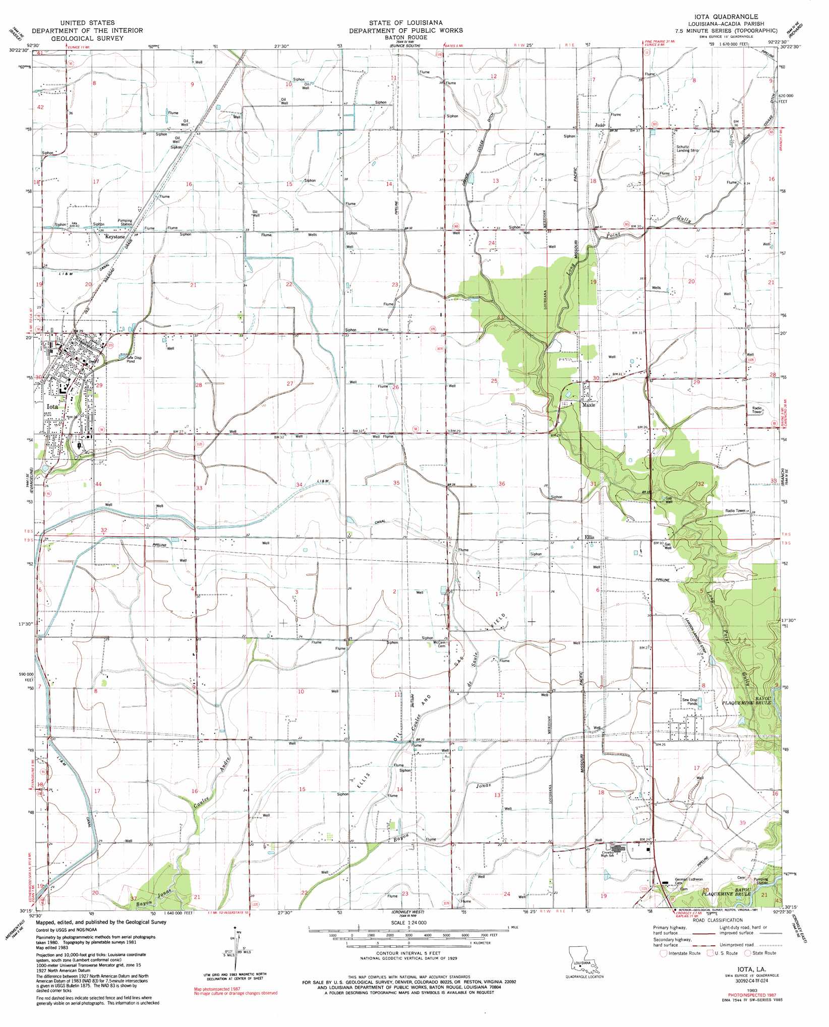
Iota Topo Map Louisiana
To zoom in, hover over the map of Iota
USGS Topo Quad 30092c4 - 1:24,000 scale
| Topo Map Name: | Iota |
| USGS Topo Quad ID: | 30092c4 |
| Print Size: | ca. 21 1/4" wide x 27" high |
| Southeast Coordinates: | 30.25° N latitude / 92.375° W longitude |
| Map Center Coordinates: | 30.3125° N latitude / 92.4375° W longitude |
| U.S. State: | LA |
| Filename: | o30092c4.jpg |
| Download Map JPG Image: | Iota topo map 1:24,000 scale |
| Map Type: | Topographic |
| Topo Series: | 7.5´ |
| Map Scale: | 1:24,000 |
| Source of Map Images: | United States Geological Survey (USGS) |
| Alternate Map Versions: |
Iota LA 1983, updated 1983 Download PDF Buy paper map Iota LA 1983, updated 1991 Download PDF Buy paper map Iota LA 2012 Download PDF Buy paper map Iota LA 2015 Download PDF Buy paper map |
1:24,000 Topo Quads surrounding Iota
Soileau |
Duralde |
Eunice North |
Chataignier |
Lawtell |
Elton |
Basile |
Eunice South |
Richard |
Church Point |
Hathaway |
Evangeline |
Iota |
Branch |
Mire |
Jennings |
Mermentau |
Crowley West |
Crowley East |
Duson |
Lake Arthur |
Gueydan |
Wright |
Kaplan North |
Leroy |
> Back to 30092a1 at 1:100,000 scale
> Back to 30092a1 at 1:250,000 scale
> Back to U.S. Topo Maps home
Iota topo map: Gazetteer
Iota: Airports
Lawson Field elevation 8m 26′Reed Flying Service Incorporated Airport elevation 10m 32′
Schultz Landing Strip elevation 11m 36′
Iota: Oilfields
Grand Coulee Oil and Gas Field elevation 11m 36′Llis Oil and Gas Field elevation 7m 22′
Maxie Oil and Gas Field elevation 8m 26′
Iota: Populated Places
Ellis elevation 9m 29′Iota elevation 9m 29′
Judd elevation 11m 36′
Keystone elevation 10m 32′
Maxie elevation 9m 29′
Iota: Post Offices
Echo Post Office (historical) elevation 8m 26′Iota: Streams
Coulee Andre elevation 3m 9′Coulee de Saule elevation 2m 6′
Iota digital topo map on disk
Buy this Iota topo map showing relief, roads, GPS coordinates and other geographical features, as a high-resolution digital map file on DVD: