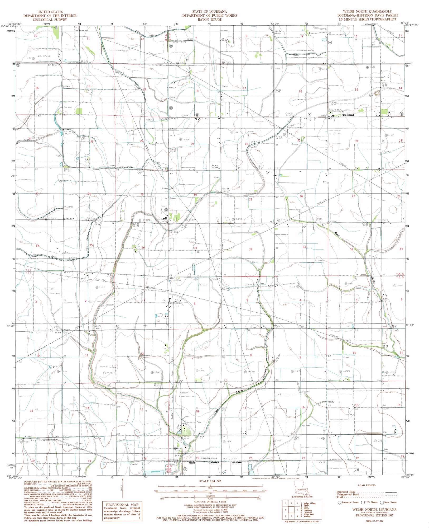
Welsh North Topo Map Louisiana
To zoom in, hover over the map of Welsh North
USGS Topo Quad 30092c7 - 1:24,000 scale
| Topo Map Name: | Welsh North |
| USGS Topo Quad ID: | 30092c7 |
| Print Size: | ca. 21 1/4" wide x 27" high |
| Southeast Coordinates: | 30.25° N latitude / 92.75° W longitude |
| Map Center Coordinates: | 30.3125° N latitude / 92.8125° W longitude |
| U.S. State: | LA |
| Filename: | o30092c7.jpg |
| Download Map JPG Image: | Welsh North topo map 1:24,000 scale |
| Map Type: | Topographic |
| Topo Series: | 7.5´ |
| Map Scale: | 1:24,000 |
| Source of Map Images: | United States Geological Survey (USGS) |
| Alternate Map Versions: |
Welsh North LA 1985, updated 1985 Download PDF Buy paper map Welsh North LA 1994, updated 1996 Download PDF Buy paper map Welsh North LA 2012 Download PDF Buy paper map Welsh North LA 2015 Download PDF Buy paper map |
1:24,000 Topo Quads surrounding Welsh North
Reeves |
Le Blanc |
Oberlin |
Soileau |
Duralde |
Topsy |
Indian Village |
Kinder |
Elton |
Basile |
Hecker |
Fenton |
Welsh North |
Hathaway |
Evangeline |
Iowa |
Lacassine |
Welsh South |
Jennings |
Mermentau |
Lake Charles Se |
Hayes |
Thornwell |
Lake Arthur |
Gueydan |
> Back to 30092a1 at 1:100,000 scale
> Back to 30092a1 at 1:250,000 scale
> Back to U.S. Topo Maps home
Welsh North topo map: Gazetteer
Welsh North: Oilfields
North Welsh Gas Field elevation 7m 22′Welsh North: Populated Places
Pine Island elevation 12m 39′Welsh North digital topo map on disk
Buy this Welsh North topo map showing relief, roads, GPS coordinates and other geographical features, as a high-resolution digital map file on DVD: