Basile Topo Map Louisiana
To zoom in, hover over the map of Basile
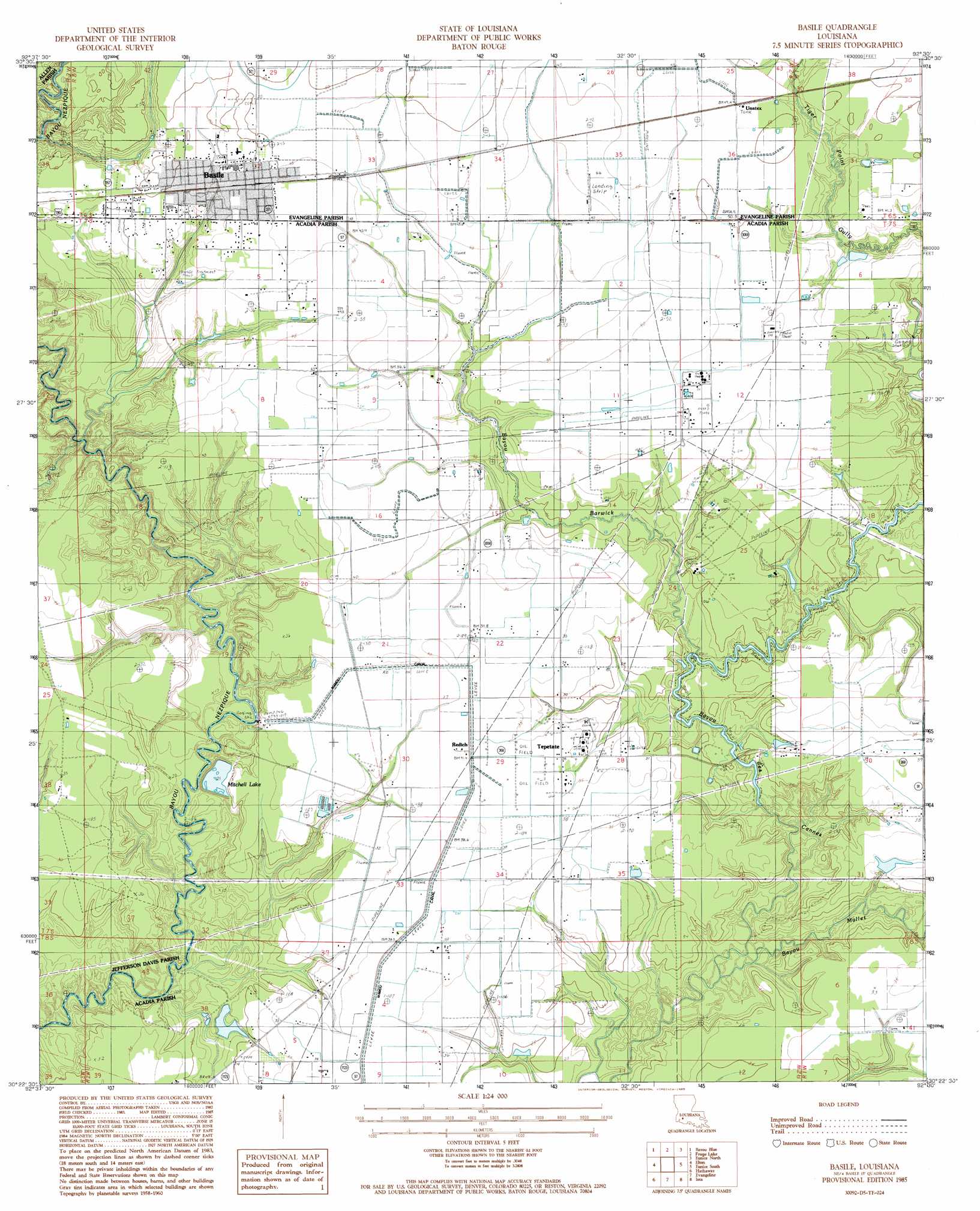
USGS Topo Quad 30092d5 - 1:24,000 scale
| Topo Map Name: | Basile |
| USGS Topo Quad ID: | 30092d5 |
| Print Size: | ca. 21 1/4" wide x 27" high |
| Southeast Coordinates: | 30.375° N latitude / 92.5° W longitude |
| Map Center Coordinates: | 30.4375° N latitude / 92.5625° W longitude |
| U.S. State: | LA |
| Filename: | o30092d5.jpg |
| Download Map JPG Image: | Basile topo map 1:24,000 scale |
| Map Type: | Topographic |
| Topo Series: | 7.5´ |
| Map Scale: | 1:24,000 |
| Source of Map Images: | United States Geological Survey (USGS) |
| Alternate Map Versions: |
Basile LA 1985, updated 1985 Download PDF Buy paper map Basile LA 1985, updated 1985 Download PDF Buy paper map Basile LA 2012 Download PDF Buy paper map Basile LA 2015 Download PDF Buy paper map |
1:24,000 Topo Quads surrounding Basile
Pine Chapel |
Guy |
Bond |
Mamou |
Ville Platte |
Oberlin |
Soileau |
Duralde |
Eunice North |
Chataignier |
Kinder |
Elton |
Basile |
Eunice South |
Richard |
Welsh North |
Hathaway |
Evangeline |
Iota |
Branch |
Welsh South |
Jennings |
Mermentau |
Crowley West |
Crowley East |
> Back to 30092a1 at 1:100,000 scale
> Back to 30092a1 at 1:250,000 scale
> Back to U.S. Topo Maps home
Basile topo map: Gazetteer
Basile: Airports
Millers Flying Service Airport elevation 12m 39′Basile: Canals
Mamou Canal elevation 11m 36′Basile: Oilfields
North Tepetate Oil and Gas Field elevation 12m 39′Tepetate Oil and Gas Field elevation 11m 36′
Basile: Populated Places
Basile elevation 14m 45′Redich elevation 11m 36′
Tepetate elevation 10m 32′
Tyrone elevation 15m 49′
Unatex elevation 15m 49′
Basile: Reservoirs
Mitchell Lake elevation 5m 16′Basile: Streams
Bayou Barwick elevation 8m 26′Bayou Mallet elevation 3m 9′
Berwick Creek elevation 3m 9′
Basile digital topo map on disk
Buy this Basile topo map showing relief, roads, GPS coordinates and other geographical features, as a high-resolution digital map file on DVD: