Duralde Topo Map Louisiana
To zoom in, hover over the map of Duralde
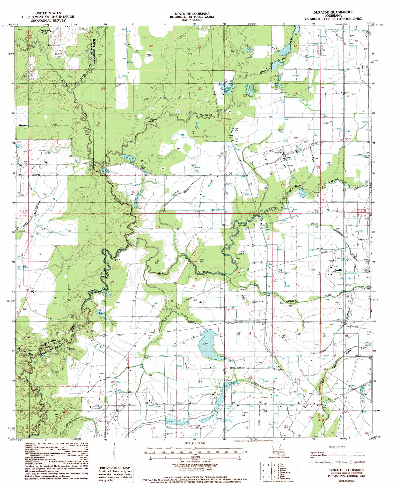
USGS Topo Quad 30092e5 - 1:24,000 scale
| Topo Map Name: | Duralde |
| USGS Topo Quad ID: | 30092e5 |
| Print Size: | ca. 21 1/4" wide x 27" high |
| Southeast Coordinates: | 30.5° N latitude / 92.5° W longitude |
| Map Center Coordinates: | 30.5625° N latitude / 92.5625° W longitude |
| U.S. State: | LA |
| Filename: | o30092e5.jpg |
| Download Map JPG Image: | Duralde topo map 1:24,000 scale |
| Map Type: | Topographic |
| Topo Series: | 7.5´ |
| Map Scale: | 1:24,000 |
| Source of Map Images: | United States Geological Survey (USGS) |
| Alternate Map Versions: |
Duralde LA 1986, updated 1987 Download PDF Buy paper map Duralde LA 2012 Download PDF Buy paper map Duralde LA 2015 Download PDF Buy paper map |
1:24,000 Topo Quads surrounding Duralde
Elizabeth |
Oakdale |
Beaver |
Pine Prairie |
Saint Landry |
Pine Chapel |
Guy |
Bond |
Mamou |
Ville Platte |
Oberlin |
Soileau |
Duralde |
Eunice North |
Chataignier |
Kinder |
Elton |
Basile |
Eunice South |
Richard |
Welsh North |
Hathaway |
Evangeline |
Iota |
Branch |
> Back to 30092e1 at 1:100,000 scale
> Back to 30092a1 at 1:250,000 scale
> Back to U.S. Topo Maps home
Duralde topo map: Gazetteer
Duralde: Lakes
Fruge Lake (historical) elevation 13m 42′Duralde: Oilfields
East Basile Oil and Gas Field elevation 16m 52′North Basile Oil Field elevation 17m 55′
West Duralde Oil Field elevation 17m 55′
West Fenris Gas Field elevation 14m 45′
Duralde: Populated Places
Duralde elevation 16m 52′Hampton elevation 19m 62′
Duralde: Streams
Bayou Blue elevation 8m 26′Bayou Duralde elevation 9m 29′
Caney Creek elevation 12m 39′
Castor Creek elevation 10m 32′
Coulee Valentine elevation 8m 26′
Duplechien Gully elevation 14m 45′
Grand Louis Bayou elevation 11m 36′
Mulberry Creek elevation 13m 42′
Duralde digital topo map on disk
Buy this Duralde topo map showing relief, roads, GPS coordinates and other geographical features, as a high-resolution digital map file on DVD: