Ville Platte Topo Map Louisiana
To zoom in, hover over the map of Ville Platte
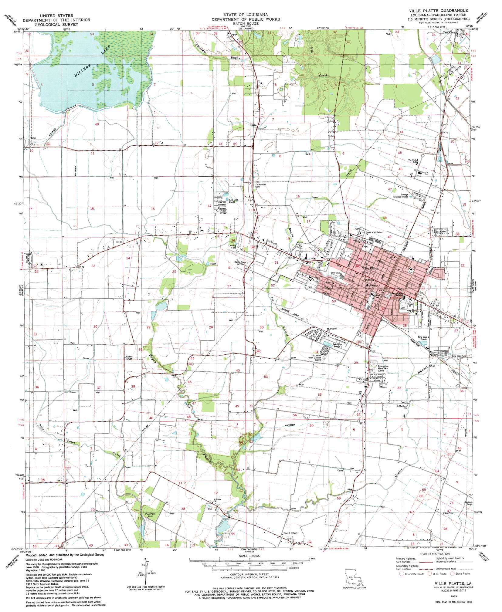
USGS Topo Quad 30092f3 - 1:24,000 scale
| Topo Map Name: | Ville Platte |
| USGS Topo Quad ID: | 30092f3 |
| Print Size: | ca. 21 1/4" wide x 27" high |
| Southeast Coordinates: | 30.625° N latitude / 92.25° W longitude |
| Map Center Coordinates: | 30.6875° N latitude / 92.3125° W longitude |
| U.S. State: | LA |
| Filename: | o30092f3.jpg |
| Download Map JPG Image: | Ville Platte topo map 1:24,000 scale |
| Map Type: | Topographic |
| Topo Series: | 7.5´ |
| Map Scale: | 1:24,000 |
| Source of Map Images: | United States Geological Survey (USGS) |
| Alternate Map Versions: |
Ville Platte LA 1983, updated 1983 Download PDF Buy paper map Ville Platte LA 2012 Download PDF Buy paper map Ville Platte LA 2015 Download PDF Buy paper map |
1:24,000 Topo Quads surrounding Ville Platte
Glenmora |
Cocodrie Lake |
Lone Pine |
Bunkie |
Cottonport |
Beaver |
Pine Prairie |
Saint Landry |
Whiteville |
Morrow |
Bond |
Mamou |
Ville Platte |
Tate Cove |
Beggs |
Duralde |
Eunice North |
Chataignier |
Lawtell |
Opelousas |
Basile |
Eunice South |
Richard |
Church Point |
Sunset |
> Back to 30092e1 at 1:100,000 scale
> Back to 30092a1 at 1:250,000 scale
> Back to U.S. Topo Maps home
Ville Platte topo map: Gazetteer
Ville Platte: Airports
Humana Hospital Ville Platte Heliport elevation 22m 72′Sylvesters Airport elevation 22m 72′
Ville Platte: Dams
Millers Lake Dam elevation 22m 72′Ville Platte: Flats
Prairie Mammou elevation 20m 65′Ville Platte: Oilfields
Point Blue Gas Field elevation 18m 59′Ville Platte: Parks
Henry J Vidrine Memorial Park elevation 21m 68′Southside City Park elevation 20m 65′
Ville Platte: Populated Places
Point Blue elevation 19m 62′Ville Platte elevation 22m 72′
Ville Platte: Post Offices
Lelia Post Office (historical) elevation 19m 62′Ville Platte Post Office elevation 23m 75′
Ville Platte: Reservoirs
Millers Lake elevation 22m 72′Ville Platte: Streams
Bayou Joe Marcel elevation 14m 45′Coulee Manuel elevation 14m 45′
Ville Platte digital topo map on disk
Buy this Ville Platte topo map showing relief, roads, GPS coordinates and other geographical features, as a high-resolution digital map file on DVD: