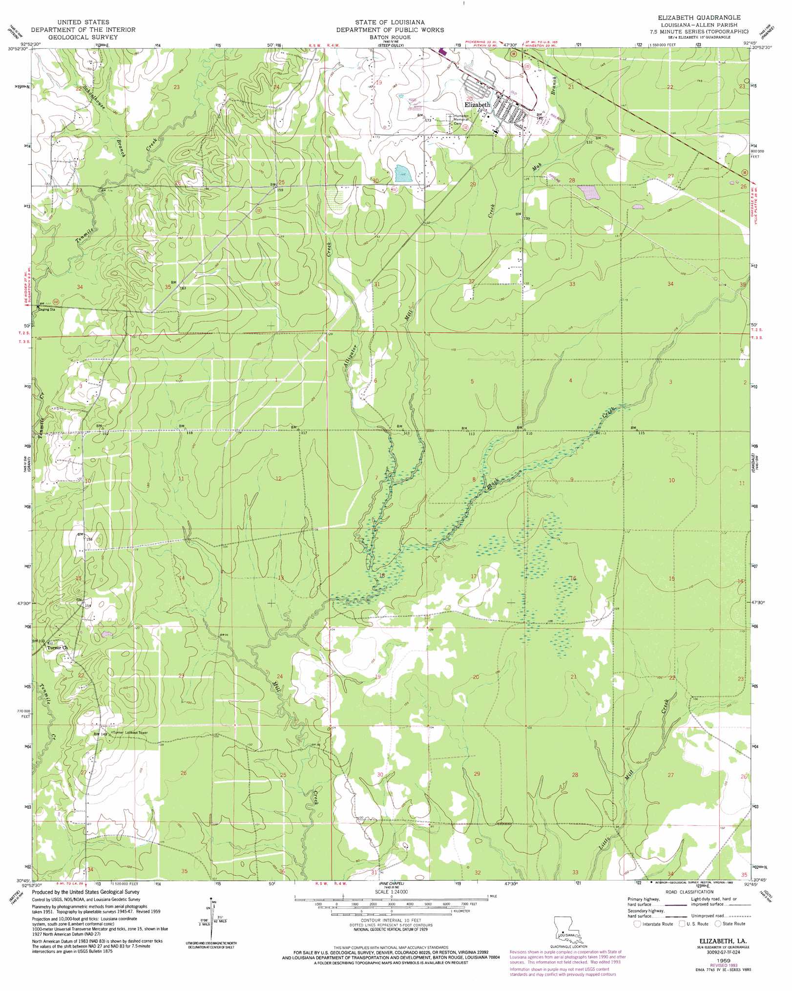
Elizabeth Topo Map Louisiana
To zoom in, hover over the map of Elizabeth
USGS Topo Quad 30092g7 - 1:24,000 scale
| Topo Map Name: | Elizabeth |
| USGS Topo Quad ID: | 30092g7 |
| Print Size: | ca. 21 1/4" wide x 27" high |
| Southeast Coordinates: | 30.75° N latitude / 92.75° W longitude |
| Map Center Coordinates: | 30.8125° N latitude / 92.8125° W longitude |
| U.S. State: | LA |
| Filename: | o30092g7.jpg |
| Download Map JPG Image: | Elizabeth topo map 1:24,000 scale |
| Map Type: | Topographic |
| Topo Series: | 7.5´ |
| Map Scale: | 1:24,000 |
| Source of Map Images: | United States Geological Survey (USGS) |
| Alternate Map Versions: |
Elizabeth LA 1948, updated 1948 Download PDF Buy paper map Elizabeth LA 1959, updated 1960 Download PDF Buy paper map Elizabeth LA 1959, updated 1968 Download PDF Buy paper map Elizabeth LA 1959, updated 1993 Download PDF Buy paper map Elizabeth LA 2012 Download PDF Buy paper map Elizabeth LA 2015 Download PDF Buy paper map |
1:24,000 Topo Quads surrounding Elizabeth
Birds Creek |
Fullerton Lake |
Afeman |
Melder |
Forest Hill |
Sugrue |
Pitkin |
Steep Gully |
Pawnee |
Glenmora |
Sugartown |
Grant |
Elizabeth |
Oakdale |
Beaver |
Dry Creek |
Mittie |
Pine Chapel |
Guy |
Bond |
Reeves |
Le Blanc |
Oberlin |
Soileau |
Duralde |
> Back to 30092e1 at 1:100,000 scale
> Back to 30092a1 at 1:250,000 scale
> Back to U.S. Topo Maps home
Elizabeth topo map: Gazetteer
Elizabeth: Dams
Louisiana Noname 60 Dam elevation 44m 144′Elizabeth: Oilfields
Elizabeth Gas Field elevation 50m 164′Elizabeth: Populated Places
Elizabeth elevation 44m 144′Mab elevation 44m 144′
Marionville (historical) elevation 39m 127′
Elizabeth: Streams
Alligator Creek elevation 31m 101′Black Creek elevation 29m 95′
Carter Branch elevation 33m 108′
Mab Branch elevation 37m 121′
Schoolhouse Branch elevation 34m 111′
Elizabeth digital topo map on disk
Buy this Elizabeth topo map showing relief, roads, GPS coordinates and other geographical features, as a high-resolution digital map file on DVD: