Pawnee Topo Map Louisiana
To zoom in, hover over the map of Pawnee
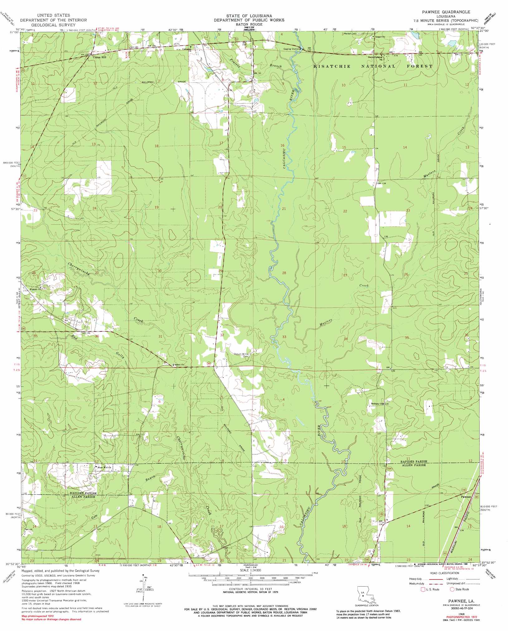
USGS Topo Quad 30092h6 - 1:24,000 scale
| Topo Map Name: | Pawnee |
| USGS Topo Quad ID: | 30092h6 |
| Print Size: | ca. 21 1/4" wide x 27" high |
| Southeast Coordinates: | 30.875° N latitude / 92.625° W longitude |
| Map Center Coordinates: | 30.9375° N latitude / 92.6875° W longitude |
| U.S. State: | LA |
| Filename: | o30092h6.jpg |
| Download Map JPG Image: | Pawnee topo map 1:24,000 scale |
| Map Type: | Topographic |
| Topo Series: | 7.5´ |
| Map Scale: | 1:24,000 |
| Source of Map Images: | United States Geological Survey (USGS) |
| Alternate Map Versions: |
Pawnee LA 1968, updated 1969 Download PDF Buy paper map Pawnee LA 1968, updated 1988 Download PDF Buy paper map Pawnee LA 2003, updated 2005 Download PDF Buy paper map Pawnee LA 2012 Download PDF Buy paper map Pawnee LA 2015 Download PDF Buy paper map |
| FStopo: | US Forest Service topo Pawnee is available: Download FStopo PDF Download FStopo TIF |
1:24,000 Topo Quads surrounding Pawnee
Lacamp |
Sieper |
Elmer |
Woodworth West |
Woodworth East |
Fullerton Lake |
Afeman |
Melder |
Forest Hill |
Lecompte |
Pitkin |
Steep Gully |
Pawnee |
Glenmora |
Cocodrie Lake |
Grant |
Elizabeth |
Oakdale |
Beaver |
Pine Prairie |
Mittie |
Pine Chapel |
Guy |
Bond |
Mamou |
> Back to 30092e1 at 1:100,000 scale
> Back to 30092a1 at 1:250,000 scale
> Back to U.S. Topo Maps home
Pawnee topo map: Gazetteer
Pawnee: Populated Places
Bethel elevation 38m 124′Osburn elevation 41m 134′
Pawnee elevation 39m 127′
Union Hill elevation 60m 196′
Pawnee: Streams
Bad Gully elevation 36m 118′Cow Bayou elevation 33m 108′
Masters Creek elevation 32m 104′
Prairie Branch elevation 37m 121′
Pawnee digital topo map on disk
Buy this Pawnee topo map showing relief, roads, GPS coordinates and other geographical features, as a high-resolution digital map file on DVD: