Iowa Topo Map Louisiana
To zoom in, hover over the map of Iowa
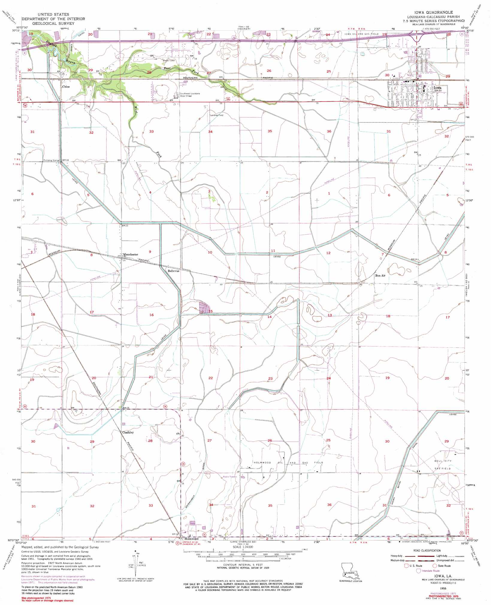
USGS Topo Quad 30093b1 - 1:24,000 scale
| Topo Map Name: | Iowa |
| USGS Topo Quad ID: | 30093b1 |
| Print Size: | ca. 21 1/4" wide x 27" high |
| Southeast Coordinates: | 30.125° N latitude / 93° W longitude |
| Map Center Coordinates: | 30.1875° N latitude / 93.0625° W longitude |
| U.S. State: | LA |
| Filename: | o30093b1.jpg |
| Download Map JPG Image: | Iowa topo map 1:24,000 scale |
| Map Type: | Topographic |
| Topo Series: | 7.5´ |
| Map Scale: | 1:24,000 |
| Source of Map Images: | United States Geological Survey (USGS) |
| Alternate Map Versions: |
Iowa LA 1955, updated 1956 Download PDF Buy paper map Iowa LA 1955, updated 1971 Download PDF Buy paper map Iowa LA 1955, updated 1982 Download PDF Buy paper map Iowa LA 1994, updated 1996 Download PDF Buy paper map Iowa LA 2012 Download PDF Buy paper map Iowa LA 2015 Download PDF Buy paper map |
1:24,000 Topo Quads surrounding Iowa
Gordon |
Gaytine |
Topsy |
Indian Village |
Kinder |
Buhler |
Moss Bluff |
Hecker |
Fenton |
Welsh North |
Westlake |
Lake Charles |
Iowa |
Lacassine |
Welsh South |
Moss Lake |
Lake Charles Sw |
Lake Charles Se |
Hayes |
Thornwell |
Hackberry |
Sweet Lake |
Boudreaux Lake |
Lake Misere |
Latania Lake |
> Back to 30093a1 at 1:100,000 scale
> Back to 30092a1 at 1:250,000 scale
> Back to U.S. Topo Maps home
Iowa topo map: Gazetteer
Iowa: Airports
Morgan Crop Service Airport elevation 4m 13′Morgan Crop Service Number 2 Airport elevation 4m 13′
O'Brien Flying Service Airport elevation 7m 22′
Iowa: Areas
Calcasieu Prairie elevation 6m 19′Iowa: Canals
Government Ditch elevation 5m 16′Indian Bayou Canal elevation 3m 9′
Iowa: Crossings
Interchange 43 elevation 8m 26′Iowa: Oilfields
Bell City Gas Field elevation 3m 9′Chloe Oil Field elevation 5m 16′
East Manchester Gas Field elevation 6m 19′
Holmwood Oil and Gas Field elevation 5m 16′
West Holmwood Gas Field elevation 3m 9′
Iowa: Populated Places
Bellevue elevation 6m 19′Bon Air elevation 6m 19′
Chalkley elevation 6m 19′
Chloe elevation 4m 13′
Harbor elevation 5m 16′
Holmwood elevation 5m 16′
Iowa elevation 6m 19′
Manchester elevation 7m 22′
Iowa: Streams
East Fork English Bayou elevation 0m 0′West Fork English Bayou elevation 0m 0′
Iowa digital topo map on disk
Buy this Iowa topo map showing relief, roads, GPS coordinates and other geographical features, as a high-resolution digital map file on DVD: