Texla Topo Map Texas
To zoom in, hover over the map of Texla
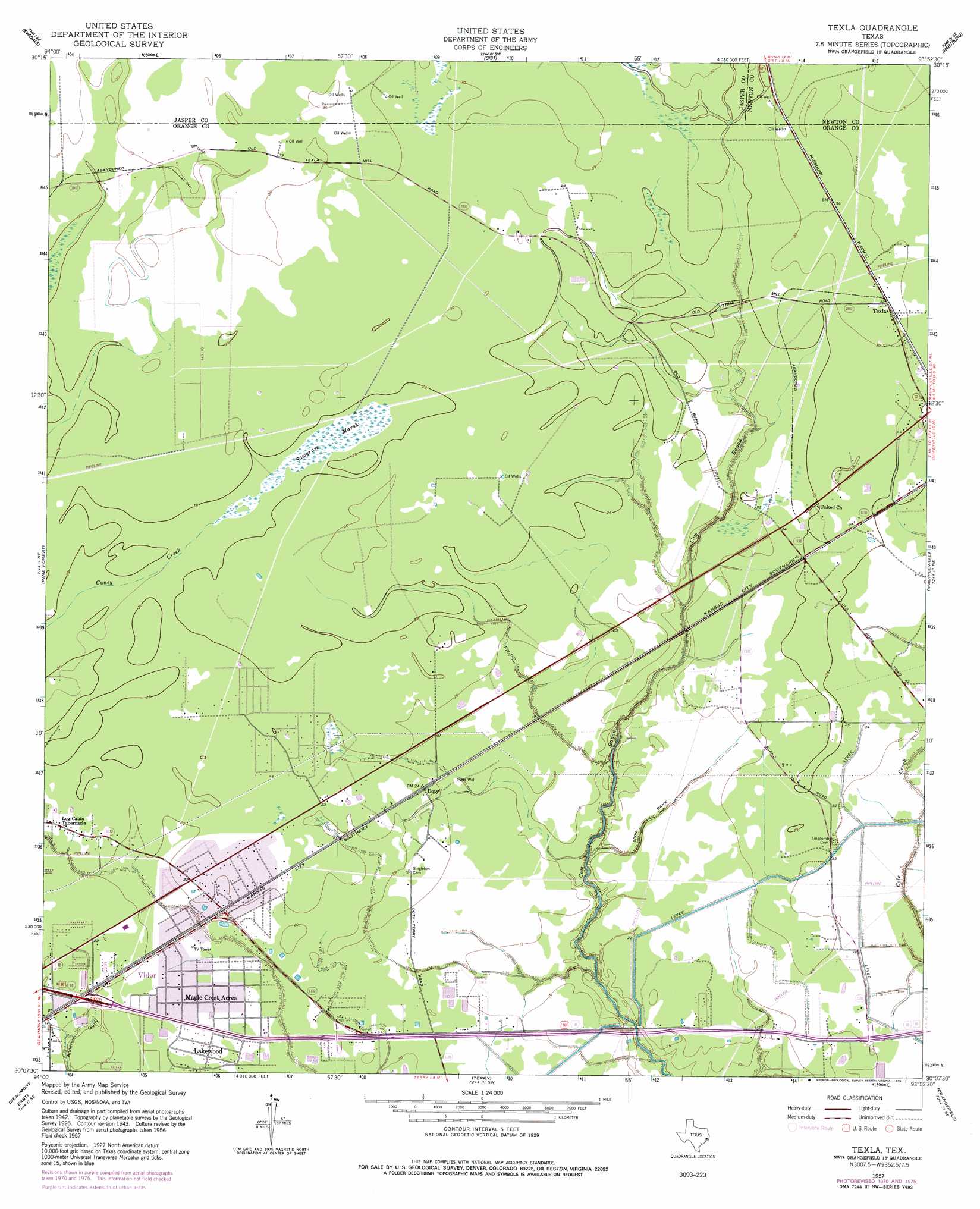
USGS Topo Quad 30093b8 - 1:24,000 scale
| Topo Map Name: | Texla |
| USGS Topo Quad ID: | 30093b8 |
| Print Size: | ca. 21 1/4" wide x 27" high |
| Southeast Coordinates: | 30.125° N latitude / 93.875° W longitude |
| Map Center Coordinates: | 30.1875° N latitude / 93.9375° W longitude |
| U.S. State: | TX |
| Filename: | o30093b8.jpg |
| Download Map JPG Image: | Texla topo map 1:24,000 scale |
| Map Type: | Topographic |
| Topo Series: | 7.5´ |
| Map Scale: | 1:24,000 |
| Source of Map Images: | United States Geological Survey (USGS) |
| Alternate Map Versions: |
Texla TX 1926 Download PDF Buy paper map Texla TX 1943, updated 1953 Download PDF Buy paper map Texla TX 1957, updated 1958 Download PDF Buy paper map Texla TX 1957, updated 1971 Download PDF Buy paper map Texla TX 1957, updated 1979 Download PDF Buy paper map Texla TX 2010 Download PDF Buy paper map Texla TX 2012 Download PDF Buy paper map Texla TX 2016 Download PDF Buy paper map |
1:24,000 Topo Quads surrounding Texla
Deserter Baygall |
Franklin Lake |
Buna |
Sudduth Bluff |
Shoats Creek |
Silsbee |
Evadale |
Gist |
Hartburg |
Starks |
Voth |
Pine Forest |
Texla |
Mauriceville |
Echo |
Beaumont West |
Beaumont East |
Terry |
Orangefield |
Orange |
Fannett East |
Port Acres |
Port Arthur North |
West Of Greens Bayou |
Greens Bayou |
> Back to 30093a1 at 1:100,000 scale
> Back to 30092a1 at 1:250,000 scale
> Back to U.S. Topo Maps home
Texla topo map: Gazetteer
Texla: Airports
Jenkins Airport elevation 4m 13′Texla: Populated Places
Doty elevation 6m 19′Lakewood elevation 6m 19′
Maple Crest Acres elevation 6m 19′
Texla elevation 9m 29′
Texla: Swamps
Sawgrass Marsh elevation 8m 26′Texla digital topo map on disk
Buy this Texla topo map showing relief, roads, GPS coordinates and other geographical features, as a high-resolution digital map file on DVD: