Lunita Topo Map Louisiana
To zoom in, hover over the map of Lunita
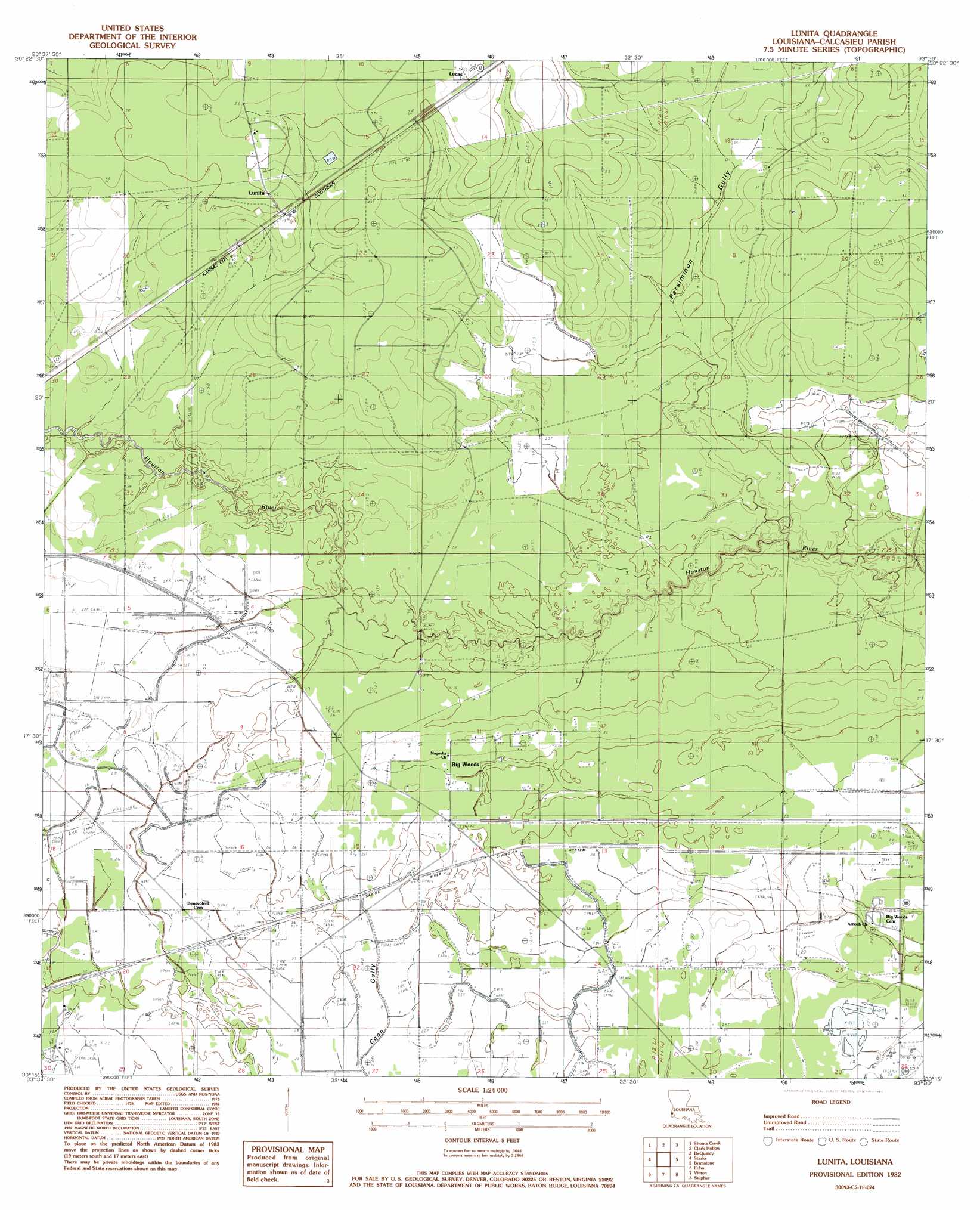
USGS Topo Quad 30093c5 - 1:24,000 scale
| Topo Map Name: | Lunita |
| USGS Topo Quad ID: | 30093c5 |
| Print Size: | ca. 21 1/4" wide x 27" high |
| Southeast Coordinates: | 30.25° N latitude / 93.5° W longitude |
| Map Center Coordinates: | 30.3125° N latitude / 93.5625° W longitude |
| U.S. State: | LA |
| Filename: | o30093c5.jpg |
| Download Map JPG Image: | Lunita topo map 1:24,000 scale |
| Map Type: | Topographic |
| Topo Series: | 7.5´ |
| Map Scale: | 1:24,000 |
| Source of Map Images: | United States Geological Survey (USGS) |
| Alternate Map Versions: |
Lunita LA 1982, updated 1983 Download PDF Buy paper map Lunita LA 1994, updated 1996 Download PDF Buy paper map Lunita LA 2012 Download PDF Buy paper map Lunita LA 2015 Download PDF Buy paper map |
1:24,000 Topo Quads surrounding Lunita
Trout Creek |
Bancroft |
Fields |
Oretta |
Kernan |
Sudduth Bluff |
Shoats Creek |
Clark Hollow |
De Quincy |
Gordon |
Hartburg |
Starks |
Lunita |
Brimstone |
Buhler |
Mauriceville |
Echo |
Vinton |
Sulphur |
Westlake |
Orangefield |
Orange |
Cameron Farms |
Black Lake |
Moss Lake |
> Back to 30093a1 at 1:100,000 scale
> Back to 30092a1 at 1:250,000 scale
> Back to U.S. Topo Maps home
Lunita topo map: Gazetteer
Lunita: Airports
Starks Compressor Station Heliport elevation 9m 29′Lunita: Canals
Sabine River Diversion System elevation 9m 29′Lunita: Lakes
Richards Lake elevation 8m 26′Lunita: Populated Places
Big Woods elevation 7m 22′Lucas elevation 17m 55′
Lunita elevation 16m 52′
Lunita: Streams
Bear Head Creek elevation 7m 22′Persimmon Gully elevation 3m 9′
Lunita digital topo map on disk
Buy this Lunita topo map showing relief, roads, GPS coordinates and other geographical features, as a high-resolution digital map file on DVD: