Trout Creek Topo Map Texas
To zoom in, hover over the map of Trout Creek
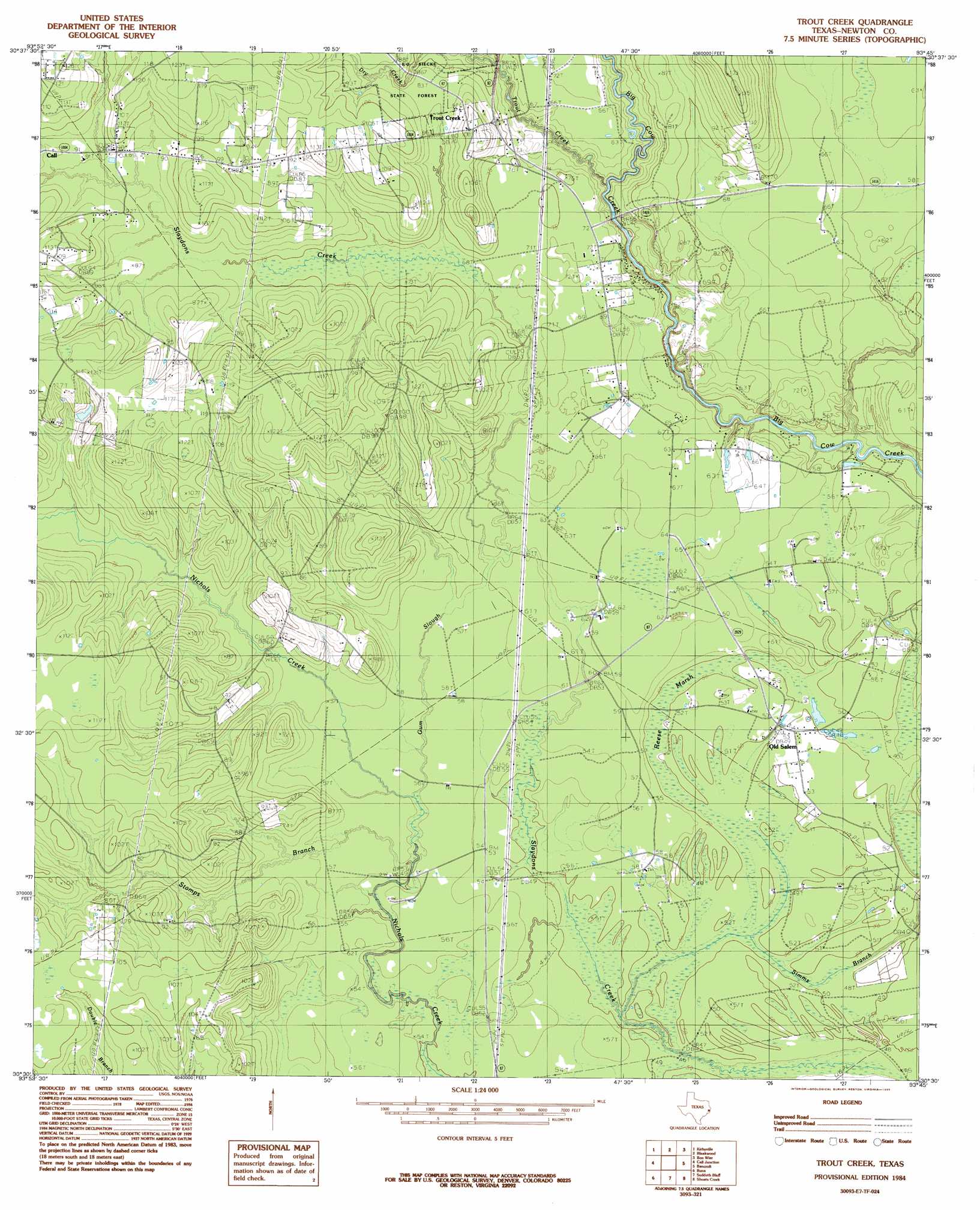
USGS Topo Quad 30093e7 - 1:24,000 scale
| Topo Map Name: | Trout Creek |
| USGS Topo Quad ID: | 30093e7 |
| Print Size: | ca. 21 1/4" wide x 27" high |
| Southeast Coordinates: | 30.5° N latitude / 93.75° W longitude |
| Map Center Coordinates: | 30.5625° N latitude / 93.8125° W longitude |
| U.S. State: | TX |
| Filename: | o30093e7.jpg |
| Download Map JPG Image: | Trout Creek topo map 1:24,000 scale |
| Map Type: | Topographic |
| Topo Series: | 7.5´ |
| Map Scale: | 1:24,000 |
| Source of Map Images: | United States Geological Survey (USGS) |
| Alternate Map Versions: |
Trout Creek TX 1984, updated 1985 Download PDF Buy paper map Trout Creek TX 2010 Download PDF Buy paper map Trout Creek TX 2012 Download PDF Buy paper map Trout Creek TX 2016 Download PDF Buy paper map |
1:24,000 Topo Quads surrounding Trout Creek
Beech Grove |
Roganville |
Newton West |
Newton East |
Merryville North |
Magnolia Springs |
Kirbyville |
Bleakwood |
Bon Wier |
Merryville South |
Potato Patch Lake |
Call Junction |
Trout Creek |
Bancroft |
Fields |
Franklin Lake |
Buna |
Sudduth Bluff |
Shoats Creek |
Clark Hollow |
Evadale |
Gist |
Hartburg |
Starks |
Lunita |
> Back to 30093e1 at 1:100,000 scale
> Back to 30092a1 at 1:250,000 scale
> Back to U.S. Topo Maps home
Trout Creek topo map: Gazetteer
Trout Creek: Guts
Gum Slough elevation 17m 55′The Cutoff elevation 15m 49′
Trout Creek: Oilfields
Newton Oil Field elevation 16m 52′Trout Creek: Populated Places
Call elevation 29m 95′Call elevation 29m 95′
Salem elevation 15m 49′
Trout Creek elevation 20m 65′
Trout Creek: Streams
Stamps Branch elevation 17m 55′Trout Creek elevation 13m 42′
Trout Creek: Swamps
Reese Marsh elevation 15m 49′Trout Creek digital topo map on disk
Buy this Trout Creek topo map showing relief, roads, GPS coordinates and other geographical features, as a high-resolution digital map file on DVD: