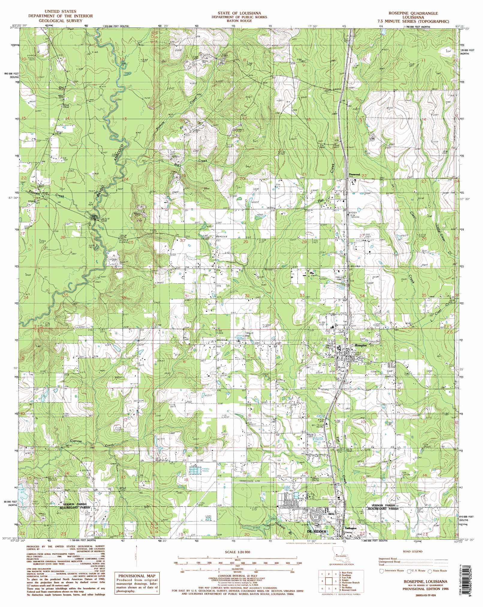
Rose Pine Topo Map Louisiana
To zoom in, hover over the map of Rose Pine
USGS Topo Quad 30093h3 - 1:24,000 scale
| Topo Map Name: | Rose Pine |
| USGS Topo Quad ID: | 30093h3 |
| Print Size: | ca. 21 1/4" wide x 27" high |
| Southeast Coordinates: | 30.875° N latitude / 93.25° W longitude |
| Map Center Coordinates: | 30.9375° N latitude / 93.3125° W longitude |
| U.S. State: | LA |
| Filename: | o30093h3.jpg |
| Download Map JPG Image: | Rose Pine topo map 1:24,000 scale |
| Map Type: | Topographic |
| Topo Series: | 7.5´ |
| Map Scale: | 1:24,000 |
| Source of Map Images: | United States Geological Survey (USGS) |
| Alternate Map Versions: |
Rosepine LA 1986, updated 1986 Download PDF Buy paper map Rosepine LA 1986, updated 1986 Download PDF Buy paper map Rosepine LA 1994, updated 1997 Download PDF Buy paper map Rosepine LA 2012 Download PDF Buy paper map Rosepine LA 2015 Download PDF Buy paper map |
1:24,000 Topo Quads surrounding Rose Pine
Haddens |
Little Sandy Creek |
Leesville |
Slagle |
Simpson South |
Wiergate Se |
Burr Ferry |
Newllano |
Fort Polk |
Birds Creek |
Evans |
Knight |
Rose Pine |
Hurricane Branch |
Sugrue |
Merryville North |
Neale |
De Ridder |
Boneset Creek |
Sugartown |
Merryville South |
Singer |
Mach Branch |
Redhead Branch |
Dry Creek |
> Back to 30093e1 at 1:100,000 scale
> Back to 30092a1 at 1:250,000 scale
> Back to U.S. Topo Maps home
Rose Pine topo map: Gazetteer
Rose Pine: Dams
Louisiana Noname 66 Dam elevation 60m 196′Louisiana Noname 67 Dam elevation 57m 187′
Rose Pine: Populated Places
Neame elevation 81m 265′Pinewood elevation 76m 249′
Rosepine elevation 69m 226′
Rose Pine: Post Offices
Rosepine Post Office elevation 70m 229′Rose Pine: Streams
Big Branch elevation 43m 141′Little Clear Creek elevation 53m 173′
Nichols Creek elevation 43m 141′
Pocosin Creek elevation 37m 121′
Rose Pine digital topo map on disk
Buy this Rose Pine topo map showing relief, roads, GPS coordinates and other geographical features, as a high-resolution digital map file on DVD: