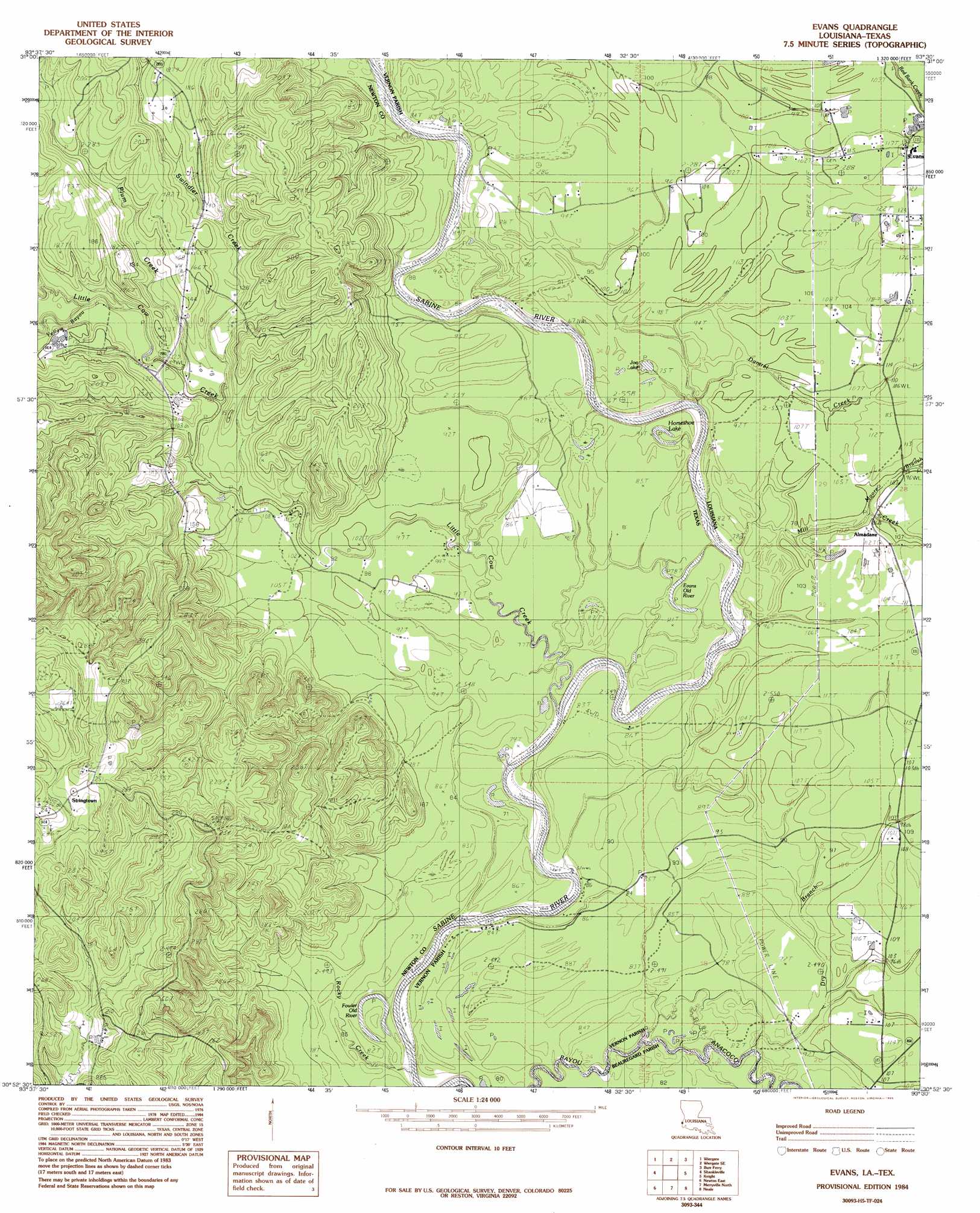
Evans Topo Map Louisiana
To zoom in, hover over the map of Evans
USGS Topo Quad 30093h5 - 1:24,000 scale
| Topo Map Name: | Evans |
| USGS Topo Quad ID: | 30093h5 |
| Print Size: | ca. 21 1/4" wide x 27" high |
| Southeast Coordinates: | 30.875° N latitude / 93.5° W longitude |
| Map Center Coordinates: | 30.9375° N latitude / 93.5625° W longitude |
| U.S. States: | LA, TX |
| Filename: | o30093h5.jpg |
| Download Map JPG Image: | Evans topo map 1:24,000 scale |
| Map Type: | Topographic |
| Topo Series: | 7.5´ |
| Map Scale: | 1:24,000 |
| Source of Map Images: | United States Geological Survey (USGS) |
| Alternate Map Versions: |
Evans LA 1984, updated 1985 Download PDF Buy paper map Evans LA 2010 Download PDF Buy paper map Evans LA 2012 Download PDF Buy paper map Evans LA 2015 Download PDF Buy paper map |
1:24,000 Topo Quads surrounding Evans
Hurricane Creek |
Fairmount |
Haddens |
Little Sandy Creek |
Leesville |
Weeks Settlement |
Wiergate |
Wiergate Se |
Burr Ferry |
Newllano |
Jamestown |
Shankleville |
Evans |
Knight |
Rose Pine |
Newton West |
Newton East |
Merryville North |
Neale |
De Ridder |
Bleakwood |
Bon Wier |
Merryville South |
Singer |
Mach Branch |
> Back to 30093e1 at 1:100,000 scale
> Back to 30092a1 at 1:250,000 scale
> Back to U.S. Topo Maps home
Evans topo map: Gazetteer
Evans: Lakes
Evans Old River elevation 24m 78′Fowler Old River elevation 20m 65′
Horseshoe Lake elevation 23m 75′
Joe Lake elevation 24m 78′
Evans: Populated Places
Almadane elevation 33m 108′Evans elevation 39m 127′
Sutton Junction (historical) elevation 32m 104′
Evans: Post Offices
Evans Post Office elevation 39m 127′Evans: Streams
Damrel Creek elevation 21m 68′Dry Branch elevation 26m 85′
Little Cow Creek elevation 20m 65′
Mill Creek elevation 21m 68′
Moore Branch elevation 26m 85′
Plum Creek elevation 35m 114′
Swindler Creek elevation 32m 104′
Yellow Bayou elevation 37m 121′
Evans digital topo map on disk
Buy this Evans topo map showing relief, roads, GPS coordinates and other geographical features, as a high-resolution digital map file on DVD: