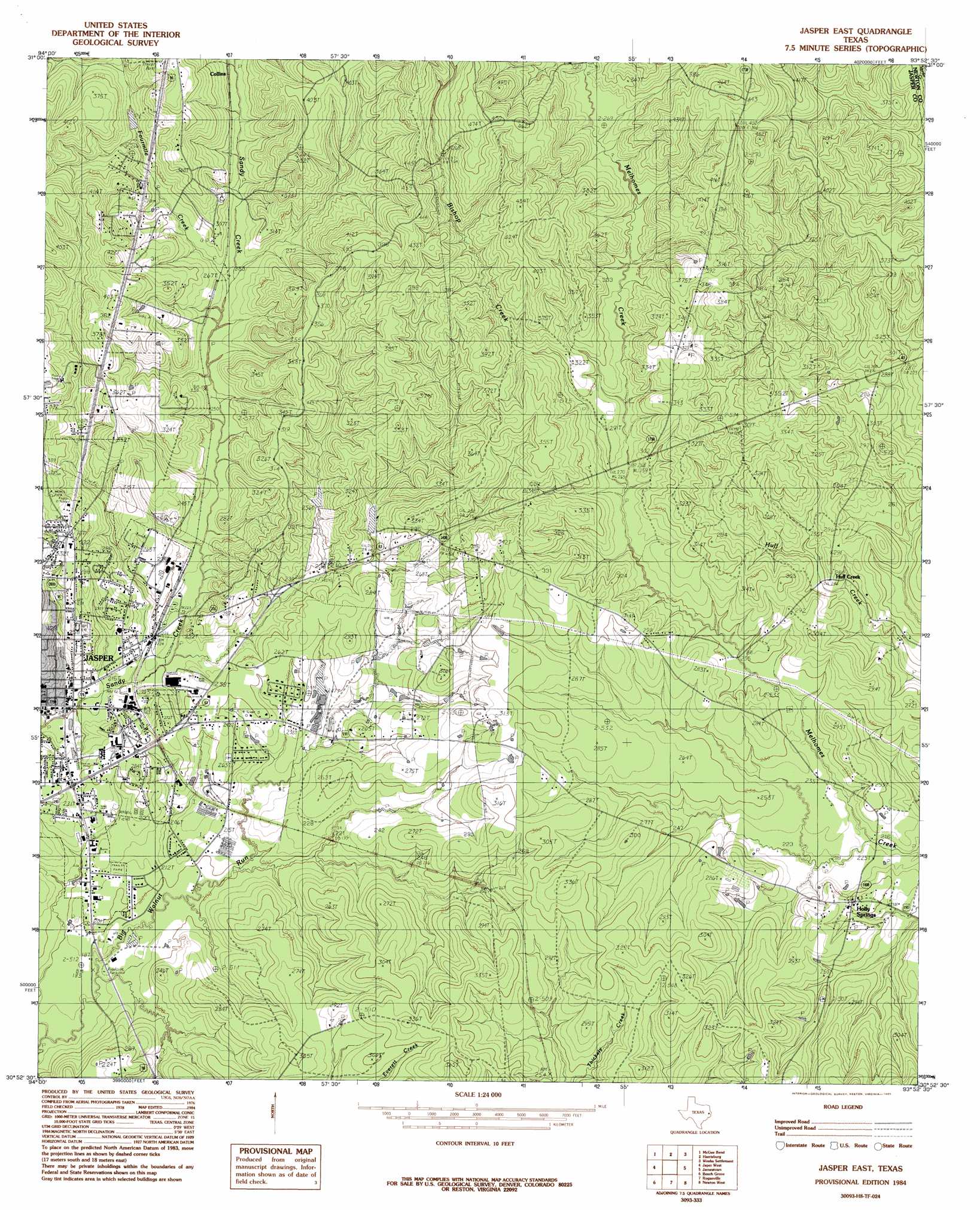
Jasper East Topo Map Texas
To zoom in, hover over the map of Jasper East
USGS Topo Quad 30093h8 - 1:24,000 scale
| Topo Map Name: | Jasper East |
| USGS Topo Quad ID: | 30093h8 |
| Print Size: | ca. 21 1/4" wide x 27" high |
| Southeast Coordinates: | 30.875° N latitude / 93.875° W longitude |
| Map Center Coordinates: | 30.9375° N latitude / 93.9375° W longitude |
| U.S. State: | TX |
| Filename: | o30093h8.jpg |
| Download Map JPG Image: | Jasper East topo map 1:24,000 scale |
| Map Type: | Topographic |
| Topo Series: | 7.5´ |
| Map Scale: | 1:24,000 |
| Source of Map Images: | United States Geological Survey (USGS) |
| Alternate Map Versions: |
Jasper East TX 1984, updated 1985 Download PDF Buy paper map Jasper East TX 2010 Download PDF Buy paper map Jasper East TX 2012 Download PDF Buy paper map Jasper East TX 2016 Download PDF Buy paper map |
1:24,000 Topo Quads surrounding Jasper East
Veach |
Buck Bay |
Pineland South |
Hurricane Creek |
Fairmount |
Ebenezer |
Mcgee Bend |
Harrisburg |
Weeks Settlement |
Wiergate |
Pace Hill |
Jasper West |
Jasper East |
Jamestown |
Shankleville |
Town Bluff |
Beech Grove |
Roganville |
Newton West |
Newton East |
Spurger |
Magnolia Springs |
Kirbyville |
Bleakwood |
Bon Wier |
> Back to 30093e1 at 1:100,000 scale
> Back to 30092a1 at 1:250,000 scale
> Back to U.S. Topo Maps home
Jasper East topo map: Gazetteer
Jasper East: Parks
Carridine Park elevation 86m 282′Kiwanis Park elevation 62m 203′
Steers Stadium elevation 82m 269′
Jasper East: Populated Places
Blox elevation 79m 259′Holly Springs elevation 81m 265′
Huff Creek elevation 79m 259′
Jasper elevation 62m 203′
New Blox elevation 95m 311′
Jasper East: Springs
Buck Spring elevation 99m 324′Jasper East: Streams
Bishop Creek elevation 79m 259′Fourmile Creek elevation 77m 252′
Little Sandy Creek elevation 64m 209′
Jasper East digital topo map on disk
Buy this Jasper East topo map showing relief, roads, GPS coordinates and other geographical features, as a high-resolution digital map file on DVD: