Bevil Oaks Topo Map Texas
To zoom in, hover over the map of Bevil Oaks
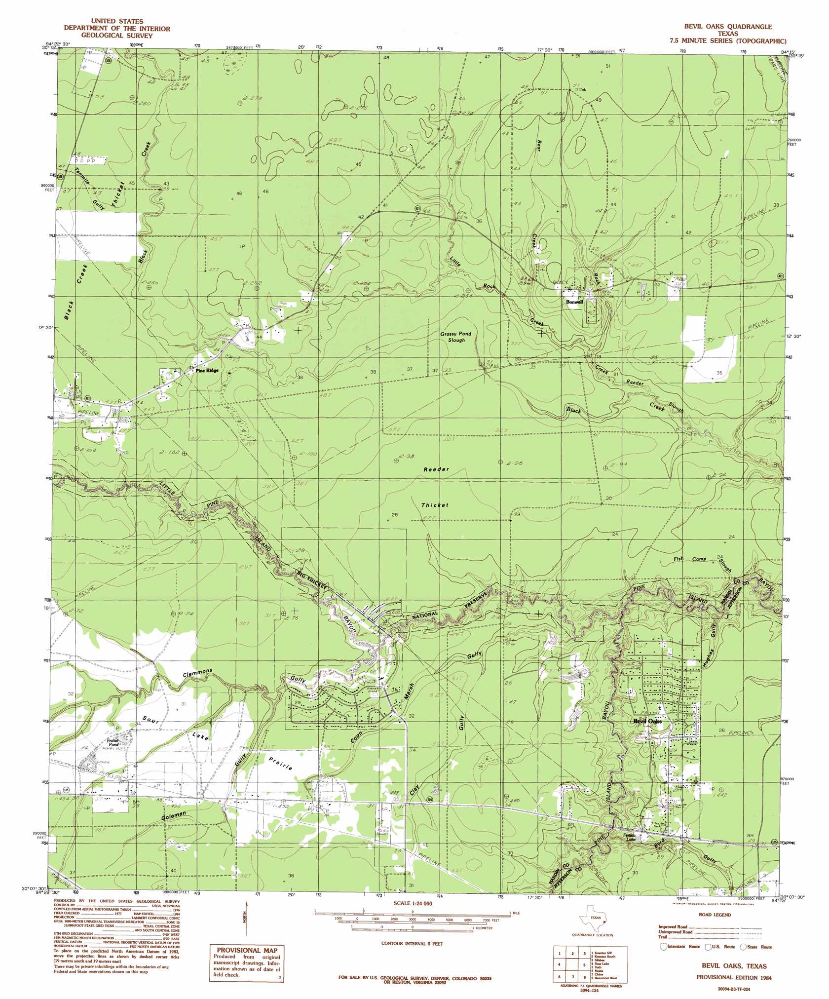
USGS Topo Quad 30094b3 - 1:24,000 scale
| Topo Map Name: | Bevil Oaks |
| USGS Topo Quad ID: | 30094b3 |
| Print Size: | ca. 21 1/4" wide x 27" high |
| Southeast Coordinates: | 30.125° N latitude / 94.25° W longitude |
| Map Center Coordinates: | 30.1875° N latitude / 94.3125° W longitude |
| U.S. State: | TX |
| Filename: | o30094b3.jpg |
| Download Map JPG Image: | Bevil Oaks topo map 1:24,000 scale |
| Map Type: | Topographic |
| Topo Series: | 7.5´ |
| Map Scale: | 1:24,000 |
| Source of Map Images: | United States Geological Survey (USGS) |
| Alternate Map Versions: |
Bevil Oaks TX 1984, updated 1985 Download PDF Buy paper map Bevil Oaks TX 1984, updated 1985 Download PDF Buy paper map Bevil Oaks TX 2010 Download PDF Buy paper map Bevil Oaks TX 2013 Download PDF Buy paper map Bevil Oaks TX 2016 Download PDF Buy paper map |
1:24,000 Topo Quads surrounding Bevil Oaks
Bragg |
Village Mills |
Kountze North |
Deserter Baygall |
Franklin Lake |
Saratoga |
Kountze Sw |
Kountze South |
Silsbee |
Evadale |
Thorson Gully |
Sour Lake |
Bevil Oaks |
Voth |
Pine Forest |
Devers |
Nome |
China |
Beaumont West |
Beaumont East |
Whites Bayou |
Winnie Nw |
Fannett West |
Fannett East |
Port Acres |
> Back to 30094a1 at 1:100,000 scale
> Back to 30094a1 at 1:250,000 scale
> Back to U.S. Topo Maps home
Bevil Oaks topo map: Gazetteer
Bevil Oaks: Flats
Sour Lake Prairie elevation 9m 29′Bevil Oaks: Lakes
Fralise Pond elevation 10m 32′Grassy Pond elevation 11m 36′
Bevil Oaks: Populated Places
Bevil Oaks elevation 8m 26′Pine Ridge elevation 13m 42′
Pinewood Estates elevation 8m 26′
Bevil Oaks: Reservoirs
Fertitta Lake elevation 9m 29′Bevil Oaks: Streams
Bear Creek elevation 8m 26′Fish Camp Slough elevation 5m 16′
Little Pine Island Bayou elevation 2m 6′
Little Rock Creek elevation 6m 19′
Reeder Slough elevation 6m 19′
Rock Creek elevation 6m 19′
Bevil Oaks: Swamps
Grassy Pond Slough elevation 11m 36′Bevil Oaks: Valleys
Byrd Gully elevation 4m 13′Clay Gully elevation 7m 22′
Clemmons Gully elevation 6m 19′
Coon Marsh Gully elevation 3m 9′
Goleman Gully elevation 6m 19′
Hughes Gully elevation 1m 3′
Tenmile Gully elevation 12m 39′
Bevil Oaks: Woods
Black Creek Thicket elevation 13m 42′Keith Brambles elevation 10m 32′
Reeder Thicket elevation 11m 36′
Bevil Oaks digital topo map on disk
Buy this Bevil Oaks topo map showing relief, roads, GPS coordinates and other geographical features, as a high-resolution digital map file on DVD: