Sour Lake Topo Map Texas
To zoom in, hover over the map of Sour Lake
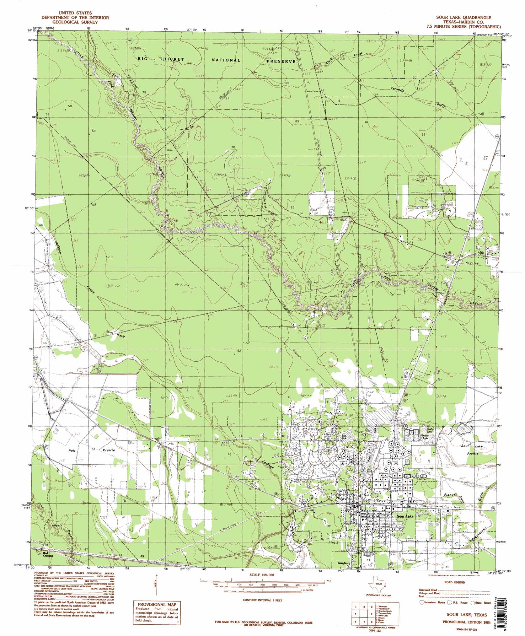
USGS Topo Quad 30094b4 - 1:24,000 scale
| Topo Map Name: | Sour Lake |
| USGS Topo Quad ID: | 30094b4 |
| Print Size: | ca. 21 1/4" wide x 27" high |
| Southeast Coordinates: | 30.125° N latitude / 94.375° W longitude |
| Map Center Coordinates: | 30.1875° N latitude / 94.4375° W longitude |
| U.S. State: | TX |
| Filename: | o30094b4.jpg |
| Download Map JPG Image: | Sour Lake topo map 1:24,000 scale |
| Map Type: | Topographic |
| Topo Series: | 7.5´ |
| Map Scale: | 1:24,000 |
| Source of Map Images: | United States Geological Survey (USGS) |
| Alternate Map Versions: |
Sour Lake TX 1984, updated 1985 Download PDF Buy paper map Sour Lake TX 1984, updated 1985 Download PDF Buy paper map Sour Lake TX 2010 Download PDF Buy paper map Sour Lake TX 2013 Download PDF Buy paper map Sour Lake TX 2016 Download PDF Buy paper map |
1:24,000 Topo Quads surrounding Sour Lake
Votaw |
Bragg |
Village Mills |
Kountze North |
Deserter Baygall |
Arizona Creek |
Saratoga |
Kountze Sw |
Kountze South |
Silsbee |
Hardin |
Thorson Gully |
Sour Lake |
Bevil Oaks |
Voth |
Daisetta |
Devers |
Nome |
China |
Beaumont West |
Shiloh |
Whites Bayou |
Winnie Nw |
Fannett West |
Fannett East |
> Back to 30094a1 at 1:100,000 scale
> Back to 30094a1 at 1:250,000 scale
> Back to U.S. Topo Maps home
Sour Lake topo map: Gazetteer
Sour Lake: Areas
Fourmile Burnout elevation 15m 49′Sour Lake: Flats
Jones Prairie elevation 15m 49′Pelt Prairie elevation 16m 52′
Sour Lake: Lakes
The Sour Lakes elevation 12m 39′Sour Lake: Oilfields
Sour Lake Dome Oil Field elevation 14m 45′Sour Lake: Populated Places
Hathaway elevation 15m 49′Sour Lake elevation 15m 49′
Sour Lake: Reservoirs
Bushy Lake elevation 11m 36′Grassy Lake elevation 11m 36′
Sour Lake: Streams
Yearling Tick Branch elevation 14m 45′Sour Lake: Valleys
Pignut Gully elevation 9m 29′Sour Lake digital topo map on disk
Buy this Sour Lake topo map showing relief, roads, GPS coordinates and other geographical features, as a high-resolution digital map file on DVD: