Hardin Topo Map Texas
To zoom in, hover over the map of Hardin
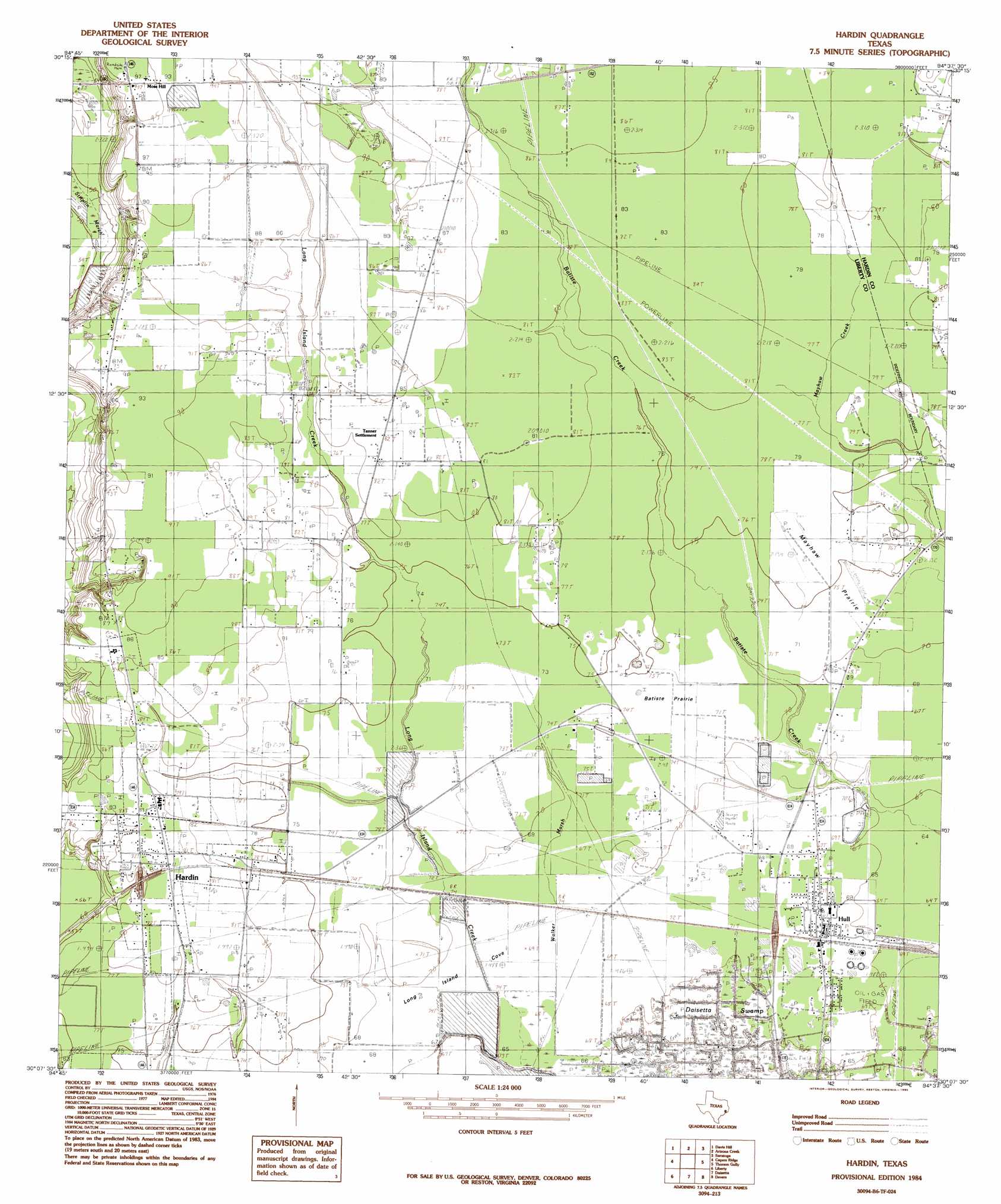
USGS Topo Quad 30094b6 - 1:24,000 scale
| Topo Map Name: | Hardin |
| USGS Topo Quad ID: | 30094b6 |
| Print Size: | ca. 21 1/4" wide x 27" high |
| Southeast Coordinates: | 30.125° N latitude / 94.625° W longitude |
| Map Center Coordinates: | 30.1875° N latitude / 94.6875° W longitude |
| U.S. State: | TX |
| Filename: | o30094b6.jpg |
| Download Map JPG Image: | Hardin topo map 1:24,000 scale |
| Map Type: | Topographic |
| Topo Series: | 7.5´ |
| Map Scale: | 1:24,000 |
| Source of Map Images: | United States Geological Survey (USGS) |
| Alternate Map Versions: |
Hardin TX 1984, updated 1985 Download PDF Buy paper map Hardin TX 2010 Download PDF Buy paper map Hardin TX 2013 Download PDF Buy paper map Hardin TX 2016 Download PDF Buy paper map |
1:24,000 Topo Quads surrounding Hardin
Rayburn |
Romayor |
Votaw |
Bragg |
Village Mills |
Tarkington Prairie |
Davis Hill |
Arizona Creek |
Saratoga |
Kountze Sw |
Simmons Bottom |
Capers Ridge |
Hardin |
Thorson Gully |
Sour Lake |
Dayton |
Liberty |
Daisetta |
Devers |
Nome |
Sheeks |
Moss Bluff |
Shiloh |
Whites Bayou |
Winnie Nw |
> Back to 30094a1 at 1:100,000 scale
> Back to 30094a1 at 1:250,000 scale
> Back to U.S. Topo Maps home
Hardin topo map: Gazetteer
Hardin: Basins
Long Island Cove elevation 21m 68′Hardin: Dams
Lake Forest Dam elevation 16m 52′Lovell Reservoir Number 1 Levee elevation 23m 75′
Hardin: Flats
Batiste Prairie elevation 22m 72′Mayhaw Prairie elevation 23m 75′
Hardin: Oilfields
Hull Oil and Gas Field elevation 20m 65′Hardin: Populated Places
Dowdel Settlement elevation 24m 78′Hardin elevation 25m 82′
Hull elevation 21m 68′
Moss Hill elevation 29m 95′
New Hope elevation 29m 95′
Pedeco elevation 21m 68′
Tanner Settlement elevation 26m 85′
Hardin: Reservoirs
Lake Forest elevation 16m 52′Reservoir Number 1 elevation 23m 75′
Hardin: Streams
Walker Marsh elevation 20m 65′Hardin: Summits
Hawkins Hill elevation 27m 88′Hardin: Woods
Batiste Woods elevation 25m 82′Long Island Woods elevation 23m 75′
Hardin digital topo map on disk
Buy this Hardin topo map showing relief, roads, GPS coordinates and other geographical features, as a high-resolution digital map file on DVD: