Arizona Creek Topo Map Texas
To zoom in, hover over the map of Arizona Creek
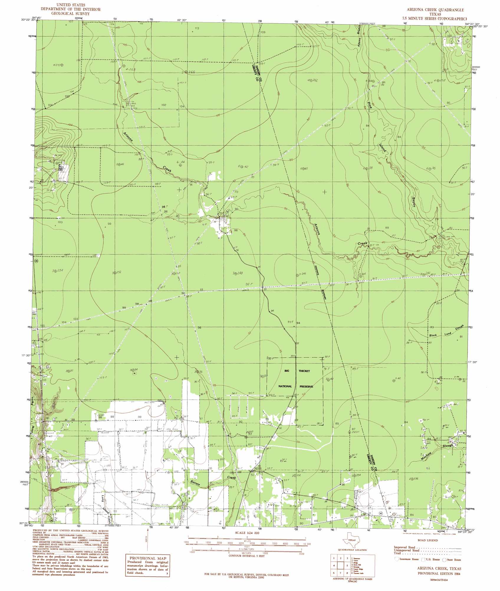
USGS Topo Quad 30094c6 - 1:24,000 scale
| Topo Map Name: | Arizona Creek |
| USGS Topo Quad ID: | 30094c6 |
| Print Size: | ca. 21 1/4" wide x 27" high |
| Southeast Coordinates: | 30.25° N latitude / 94.625° W longitude |
| Map Center Coordinates: | 30.3125° N latitude / 94.6875° W longitude |
| U.S. State: | TX |
| Filename: | o30094c6.jpg |
| Download Map JPG Image: | Arizona Creek topo map 1:24,000 scale |
| Map Type: | Topographic |
| Topo Series: | 7.5´ |
| Map Scale: | 1:24,000 |
| Source of Map Images: | United States Geological Survey (USGS) |
| Alternate Map Versions: |
Arizona Creek TX 1984, updated 1985 Download PDF Buy paper map Arizona Creek TX 2010 Download PDF Buy paper map Arizona Creek TX 2013 Download PDF Buy paper map Arizona Creek TX 2016 Download PDF Buy paper map |
1:24,000 Topo Quads surrounding Arizona Creek
Goodrich |
Schwab City |
Segno |
Jacks Creek South |
Warren |
Rayburn |
Romayor |
Votaw |
Bragg |
Village Mills |
Tarkington Prairie |
Davis Hill |
Arizona Creek |
Saratoga |
Kountze Sw |
Simmons Bottom |
Capers Ridge |
Hardin |
Thorson Gully |
Sour Lake |
Dayton |
Liberty |
Daisetta |
Devers |
Nome |
> Back to 30094a1 at 1:100,000 scale
> Back to 30094a1 at 1:250,000 scale
> Back to U.S. Topo Maps home
Arizona Creek topo map: Gazetteer
Arizona Creek: Populated Places
Big Thicket Loblolly elevation 28m 91′Ducat Settlement elevation 28m 91′
Vanva Settlement elevation 29m 95′
Arizona Creek: Streams
Adams Branch elevation 26m 85′Arizona Creek elevation 21m 68′
Arizona Creek digital topo map on disk
Buy this Arizona Creek topo map showing relief, roads, GPS coordinates and other geographical features, as a high-resolution digital map file on DVD: