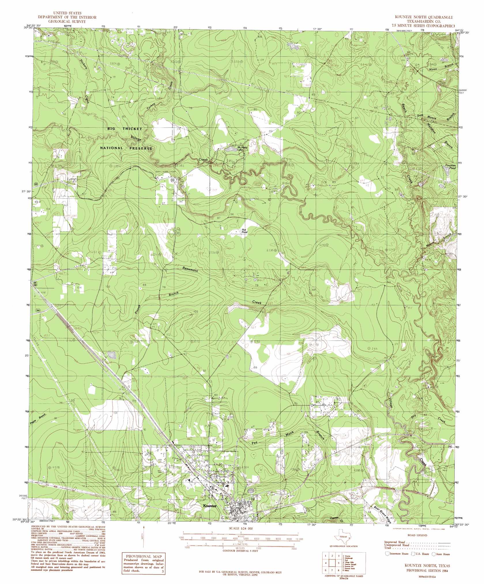
Kountze North Topo Map Texas
To zoom in, hover over the map of Kountze North
USGS Topo Quad 30094d3 - 1:24,000 scale
| Topo Map Name: | Kountze North |
| USGS Topo Quad ID: | 30094d3 |
| Print Size: | ca. 21 1/4" wide x 27" high |
| Southeast Coordinates: | 30.375° N latitude / 94.25° W longitude |
| Map Center Coordinates: | 30.4375° N latitude / 94.3125° W longitude |
| U.S. State: | TX |
| Filename: | o30094d3.jpg |
| Download Map JPG Image: | Kountze North topo map 1:24,000 scale |
| Map Type: | Topographic |
| Topo Series: | 7.5´ |
| Map Scale: | 1:24,000 |
| Source of Map Images: | United States Geological Survey (USGS) |
| Alternate Map Versions: |
Kountze North TX 1984, updated 1985 Download PDF Buy paper map Kountze North TX 2010 Download PDF Buy paper map Kountze North TX 2013 Download PDF Buy paper map Kountze North TX 2016 Download PDF Buy paper map |
1:24,000 Topo Quads surrounding Kountze North
Jacks Creek North |
Hillister |
Kirkpatrick Lake |
Spurger |
Magnolia Springs |
Jacks Creek South |
Warren |
Hicksbaugh |
Fred |
Potato Patch Lake |
Bragg |
Village Mills |
Kountze North |
Deserter Baygall |
Franklin Lake |
Saratoga |
Kountze Sw |
Kountze South |
Silsbee |
Evadale |
Thorson Gully |
Sour Lake |
Bevil Oaks |
Voth |
Pine Forest |
> Back to 30094a1 at 1:100,000 scale
> Back to 30094a1 at 1:250,000 scale
> Back to U.S. Topo Maps home
Kountze North topo map: Gazetteer
Kountze North: Lakes
Fountain Pond elevation 33m 108′McNeely Lake elevation 22m 72′
Kountze North: Oilfields
East Village Mills Oil Field elevation 30m 98′Kountze North: Streams
Beaumont Creek elevation 11m 36′Beech Creek elevation 12m 39′
Dry Creek elevation 11m 36′
Hester Branch elevation 14m 45′
Hickory Creek elevation 16m 52′
Mason Branch elevation 13m 42′
Mundine Branch elevation 18m 59′
Nixon Branch elevation 19m 62′
Pea Monk Branch elevation 9m 29′
Pinoak Branch elevation 20m 65′
Sam Moore Branch elevation 15m 49′
Turkey Creek elevation 16m 52′
Kountze North: Trails
Big Thicket - Kirby Nature Trail elevation 24m 78′Kountze North digital topo map on disk
Buy this Kountze North topo map showing relief, roads, GPS coordinates and other geographical features, as a high-resolution digital map file on DVD: