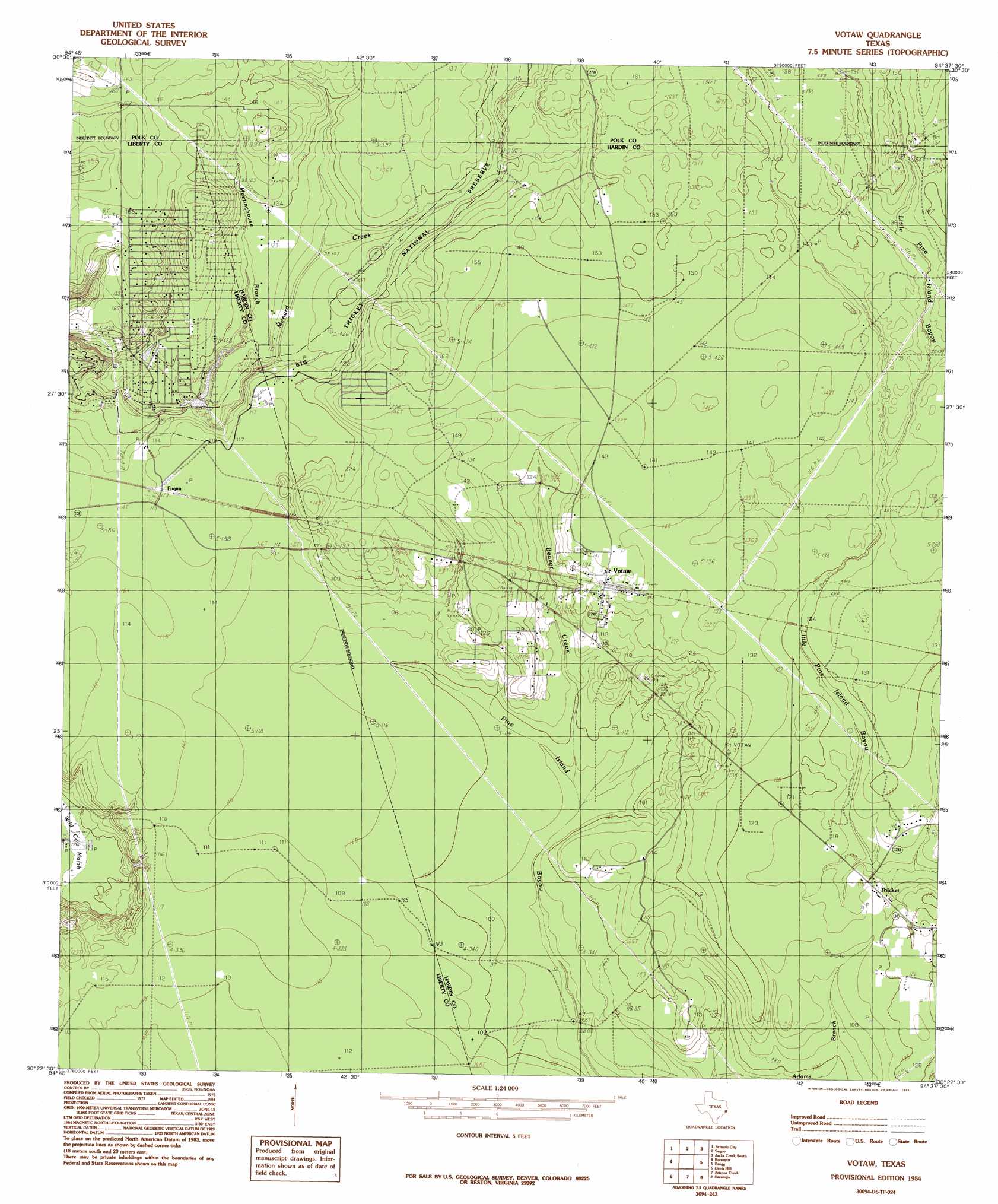
Votaw Topo Map Texas
To zoom in, hover over the map of Votaw
USGS Topo Quad 30094d6 - 1:24,000 scale
| Topo Map Name: | Votaw |
| USGS Topo Quad ID: | 30094d6 |
| Print Size: | ca. 21 1/4" wide x 27" high |
| Southeast Coordinates: | 30.375° N latitude / 94.625° W longitude |
| Map Center Coordinates: | 30.4375° N latitude / 94.6875° W longitude |
| U.S. State: | TX |
| Filename: | o30094d6.jpg |
| Download Map JPG Image: | Votaw topo map 1:24,000 scale |
| Map Type: | Topographic |
| Topo Series: | 7.5´ |
| Map Scale: | 1:24,000 |
| Source of Map Images: | United States Geological Survey (USGS) |
| Alternate Map Versions: |
Votaw TX 1984, updated 1985 Download PDF Buy paper map Votaw TX 2010 Download PDF Buy paper map Votaw TX 2013 Download PDF Buy paper map Votaw TX 2016 Download PDF Buy paper map |
1:24,000 Topo Quads surrounding Votaw
Livingston |
Soda |
Dallardsville |
Jacks Creek North |
Hillister |
Goodrich |
Schwab City |
Segno |
Jacks Creek South |
Warren |
Rayburn |
Romayor |
Votaw |
Bragg |
Village Mills |
Tarkington Prairie |
Davis Hill |
Arizona Creek |
Saratoga |
Kountze Sw |
Simmons Bottom |
Capers Ridge |
Hardin |
Thorson Gully |
Sour Lake |
> Back to 30094a1 at 1:100,000 scale
> Back to 30094a1 at 1:250,000 scale
> Back to U.S. Topo Maps home
Votaw topo map: Gazetteer
Votaw: Dams
Hoop and Holler Lake Number 1 Dam elevation 34m 111′Votaw: Populated Places
Fuqua elevation 35m 114′Hoop and Holler elevation 49m 160′
Thicket elevation 38m 124′
Votaw elevation 42m 137′
Votaw: Reservoirs
Hoop and Holler Lake Number 1 elevation 34m 111′Votaw: Streams
Beaver Creek elevation 29m 95′Meetinghouse Branch elevation 32m 104′
Votaw: Swamps
Wild Cow Marsh elevation 22m 72′Votaw digital topo map on disk
Buy this Votaw topo map showing relief, roads, GPS coordinates and other geographical features, as a high-resolution digital map file on DVD: