Hicksbaugh Topo Map Texas
To zoom in, hover over the map of Hicksbaugh
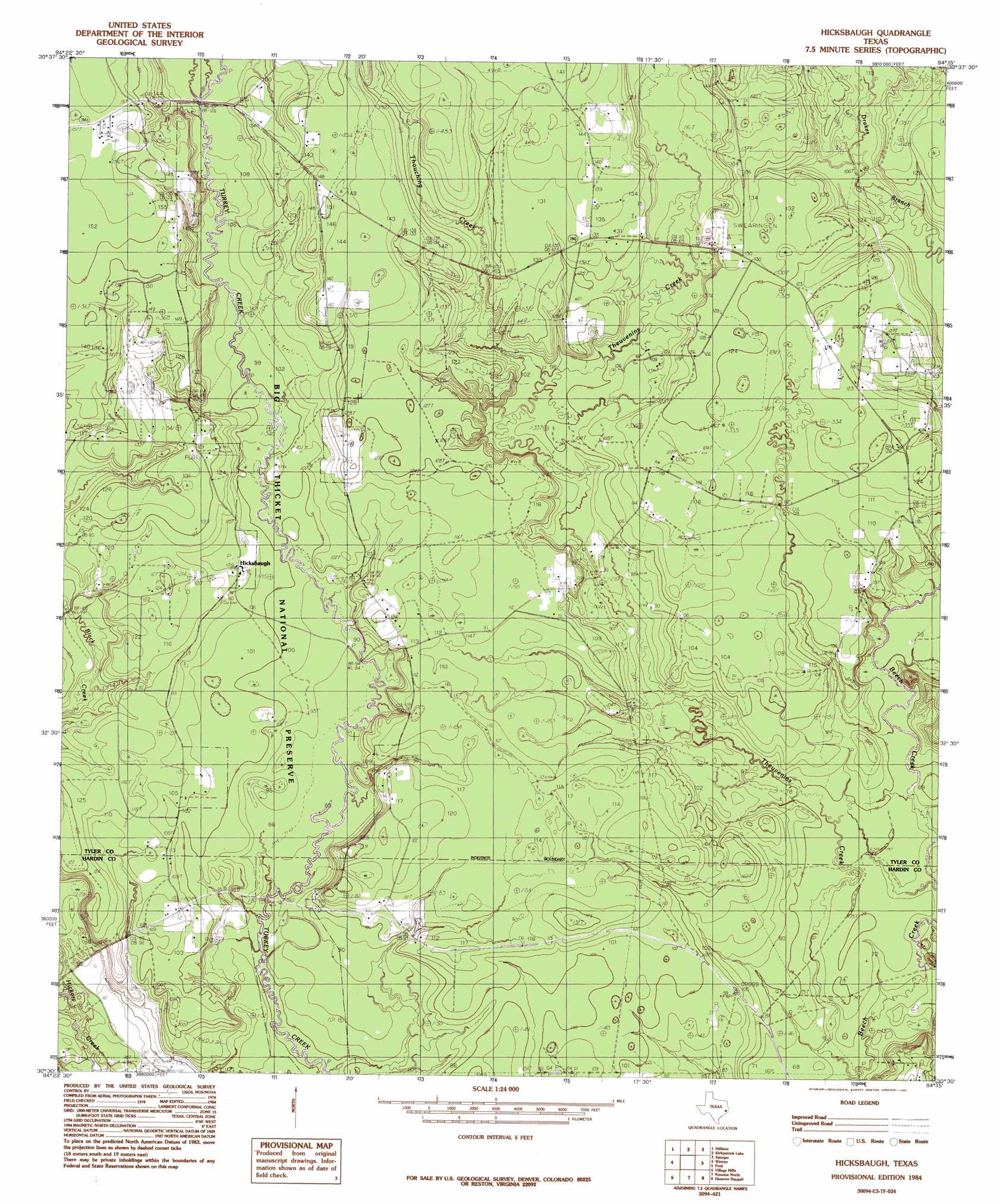
USGS Topo Quad 30094e3 - 1:24,000 scale
| Topo Map Name: | Hicksbaugh |
| USGS Topo Quad ID: | 30094e3 |
| Print Size: | ca. 21 1/4" wide x 27" high |
| Southeast Coordinates: | 30.5° N latitude / 94.25° W longitude |
| Map Center Coordinates: | 30.5625° N latitude / 94.3125° W longitude |
| U.S. State: | TX |
| Filename: | o30094e3.jpg |
| Download Map JPG Image: | Hicksbaugh topo map 1:24,000 scale |
| Map Type: | Topographic |
| Topo Series: | 7.5´ |
| Map Scale: | 1:24,000 |
| Source of Map Images: | United States Geological Survey (USGS) |
| Alternate Map Versions: |
Hicksbaugh TX 1984, updated 1985 Download PDF Buy paper map Hicksbaugh TX 2010 Download PDF Buy paper map Hicksbaugh TX 2013 Download PDF Buy paper map Hicksbaugh TX 2016 Download PDF Buy paper map |
1:24,000 Topo Quads surrounding Hicksbaugh
Chambliss Hill |
Woodville |
Birdwell Lake |
Town Bluff |
Beech Grove |
Jacks Creek North |
Hillister |
Kirkpatrick Lake |
Spurger |
Magnolia Springs |
Jacks Creek South |
Warren |
Hicksbaugh |
Fred |
Potato Patch Lake |
Bragg |
Village Mills |
Kountze North |
Deserter Baygall |
Franklin Lake |
Saratoga |
Kountze Sw |
Kountze South |
Silsbee |
Evadale |
> Back to 30094e1 at 1:100,000 scale
> Back to 30094a1 at 1:250,000 scale
> Back to U.S. Topo Maps home
Hicksbaugh topo map: Gazetteer
Hicksbaugh: Oilfields
Beech Creek Oil Field elevation 29m 95′Hicksbaugh Oil Field elevation 37m 121′
Swearingen Oil Field elevation 39m 127′
Theuvenins Oil Field elevation 35m 114′
Hicksbaugh: Populated Places
Hicksbaugh elevation 34m 111′Hicksbaugh: Streams
Theuvenins Creek elevation 19m 62′Thouching Creek elevation 24m 78′
Hicksbaugh: Trails
Big Thicket - Turkey Creek Trail elevation 26m 85′Hicksbaugh digital topo map on disk
Buy this Hicksbaugh topo map showing relief, roads, GPS coordinates and other geographical features, as a high-resolution digital map file on DVD: