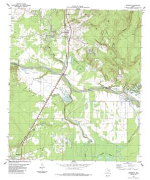
Goodrich Topo Map Texas
To zoom in, hover over the map of Goodrich
USGS Topo Quad 30094e8 - 1:24,000 scale
| Topo Map Name: | Goodrich |
| USGS Topo Quad ID: | 30094e8 |
| Print Size: | ca. 21 1/4" wide x 27" high |
| Southeast Coordinates: | 30.5° N latitude / 94.875° W longitude |
| Map Center Coordinates: | 30.5625° N latitude / 94.9375° W longitude |
| U.S. State: | TX |
| Filename: | o30094e8.jpg |
| Download Map JPG Image: | Goodrich topo map 1:24,000 scale |
| Map Type: | Topographic |
| Topo Series: | 7.5´ |
| Map Scale: | 1:24,000 |
| Source of Map Images: | United States Geological Survey (USGS) |
| Alternate Map Versions: |
Goodrich TX 1984, updated 1984 Download PDF Buy paper map Goodrich TX 2010 Download PDF Buy paper map Goodrich TX 2013 Download PDF Buy paper map Goodrich TX 2016 Download PDF Buy paper map |
1:24,000 Topo Quads surrounding Goodrich
> Back to 30094e1 at 1:100,000 scale
> Back to 30094a1 at 1:250,000 scale
> Back to U.S. Topo Maps home
Goodrich topo map: Gazetteer
Goodrich: Airports
Loghouse Stolport elevation 55m 180′Goodrich: Dams
Lake Londa Lynn Dam elevation 23m 75′Sleepy Hollow Lake Dam elevation 49m 160′
Goodrich: Oilfields
Morgan Creek Oil Field elevation 65m 213′Goodrich: Populated Places
Goodrich elevation 32m 104′New Hope elevation 33m 108′
Urbana elevation 28m 91′
Goodrich: Reservoirs
Lake Londa Lynn elevation 23m 75′Sleepy Hollow Lake elevation 49m 160′
Goodrich: Streams
Black Branch elevation 16m 52′Burnt-Out Creek elevation 33m 108′
Copeland Creek elevation 14m 45′
Fish Branch elevation 19m 62′
Long King Creek elevation 16m 52′
Sanson Creek elevation 19m 62′
Turner Creek elevation 44m 144′
Turner Creek elevation 29m 95′
Williamson Branch elevation 14m 45′
Goodrich: Swamps
McCardell Lake elevation 24m 78′The Break elevation 22m 72′
Goodrich digital topo map on disk
Buy this Goodrich topo map showing relief, roads, GPS coordinates and other geographical features, as a high-resolution digital map file on DVD:


