Soda Topo Map Texas
To zoom in, hover over the map of Soda
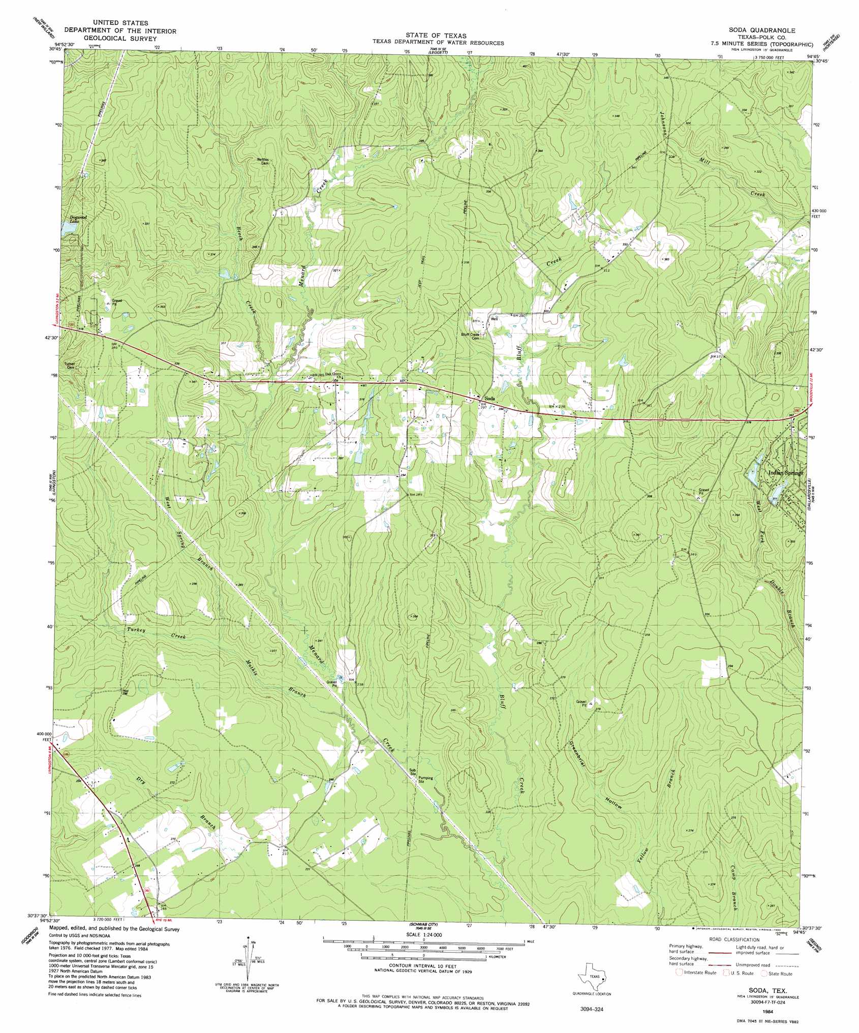
USGS Topo Quad 30094f7 - 1:24,000 scale
| Topo Map Name: | Soda |
| USGS Topo Quad ID: | 30094f7 |
| Print Size: | ca. 21 1/4" wide x 27" high |
| Southeast Coordinates: | 30.625° N latitude / 94.75° W longitude |
| Map Center Coordinates: | 30.6875° N latitude / 94.8125° W longitude |
| U.S. State: | TX |
| Filename: | o30094f7.jpg |
| Download Map JPG Image: | Soda topo map 1:24,000 scale |
| Map Type: | Topographic |
| Topo Series: | 7.5´ |
| Map Scale: | 1:24,000 |
| Source of Map Images: | United States Geological Survey (USGS) |
| Alternate Map Versions: |
Soda TX 1984, updated 1984 Download PDF Buy paper map Soda TX 2010 Download PDF Buy paper map Soda TX 2013 Download PDF Buy paper map Soda TX 2016 Download PDF Buy paper map |
1:24,000 Topo Quads surrounding Soda
Colita |
Carmona |
Corrigan |
Camden |
Chester |
Onalaska |
New Willard |
Leggett |
Hortense |
Chambliss Hill |
Blanchard |
Livingston |
Soda |
Dallardsville |
Jacks Creek North |
Camilla |
Goodrich |
Schwab City |
Segno |
Jacks Creek South |
Westcott |
Rayburn |
Romayor |
Votaw |
Bragg |
> Back to 30094e1 at 1:100,000 scale
> Back to 30094a1 at 1:250,000 scale
> Back to U.S. Topo Maps home
Soda topo map: Gazetteer
Soda: Dams
Lake Donna Dam elevation 85m 278′Lake Winnipesaukee Dam elevation 88m 288′
Soda: Reservoirs
Lake Winnipesaukee elevation 88m 288′Soda: Streams
Beech Creek elevation 76m 249′Bluff Creek elevation 63m 206′
East Menard Creek elevation 88m 288′
Mathis Branch elevation 64m 209′
Turkey Creek elevation 69m 226′
West Spring Branch elevation 70m 229′
Soda: Valleys
Greenbriar Hollow elevation 66m 216′Soda digital topo map on disk
Buy this Soda topo map showing relief, roads, GPS coordinates and other geographical features, as a high-resolution digital map file on DVD: