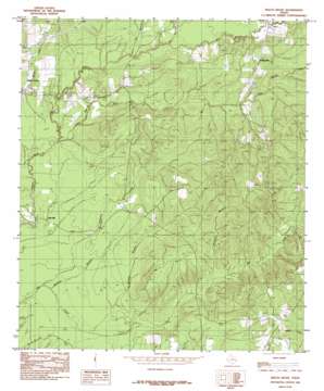
Beech Grove Topo Map Texas
To zoom in, hover over the map of Beech Grove
USGS Topo Quad 30094g1 - 1:24,000 scale
| Topo Map Name: | Beech Grove |
| USGS Topo Quad ID: | 30094g1 |
| Print Size: | ca. 21 1/4" wide x 27" high |
| Southeast Coordinates: | 30.75° N latitude / 94° W longitude |
| Map Center Coordinates: | 30.8125° N latitude / 94.0625° W longitude |
| U.S. State: | TX |
| Filename: | o30094g1.jpg |
| Download Map JPG Image: | Beech Grove topo map 1:24,000 scale |
| Map Type: | Topographic |
| Topo Series: | 7.5´ |
| Map Scale: | 1:24,000 |
| Source of Map Images: | United States Geological Survey (USGS) |
| Alternate Map Versions: |
Beech Grove TX 1984, updated 1985 Download PDF Buy paper map Beech Grove TX 2010 Download PDF Buy paper map Beech Grove TX 2013 Download PDF Buy paper map Beech Grove TX 2016 Download PDF Buy paper map |
1:24,000 Topo Quads surrounding Beech Grove
> Back to 30094e1 at 1:100,000 scale
> Back to 30094a1 at 1:250,000 scale
> Back to U.S. Topo Maps home
Beech Grove topo map: Gazetteer
Beech Grove: Parks
George Washington Smyth Historical Monument elevation 34m 111′Beech Grove: Populated Places
Beech Grove elevation 35m 114′Oak Hill elevation 28m 91′
Science Hall elevation 37m 121′
Beech Grove: Streams
Big Walnut Run elevation 28m 91′Blewett Branch elevation 24m 78′
Dry Branch elevation 41m 134′
Hurricane Branch elevation 39m 127′
Little Walnut Run elevation 28m 91′
Mill Branch elevation 37m 121′
Pickering Creek elevation 26m 85′
Robinson Branch elevation 21m 68′
Beech Grove: Summits
Spring Hill elevation 69m 226′Beech Grove digital topo map on disk
Buy this Beech Grove topo map showing relief, roads, GPS coordinates and other geographical features, as a high-resolution digital map file on DVD:


