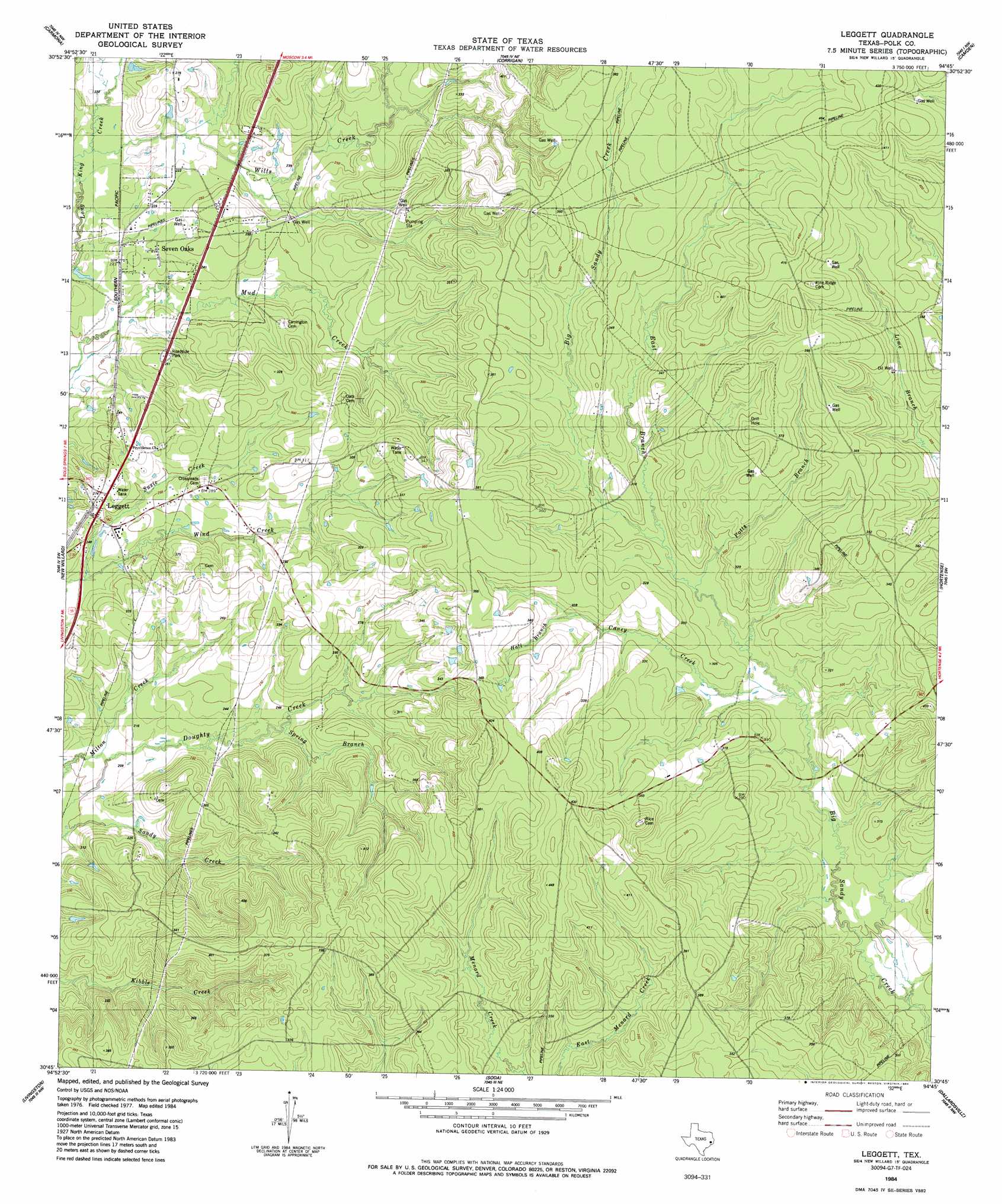
Leggett Topo Map Texas
To zoom in, hover over the map of Leggett
USGS Topo Quad 30094g7 - 1:24,000 scale
| Topo Map Name: | Leggett |
| USGS Topo Quad ID: | 30094g7 |
| Print Size: | ca. 21 1/4" wide x 27" high |
| Southeast Coordinates: | 30.75° N latitude / 94.75° W longitude |
| Map Center Coordinates: | 30.8125° N latitude / 94.8125° W longitude |
| U.S. State: | TX |
| Filename: | o30094g7.jpg |
| Download Map JPG Image: | Leggett topo map 1:24,000 scale |
| Map Type: | Topographic |
| Topo Series: | 7.5´ |
| Map Scale: | 1:24,000 |
| Source of Map Images: | United States Geological Survey (USGS) |
| Alternate Map Versions: |
Leggett TX 1984, updated 1984 Download PDF Buy paper map Leggett TX 2010 Download PDF Buy paper map Leggett TX 2013 Download PDF Buy paper map Leggett TX 2016 Download PDF Buy paper map |
1:24,000 Topo Quads surrounding Leggett
Groveton East |
Trevat |
Wakefield |
Pluck |
Wolf Hill |
Colita |
Carmona |
Corrigan |
Camden |
Chester |
Onalaska |
New Willard |
Leggett |
Hortense |
Chambliss Hill |
Blanchard |
Livingston |
Soda |
Dallardsville |
Jacks Creek North |
Camilla |
Goodrich |
Schwab City |
Segno |
Jacks Creek South |
> Back to 30094e1 at 1:100,000 scale
> Back to 30094a1 at 1:250,000 scale
> Back to U.S. Topo Maps home
Leggett topo map: Gazetteer
Leggett: Populated Places
Leggett elevation 77m 252′Ollie elevation 93m 305′
Seven Oaks elevation 67m 219′
Walda elevation 82m 269′
Leggett: Streams
Wills Creek elevation 63m 206′Leggett digital topo map on disk
Buy this Leggett topo map showing relief, roads, GPS coordinates and other geographical features, as a high-resolution digital map file on DVD: