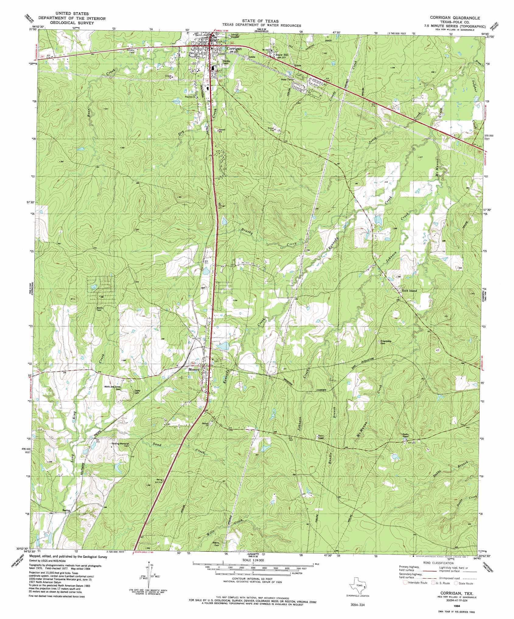
Corrigan Topo Map Texas
To zoom in, hover over the map of Corrigan
USGS Topo Quad 30094h7 - 1:24,000 scale
| Topo Map Name: | Corrigan |
| USGS Topo Quad ID: | 30094h7 |
| Print Size: | ca. 21 1/4" wide x 27" high |
| Southeast Coordinates: | 30.875° N latitude / 94.75° W longitude |
| Map Center Coordinates: | 30.9375° N latitude / 94.8125° W longitude |
| U.S. State: | TX |
| Filename: | o30094h7.jpg |
| Download Map JPG Image: | Corrigan topo map 1:24,000 scale |
| Map Type: | Topographic |
| Topo Series: | 7.5´ |
| Map Scale: | 1:24,000 |
| Source of Map Images: | United States Geological Survey (USGS) |
| Alternate Map Versions: |
Corrigan TX 1984, updated 1984 Download PDF Buy paper map Corrigan TX 2010 Download PDF Buy paper map Corrigan TX 2013 Download PDF Buy paper map Corrigan TX 2016 Download PDF Buy paper map |
1:24,000 Topo Quads surrounding Corrigan
Crecy |
Apple Springs |
Diboll |
Bald Hill |
Manning |
Groveton East |
Trevat |
Wakefield |
Pluck |
Wolf Hill |
Colita |
Carmona |
Corrigan |
Camden |
Chester |
Onalaska |
New Willard |
Leggett |
Hortense |
Chambliss Hill |
Blanchard |
Livingston |
Soda |
Dallardsville |
Jacks Creek North |
> Back to 30094e1 at 1:100,000 scale
> Back to 30094a1 at 1:250,000 scale
> Back to U.S. Topo Maps home
Corrigan topo map: Gazetteer
Corrigan: Dams
Timber Lake Dam elevation 93m 305′Corrigan: Populated Places
Asia elevation 77m 252′Bering elevation 69m 226′
Corrigan elevation 72m 236′
Moscow elevation 105m 344′
Snow Hill elevation 76m 249′
Corrigan: Reservoirs
Timber Lake elevation 93m 305′Corrigan: Streams
Beaver Creek elevation 55m 180′Brushy Creek elevation 70m 229′
Bundix Branch elevation 86m 282′
Johnson Creek elevation 61m 200′
Jones Creek elevation 57m 187′
Kennedy Creek elevation 59m 193′
Sand Creek elevation 70m 229′
Sulphur Creek elevation 58m 190′
Corrigan digital topo map on disk
Buy this Corrigan topo map showing relief, roads, GPS coordinates and other geographical features, as a high-resolution digital map file on DVD: