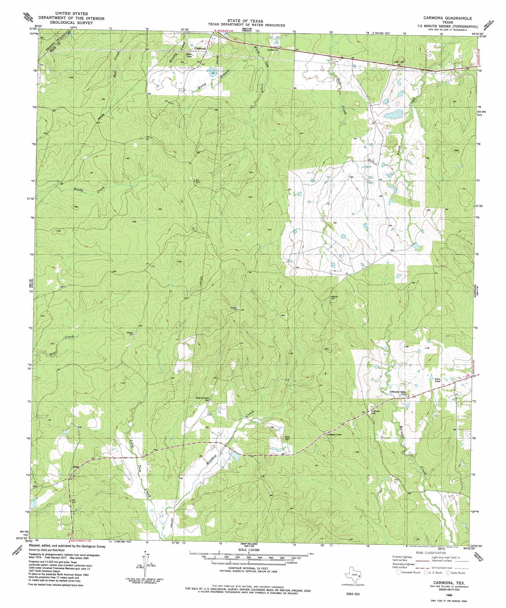
Carmona Topo Map Texas
To zoom in, hover over the map of Carmona
USGS Topo Quad 30094h8 - 1:24,000 scale
| Topo Map Name: | Carmona |
| USGS Topo Quad ID: | 30094h8 |
| Print Size: | ca. 21 1/4" wide x 27" high |
| Southeast Coordinates: | 30.875° N latitude / 94.875° W longitude |
| Map Center Coordinates: | 30.9375° N latitude / 94.9375° W longitude |
| U.S. State: | TX |
| Filename: | o30094h8.jpg |
| Download Map JPG Image: | Carmona topo map 1:24,000 scale |
| Map Type: | Topographic |
| Topo Series: | 7.5´ |
| Map Scale: | 1:24,000 |
| Source of Map Images: | United States Geological Survey (USGS) |
| Alternate Map Versions: |
Carmona TX 1984, updated 1984 Download PDF Buy paper map Carmona TX 2010 Download PDF Buy paper map Carmona TX 2013 Download PDF Buy paper map Carmona TX 2016 Download PDF Buy paper map |
1:24,000 Topo Quads surrounding Carmona
Pennington |
Crecy |
Apple Springs |
Diboll |
Bald Hill |
Groveton West |
Groveton East |
Trevat |
Wakefield |
Pluck |
Chita |
Colita |
Carmona |
Corrigan |
Camden |
Carlisle |
Onalaska |
New Willard |
Leggett |
Hortense |
Stephen Creek |
Blanchard |
Livingston |
Soda |
Dallardsville |
> Back to 30094e1 at 1:100,000 scale
> Back to 30094a1 at 1:250,000 scale
> Back to U.S. Topo Maps home
Carmona topo map: Gazetteer
Carmona: Populated Places
Carmona elevation 89m 291′Carmona: Streams
Meadow Creek elevation 65m 213′Pump Branch elevation 73m 239′
Carmona: Trails
Bull Creek Trail elevation 79m 259′Carmona digital topo map on disk
Buy this Carmona topo map showing relief, roads, GPS coordinates and other geographical features, as a high-resolution digital map file on DVD: