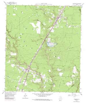
Splendora Topo Map Texas
To zoom in, hover over the map of Splendora
USGS Topo Quad 30095b2 - 1:24,000 scale
| Topo Map Name: | Splendora |
| USGS Topo Quad ID: | 30095b2 |
| Print Size: | ca. 21 1/4" wide x 27" high |
| Southeast Coordinates: | 30.125° N latitude / 95.125° W longitude |
| Map Center Coordinates: | 30.1875° N latitude / 95.1875° W longitude |
| U.S. State: | TX |
| Filename: | o30095b2.jpg |
| Download Map JPG Image: | Splendora topo map 1:24,000 scale |
| Map Type: | Topographic |
| Topo Series: | 7.5´ |
| Map Scale: | 1:24,000 |
| Source of Map Images: | United States Geological Survey (USGS) |
| Alternate Map Versions: |
Splendora TX 1959, updated 1960 Download PDF Buy paper map Splendora TX 1959, updated 1974 Download PDF Buy paper map Splendora TX 1959, updated 1980 Download PDF Buy paper map Splendora TX 1959, updated 1991 Download PDF Buy paper map Splendora TX 2010 Download PDF Buy paper map Splendora TX 2013 Download PDF Buy paper map Splendora TX 2016 Download PDF Buy paper map |
1:24,000 Topo Quads surrounding Splendora
> Back to 30095a1 at 1:100,000 scale
> Back to 30094a1 at 1:250,000 scale
> Back to U.S. Topo Maps home
Splendora topo map: Gazetteer
Splendora: Dams
Lakeland Lake Dam elevation 26m 85′Patton Village Lake Dam elevation 26m 85′
Peach Creek Dam elevation 27m 88′
Splendora: Lakes
Coleman Lake elevation 34m 111′Deer Pond elevation 36m 118′
Lakeland Lake elevation 26m 85′
Patton Lake elevation 27m 88′
Peach Creek Lake elevation 27m 88′
Splendora: Oilfields
Splendora Oil Field elevation 33m 108′Splendora: Parks
Lake Houston State Park elevation 23m 75′Splendora: Populated Places
Deerbrook elevation 35m 114′Forest Estates elevation 32m 104′
Hill and Dale Terrace elevation 34m 111′
Keefer elevation 32m 104′
Lake Spendora elevation 31m 101′
New Caney elevation 29m 95′
Patton Village elevation 27m 88′
Roman Forest elevation 32m 104′
Splendora elevation 38m 124′
Woodbranch elevation 29m 95′
Splendora: Post Offices
Splendora Post Office elevation 38m 124′Splendora: Reservoirs
Lakeland Lake elevation 26m 85′Patton Lake elevation 26m 85′
Peach Creek Lake elevation 27m 88′
Splendora: Streams
Dry Creek elevation 23m 75′Gulley Branch elevation 26m 85′
Gully Branch elevation 26m 85′
Mare Branch elevation 22m 72′
Spring Branch elevation 24m 78′
Spring Branch elevation 31m 101′
Waterhole Branch elevation 24m 78′
Splendora: Swamps
Big Carter Pond elevation 31m 101′Big Dinah Pond elevation 35m 114′
Briar Patch Pond elevation 32m 104′
Button Willow Pond elevation 38m 124′
Casey Pond elevation 31m 101′
Cat Pond elevation 30m 98′
Convict Pond elevation 35m 114′
Creed Pond elevation 30m 98′
Duck Pond elevation 35m 114′
Duke Pond elevation 41m 134′
Grassy Pond elevation 29m 95′
Hayden Pond elevation 37m 121′
Hog Pond elevation 41m 134′
Island Pond elevation 36m 118′
Keefer Pond elevation 33m 108′
Line Pond elevation 32m 104′
Little Carter Pond elevation 30m 98′
Little Dinah Pond elevation 36m 118′
Long Pond elevation 35m 114′
Mule Pond elevation 36m 118′
Pine Pond elevation 32m 104′
Presswood Pond elevation 36m 118′
Round Pond elevation 36m 118′
Sand Pond elevation 25m 82′
Section Pond elevation 38m 124′
Smith Pond elevation 43m 141′
Tie Pond elevation 29m 95′
Viney Pond elevation 35m 114′
Splendora: Valleys
Casey Gully elevation 17m 55′Church House Gully elevation 15m 49′
Orton Gully elevation 18m 59′
Splendora digital topo map on disk
Buy this Splendora topo map showing relief, roads, GPS coordinates and other geographical features, as a high-resolution digital map file on DVD:


