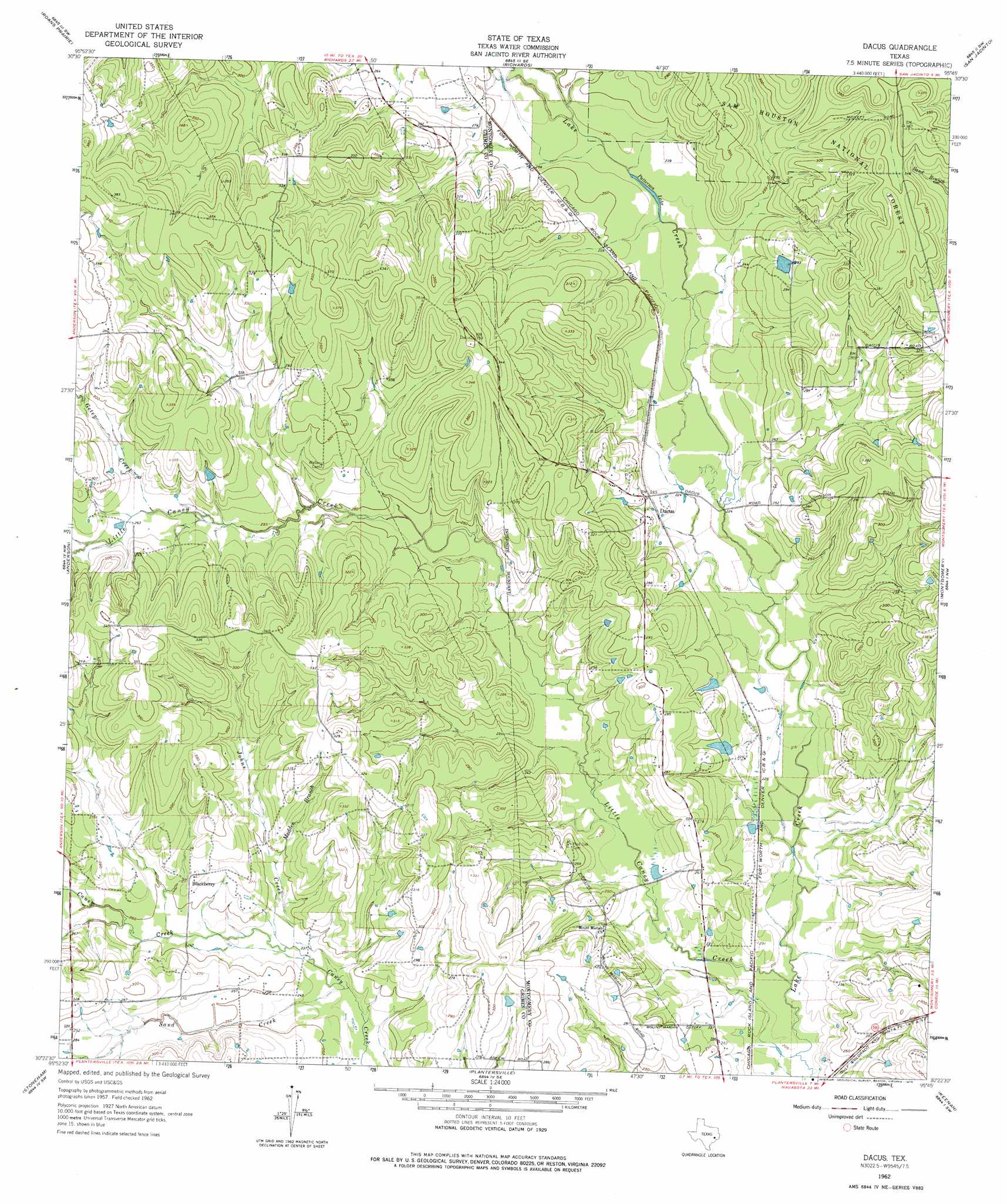
Dacus Topo Map Texas
To zoom in, hover over the map of Dacus
USGS Topo Quad 30095d7 - 1:24,000 scale
| Topo Map Name: | Dacus |
| USGS Topo Quad ID: | 30095d7 |
| Print Size: | ca. 21 1/4" wide x 27" high |
| Southeast Coordinates: | 30.375° N latitude / 95.75° W longitude |
| Map Center Coordinates: | 30.4375° N latitude / 95.8125° W longitude |
| U.S. State: | TX |
| Filename: | o30095d7.jpg |
| Download Map JPG Image: | Dacus topo map 1:24,000 scale |
| Map Type: | Topographic |
| Topo Series: | 7.5´ |
| Map Scale: | 1:24,000 |
| Source of Map Images: | United States Geological Survey (USGS) |
| Alternate Map Versions: |
Dacus TX 1962, updated 1963 Download PDF Buy paper map Dacus TX 1962, updated 1975 Download PDF Buy paper map Dacus TX 2010 Download PDF Buy paper map Dacus TX 2013 Download PDF Buy paper map Dacus TX 2016 Download PDF Buy paper map |
| FStopo: | US Forest Service topo Dacus is available: Download FStopo PDF Download FStopo TIF |
1:24,000 Topo Quads surrounding Dacus
Keith |
Singleton |
Loma |
Galilee |
Huntsville |
Carlos |
Roans Prairie |
Richards |
San Jacinto |
Moore Grove |
Navasota |
Anderson |
Dacus |
Montgomery |
Shepard Hill |
Courtney |
Stoneham |
Plantersville |
Keenan |
Cowl Spur |
Howth |
Waller Nw |
Magnolia West |
Magnolia East |
Oklahoma |
> Back to 30095a1 at 1:100,000 scale
> Back to 30094a1 at 1:250,000 scale
> Back to U.S. Topo Maps home
Dacus topo map: Gazetteer
Dacus: Lakes
Patterson Lake elevation 72m 236′Dacus: Populated Places
Blackberry elevation 84m 275′Dacus elevation 76m 249′
Dacus: Streams
Geter Creek elevation 79m 259′Johns Creek elevation 72m 236′
Kidhaw Branch elevation 73m 239′
Little Caney Creek elevation 62m 203′
Madden Branch elevation 75m 246′
Sand Creek elevation 71m 232′
Dacus digital topo map on disk
Buy this Dacus topo map showing relief, roads, GPS coordinates and other geographical features, as a high-resolution digital map file on DVD: