New Waverly Topo Map Texas
To zoom in, hover over the map of New Waverly
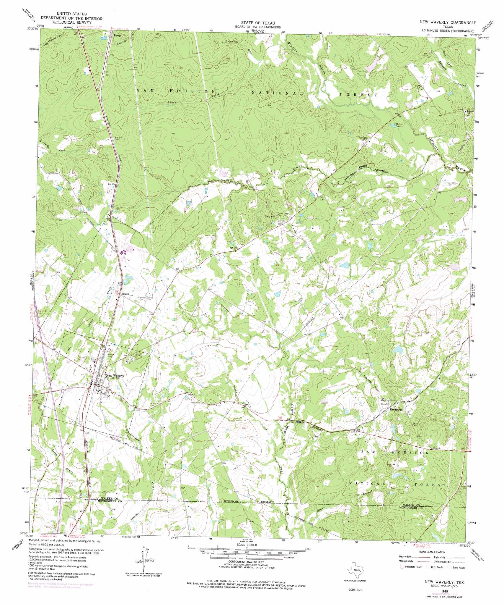
USGS Topo Quad 30095e4 - 1:24,000 scale
| Topo Map Name: | New Waverly |
| USGS Topo Quad ID: | 30095e4 |
| Print Size: | ca. 21 1/4" wide x 27" high |
| Southeast Coordinates: | 30.5° N latitude / 95.375° W longitude |
| Map Center Coordinates: | 30.5625° N latitude / 95.4375° W longitude |
| U.S. State: | TX |
| Filename: | o30095e4.jpg |
| Download Map JPG Image: | New Waverly topo map 1:24,000 scale |
| Map Type: | Topographic |
| Topo Series: | 7.5´ |
| Map Scale: | 1:24,000 |
| Source of Map Images: | United States Geological Survey (USGS) |
| Alternate Map Versions: |
New Waverly TX 1960, updated 1962 Download PDF Buy paper map New Waverly TX 1960, updated 1973 Download PDF Buy paper map New Waverly TX 1960, updated 1978 Download PDF Buy paper map New Waverly TX 1997, updated 2000 Download PDF Buy paper map New Waverly TX 2010 Download PDF Buy paper map New Waverly TX 2013 Download PDF Buy paper map New Waverly TX 2016 Download PDF Buy paper map |
| FStopo: | US Forest Service topo New Waverly is available: Download FStopo PDF Download FStopo TIF |
1:24,000 Topo Quads surrounding New Waverly
Crabbs Prairie |
Pine Prairie |
Riverside |
Staley |
Carlisle |
Galilee |
Huntsville |
Phelps |
Oakhurst |
Stephen Creek |
San Jacinto |
Moore Grove |
New Waverly |
Maynard |
Coldspring |
Montgomery |
Shepard Hill |
Willis |
Conroe Ne |
Bear Creek |
Keenan |
Cowl Spur |
Conroe |
Cut And Shoot |
Fostoria |
> Back to 30095e1 at 1:100,000 scale
> Back to 30094a1 at 1:250,000 scale
> Back to U.S. Topo Maps home
New Waverly topo map: Gazetteer
New Waverly: Dams
Griffin Lake Dam elevation 90m 295′New Waverly: Lakes
Walker Lake elevation 79m 259′New Waverly: Populated Places
Barado elevation 116m 380′Elmina elevation 116m 380′
Hawthorne elevation 129m 423′
New Waverly elevation 108m 354′
New Waverly: Reservoirs
Griffin Lake elevation 90m 295′New Waverly: Streams
Briar Creek elevation 79m 259′Goodridge Creek elevation 86m 282′
Gourd Creek elevation 76m 249′
Hegar Branch elevation 77m 252′
Rhodes Creek elevation 82m 269′
Rocky Creek elevation 82m 269′
New Waverly digital topo map on disk
Buy this New Waverly topo map showing relief, roads, GPS coordinates and other geographical features, as a high-resolution digital map file on DVD: