San Jacinto Topo Map Texas
To zoom in, hover over the map of San Jacinto
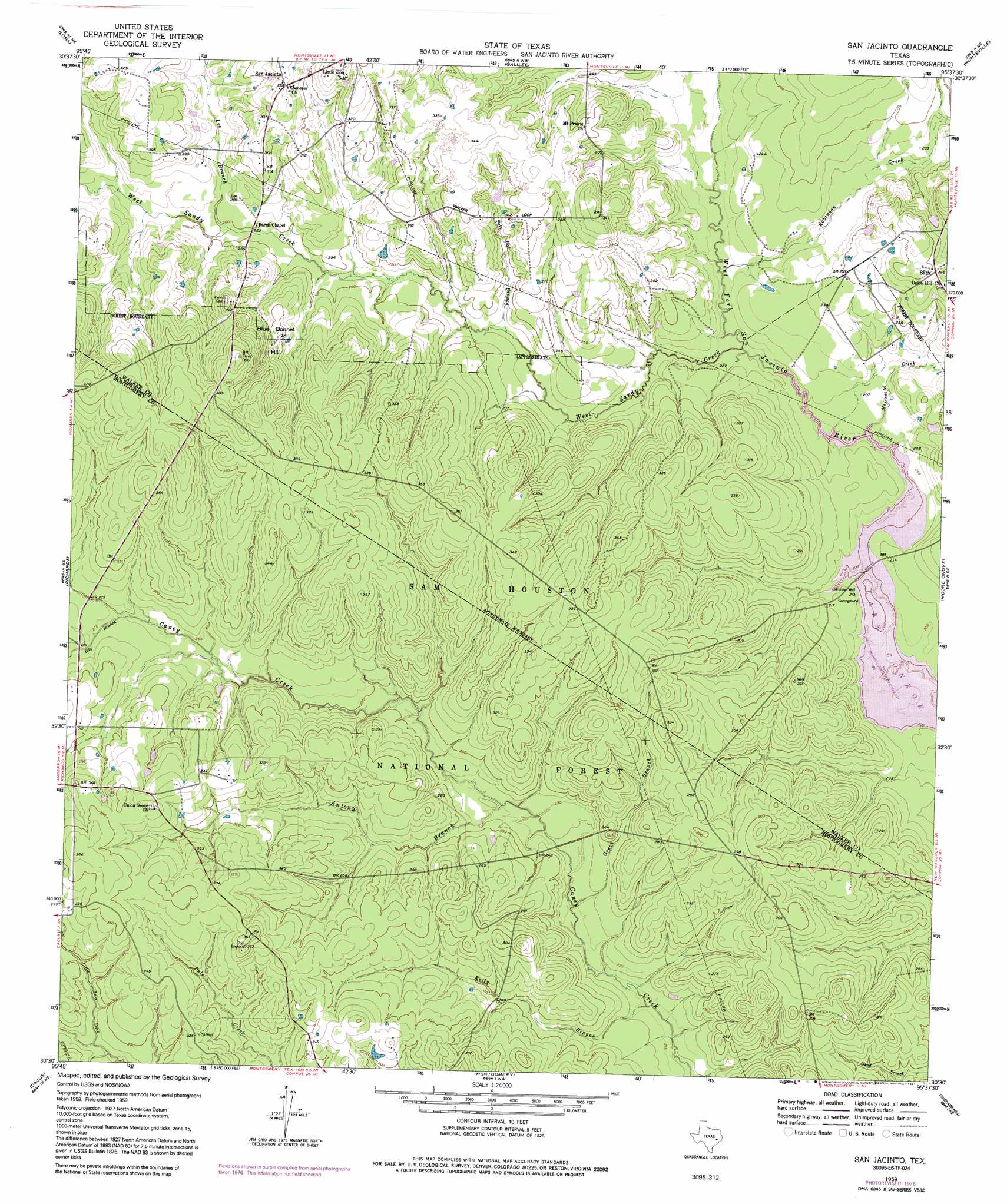
USGS Topo Quad 30095e6 - 1:24,000 scale
| Topo Map Name: | San Jacinto |
| USGS Topo Quad ID: | 30095e6 |
| Print Size: | ca. 21 1/4" wide x 27" high |
| Southeast Coordinates: | 30.5° N latitude / 95.625° W longitude |
| Map Center Coordinates: | 30.5625° N latitude / 95.6875° W longitude |
| U.S. State: | TX |
| Filename: | o30095e6.jpg |
| Download Map JPG Image: | San Jacinto topo map 1:24,000 scale |
| Map Type: | Topographic |
| Topo Series: | 7.5´ |
| Map Scale: | 1:24,000 |
| Source of Map Images: | United States Geological Survey (USGS) |
| Alternate Map Versions: |
San Jacinto TX 1959, updated 1960 Download PDF Buy paper map San Jacinto TX 1959, updated 1968 Download PDF Buy paper map San Jacinto TX 1959, updated 1978 Download PDF Buy paper map San Jacinto TX 1959, updated 1991 Download PDF Buy paper map San Jacinto TX 1997, updated 1999 Download PDF Buy paper map San Jacinto TX 2010 Download PDF Buy paper map San Jacinto TX 2013 Download PDF Buy paper map San Jacinto TX 2016 Download PDF Buy paper map |
| FStopo: | US Forest Service topo San Jacinto is available: Download FStopo PDF Download FStopo TIF |
1:24,000 Topo Quads surrounding San Jacinto
Bedias |
Steep Branch |
Crabbs Prairie |
Pine Prairie |
Riverside |
Singleton |
Loma |
Galilee |
Huntsville |
Phelps |
Roans Prairie |
Richards |
San Jacinto |
Moore Grove |
New Waverly |
Anderson |
Dacus |
Montgomery |
Shepard Hill |
Willis |
Stoneham |
Plantersville |
Keenan |
Cowl Spur |
Conroe |
> Back to 30095e1 at 1:100,000 scale
> Back to 30094a1 at 1:250,000 scale
> Back to U.S. Topo Maps home
San Jacinto topo map: Gazetteer
San Jacinto: Populated Places
Goshen elevation 104m 341′San Jacinto elevation 103m 337′
San Jacinto: Streams
Antony Branch elevation 70m 229′Bay Branch elevation 80m 262′
Green Branch elevation 67m 219′
Kelly Branch elevation 64m 209′
Lee Branch elevation 75m 246′
McDonald Creek elevation 62m 203′
Pole Cat Branch elevation 68m 223′
Robinson Creek elevation 64m 209′
West Sandy Creek elevation 63m 206′
San Jacinto: Summits
Blue Bonnet Hill elevation 96m 314′San Jacinto: Trails
Stubblefield Lake Trail elevation 66m 216′San Jacinto digital topo map on disk
Buy this San Jacinto topo map showing relief, roads, GPS coordinates and other geographical features, as a high-resolution digital map file on DVD: