Pine Prairie Topo Map Texas
To zoom in, hover over the map of Pine Prairie
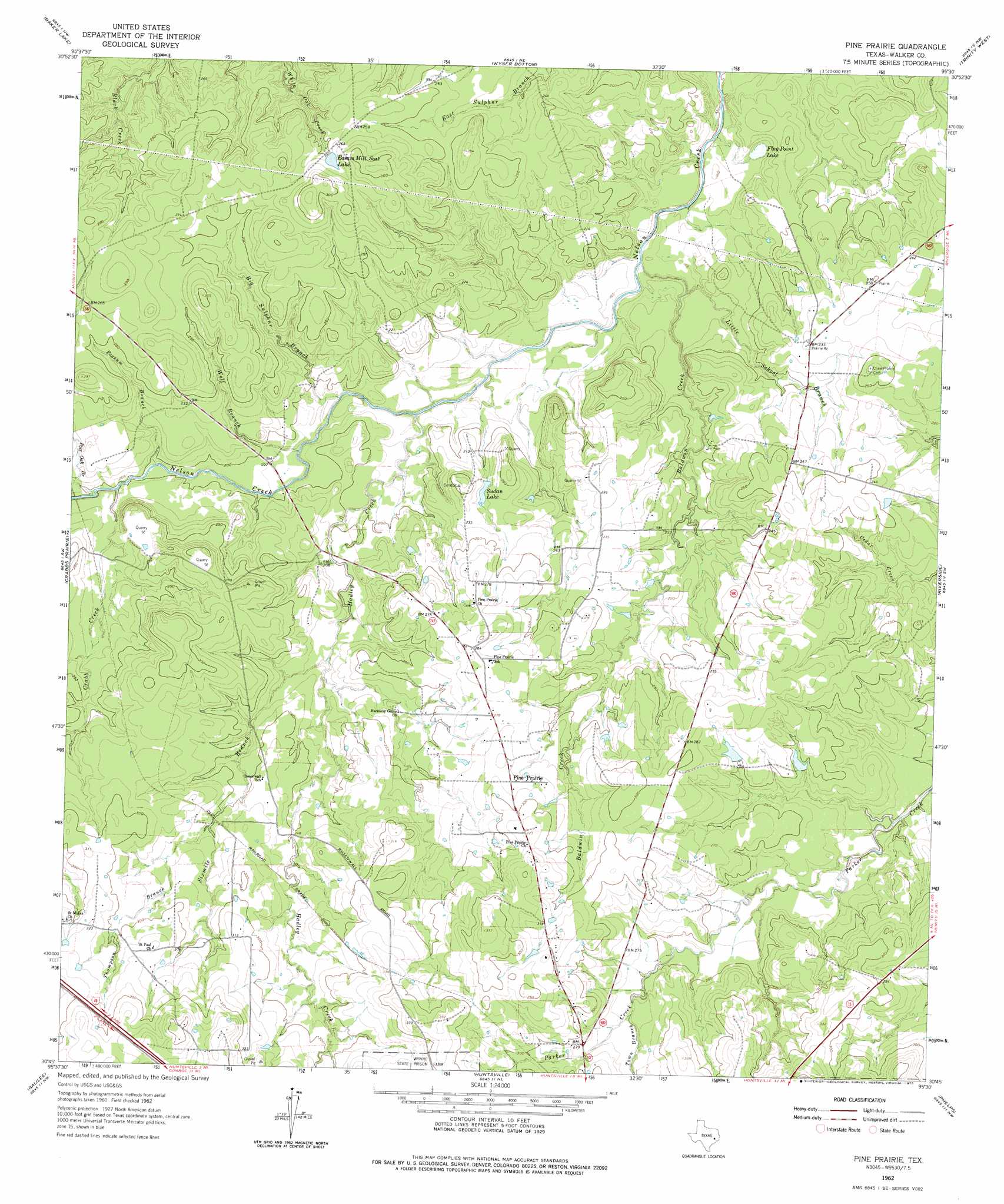
USGS Topo Quad 30095g5 - 1:24,000 scale
| Topo Map Name: | Pine Prairie |
| USGS Topo Quad ID: | 30095g5 |
| Print Size: | ca. 21 1/4" wide x 27" high |
| Southeast Coordinates: | 30.75° N latitude / 95.5° W longitude |
| Map Center Coordinates: | 30.8125° N latitude / 95.5625° W longitude |
| U.S. State: | TX |
| Filename: | o30095g5.jpg |
| Download Map JPG Image: | Pine Prairie topo map 1:24,000 scale |
| Map Type: | Topographic |
| Topo Series: | 7.5´ |
| Map Scale: | 1:24,000 |
| Source of Map Images: | United States Geological Survey (USGS) |
| Alternate Map Versions: |
Pine Prairie TX 1962, updated 1964 Download PDF Buy paper map Pine Prairie TX 1962, updated 1975 Download PDF Buy paper map Pine Prairie TX 1962, updated 1975 Download PDF Buy paper map Pine Prairie TX 1997, updated 2000 Download PDF Buy paper map Pine Prairie TX 2010 Download PDF Buy paper map Pine Prairie TX 2013 Download PDF Buy paper map Pine Prairie TX 2016 Download PDF Buy paper map |
| FStopo: | US Forest Service topo Pine Prairie is available: Download FStopo PDF Download FStopo TIF |
1:24,000 Topo Quads surrounding Pine Prairie
Elwood |
Sand Ridge |
Weldon |
Lovelady South |
Glendale |
Connor |
Baker Lake |
Wyser Bottom |
Trinity West |
Trinity East |
Steep Branch |
Crabbs Prairie |
Pine Prairie |
Riverside |
Staley |
Loma |
Galilee |
Huntsville |
Phelps |
Oakhurst |
Richards |
San Jacinto |
Moore Grove |
New Waverly |
Maynard |
> Back to 30095e1 at 1:100,000 scale
> Back to 30094a1 at 1:250,000 scale
> Back to U.S. Topo Maps home
Pine Prairie topo map: Gazetteer
Pine Prairie: Dams
Easam Mill Seat Lake Dam elevation 78m 255′Gibbs Brothers Lake Dam elevation 67m 219′
Pine Prairie: Lakes
Flag Point Lake elevation 47m 154′Pine Prairie: Populated Places
Pine Prairie elevation 86m 282′Pine Prairie: Reservoirs
Easam Mill Seat Lake elevation 80m 262′Gibbs Brothers Lake elevation 67m 219′
Sudan Lake elevation 68m 223′
Pine Prairie: Streams
Baldwin Creek elevation 46m 150′Big Sulphur Branch elevation 54m 177′
Crabb Creek elevation 61m 200′
Hadley Creek elevation 51m 167′
Little School Branch elevation 49m 160′
Possum Branch elevation 58m 190′
Post Oak Branch elevation 60m 196′
Sixmile Branch elevation 66m 216′
Thompson Creek elevation 76m 249′
Town Branch elevation 80m 262′
Wolf Branch elevation 59m 193′
Pine Prairie digital topo map on disk
Buy this Pine Prairie topo map showing relief, roads, GPS coordinates and other geographical features, as a high-resolution digital map file on DVD: