Colita Topo Map Texas
To zoom in, hover over the map of Colita
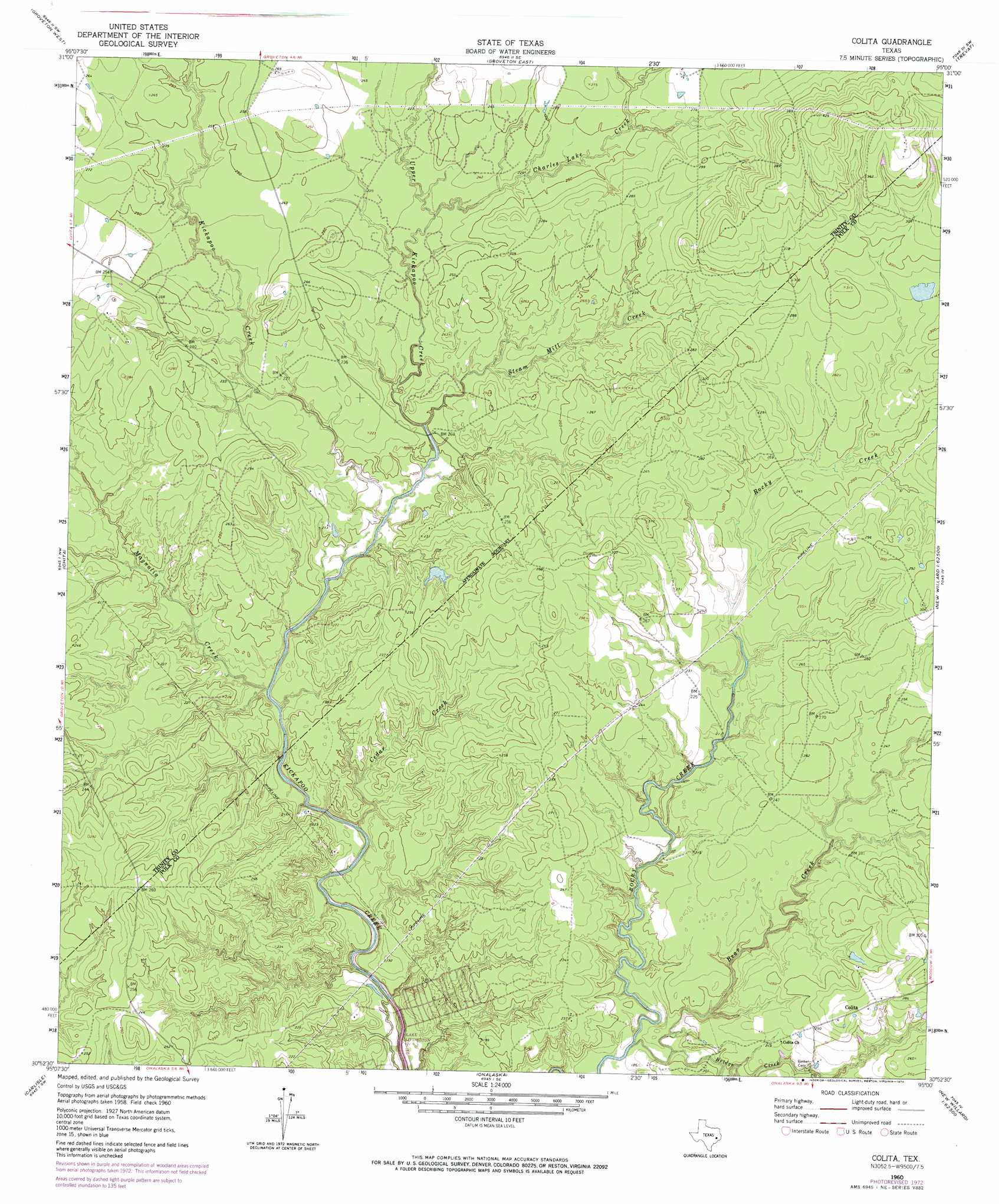
USGS Topo Quad 30095h1 - 1:24,000 scale
| Topo Map Name: | Colita |
| USGS Topo Quad ID: | 30095h1 |
| Print Size: | ca. 21 1/4" wide x 27" high |
| Southeast Coordinates: | 30.875° N latitude / 95° W longitude |
| Map Center Coordinates: | 30.9375° N latitude / 95.0625° W longitude |
| U.S. State: | TX |
| Filename: | o30095h1.jpg |
| Download Map JPG Image: | Colita topo map 1:24,000 scale |
| Map Type: | Topographic |
| Topo Series: | 7.5´ |
| Map Scale: | 1:24,000 |
| Source of Map Images: | United States Geological Survey (USGS) |
| Alternate Map Versions: |
Colita TX 1960, updated 1961 Download PDF Buy paper map Colita TX 1960, updated 1974 Download PDF Buy paper map Colita TX 1960, updated 1974 Download PDF Buy paper map Colita TX 2010 Download PDF Buy paper map Colita TX 2013 Download PDF Buy paper map Colita TX 2016 Download PDF Buy paper map |
1:24,000 Topo Quads surrounding Colita
Fodice |
Pennington |
Crecy |
Apple Springs |
Diboll |
Glendale |
Groveton West |
Groveton East |
Trevat |
Wakefield |
Trinity East |
Chita |
Colita |
Carmona |
Corrigan |
Staley |
Carlisle |
Onalaska |
New Willard |
Leggett |
Oakhurst |
Stephen Creek |
Blanchard |
Livingston |
Soda |
> Back to 30095e1 at 1:100,000 scale
> Back to 30094a1 at 1:250,000 scale
> Back to U.S. Topo Maps home
Colita topo map: Gazetteer
Colita: Dams
Carmona Lake Dam elevation 86m 282′Colita: Populated Places
Colita elevation 86m 282′Colita elevation 87m 285′
Colita: Reservoirs
Carmona Lake elevation 86m 282′Colita: Streams
Bear Creek elevation 46m 150′Bridge Creek elevation 49m 160′
Cedar Creek elevation 45m 147′
Charles Creek elevation 67m 219′
Kickapoo Creek elevation 61m 200′
Magnolia Creek elevation 48m 157′
Steam Mill Creek elevation 57m 187′
Upper Kickapoo Creek elevation 57m 187′
Colita digital topo map on disk
Buy this Colita topo map showing relief, roads, GPS coordinates and other geographical features, as a high-resolution digital map file on DVD: