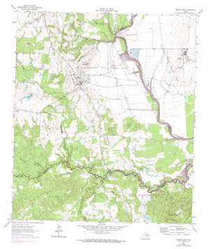
Baker Lake Topo Map Texas
To zoom in, hover over the map of Baker Lake
USGS Topo Quad 30095h6 - 1:24,000 scale
| Topo Map Name: | Baker Lake |
| USGS Topo Quad ID: | 30095h6 |
| Print Size: | ca. 21 1/4" wide x 27" high |
| Southeast Coordinates: | 30.875° N latitude / 95.625° W longitude |
| Map Center Coordinates: | 30.9375° N latitude / 95.6875° W longitude |
| U.S. State: | TX |
| Filename: | o30095h6.jpg |
| Download Map JPG Image: | Baker Lake topo map 1:24,000 scale |
| Map Type: | Topographic |
| Topo Series: | 7.5´ |
| Map Scale: | 1:24,000 |
| Source of Map Images: | United States Geological Survey (USGS) |
| Alternate Map Versions: |
Baker Lake TX 1962, updated 1966 Download PDF Buy paper map Baker Lake TX 1962, updated 1974 Download PDF Buy paper map Baker Lake TX 2010 Download PDF Buy paper map Baker Lake TX 2013 Download PDF Buy paper map Baker Lake TX 2016 Download PDF Buy paper map |
1:24,000 Topo Quads surrounding Baker Lake
> Back to 30095e1 at 1:100,000 scale
> Back to 30094a1 at 1:250,000 scale
> Back to U.S. Topo Maps home
Baker Lake topo map: Gazetteer
Baker Lake: Crossings
State Ferry (historical) elevation 40m 131′Baker Lake: Dams
Eastham Levee elevation 45m 147′Ferguson Reservoir Dam Number 1 elevation 55m 180′
Lake Palomas Dam elevation 56m 183′
Lake Picidae Dam elevation 65m 213′
Marks Lake Dam elevation 62m 203′
Baker Lake: Flats
Bald Prairie elevation 69m 226′Baker Lake: Lakes
Carson Lake elevation 43m 141′Ford Lake elevation 43m 141′
Baker Lake: Reservoirs
Baker Lake elevation 65m 213′Eastham Reservoir elevation 45m 147′
Ferguson Reservoir Number 1 elevation 55m 180′
Lake Palomas elevation 56m 183′
Lake Picidae elevation 65m 213′
Marks Lake elevation 62m 203′
Baker Lake: Streams
Black Oak Branch elevation 45m 147′Cedar Branch elevation 47m 154′
Cedar Creek elevation 40m 131′
Kay Branch elevation 40m 131′
Larrison Creek elevation 41m 134′
Pine Branch elevation 55m 180′
Pollard Branch elevation 47m 154′
Salt Branch elevation 40m 131′
South Bedias Creek elevation 43m 141′
Baker Lake digital topo map on disk
Buy this Baker Lake topo map showing relief, roads, GPS coordinates and other geographical features, as a high-resolution digital map file on DVD:


