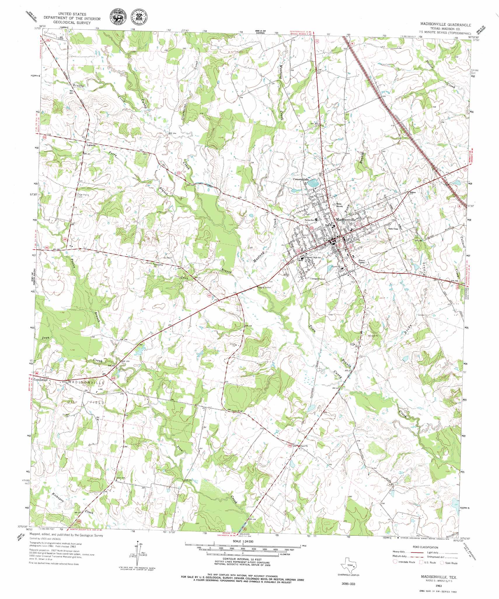
Madisonville Topo Map Texas
To zoom in, hover over the map of Madisonville
USGS Topo Quad 30095h8 - 1:24,000 scale
| Topo Map Name: | Madisonville |
| USGS Topo Quad ID: | 30095h8 |
| Print Size: | ca. 21 1/4" wide x 27" high |
| Southeast Coordinates: | 30.875° N latitude / 95.875° W longitude |
| Map Center Coordinates: | 30.9375° N latitude / 95.9375° W longitude |
| U.S. State: | TX |
| Filename: | o30095h8.jpg |
| Download Map JPG Image: | Madisonville topo map 1:24,000 scale |
| Map Type: | Topographic |
| Topo Series: | 7.5´ |
| Map Scale: | 1:24,000 |
| Source of Map Images: | United States Geological Survey (USGS) |
| Alternate Map Versions: |
Madisonville TX 1963, updated 1964 Download PDF Buy paper map Madisonville TX 1963, updated 1979 Download PDF Buy paper map Madisonville TX 2010 Download PDF Buy paper map Madisonville TX 2013 Download PDF Buy paper map Madisonville TX 2016 Download PDF Buy paper map |
1:24,000 Topo Quads surrounding Madisonville
Margie |
Spring Seat |
Leona |
Middleton |
Austonio |
Hilltop Lakes |
Normangee |
Leona Sw |
Elwood |
Sand Ridge |
Canary |
North Zulch |
Madisonville |
Connor |
Baker Lake |
Clear Lake |
Iola |
Bedias |
Steep Branch |
Crabbs Prairie |
Reliance |
Keith |
Singleton |
Loma |
Galilee |
> Back to 30095e1 at 1:100,000 scale
> Back to 30094a1 at 1:250,000 scale
> Back to U.S. Topo Maps home
Madisonville topo map: Gazetteer
Madisonville: Airports
Madisonville Municipal Airport elevation 81m 265′Madisonville: Dams
City of Madisonville Lake Dam elevation 87m 285′Osborne Lake Dam elevation 78m 255′
Soil Conservation Service Site 1 Dam elevation 84m 275′
Soil Conservation Service Site 2 Dam elevation 81m 265′
Stewart Lake Dam elevation 69m 226′
Madisonville: Populated Places
Laceola elevation 87m 285′Madisonville elevation 76m 249′
Madisonville: Reservoirs
City of Madisonville Lake elevation 87m 285′Crescent Lake elevation 87m 285′
Osborne Lake elevation 78m 255′
Soil Conservation Service Site 1 Reservoir elevation 84m 275′
Soil Conservation Service Site 2 Reservoir elevation 81m 265′
Stewart Lake elevation 69m 226′
Madisonville: Streams
Brushy Creek elevation 75m 246′Coon Branch elevation 67m 219′
Ferry Branch elevation 70m 229′
Greenbriar Creek elevation 73m 239′
Mustang Creek elevation 67m 219′
Pooles Branch elevation 76m 249′
Reed Branch elevation 62m 203′
Town Branch elevation 63m 206′
Madisonville digital topo map on disk
Buy this Madisonville topo map showing relief, roads, GPS coordinates and other geographical features, as a high-resolution digital map file on DVD: