Warda Topo Map Texas
To zoom in, hover over the map of Warda
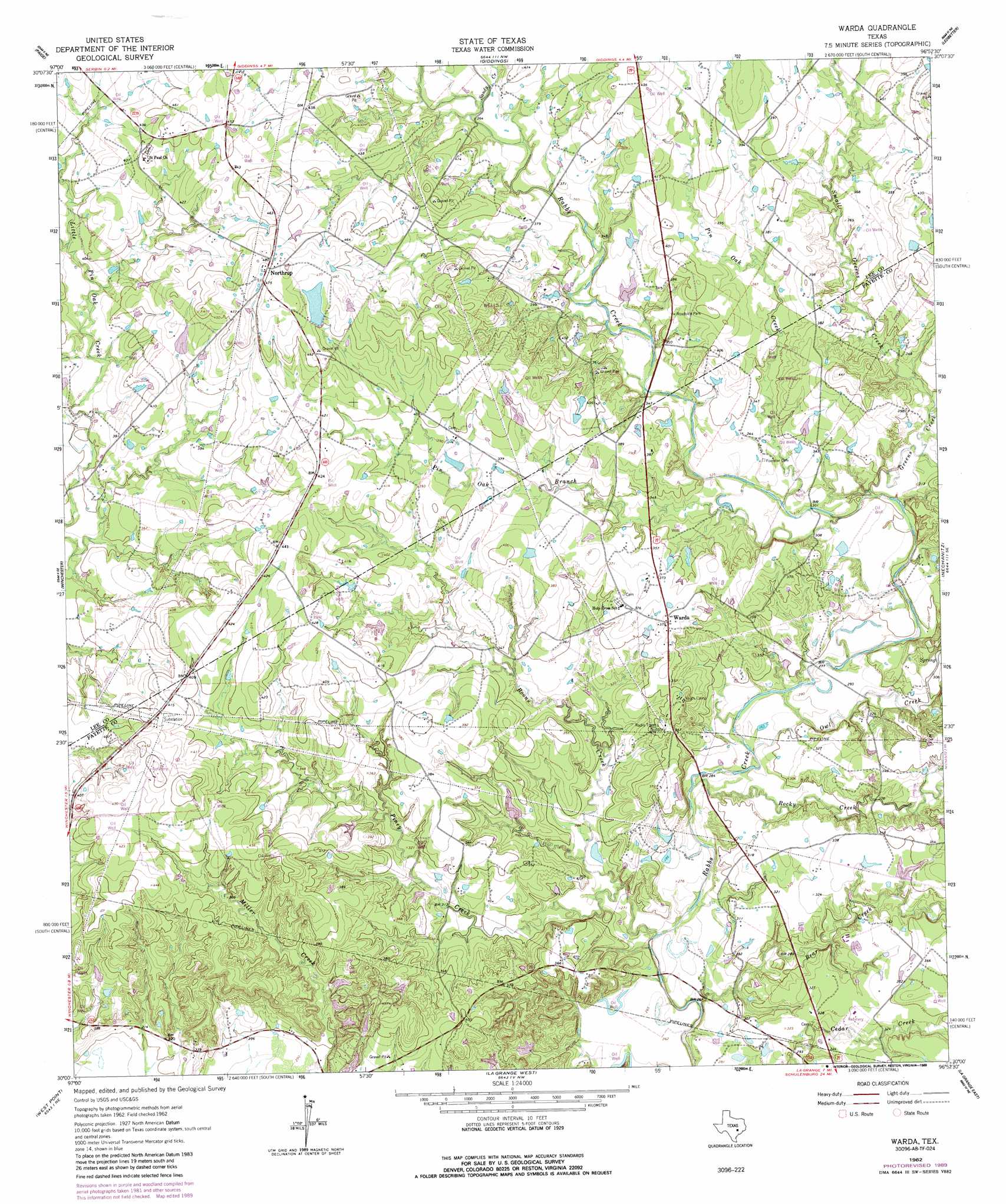
USGS Topo Quad 30096a8 - 1:24,000 scale
| Topo Map Name: | Warda |
| USGS Topo Quad ID: | 30096a8 |
| Print Size: | ca. 21 1/4" wide x 27" high |
| Southeast Coordinates: | 30° N latitude / 96.875° W longitude |
| Map Center Coordinates: | 30.0625° N latitude / 96.9375° W longitude |
| U.S. State: | TX |
| Filename: | o30096a8.jpg |
| Download Map JPG Image: | Warda topo map 1:24,000 scale |
| Map Type: | Topographic |
| Topo Series: | 7.5´ |
| Map Scale: | 1:24,000 |
| Source of Map Images: | United States Geological Survey (USGS) |
| Alternate Map Versions: |
Warda TX 1962, updated 1965 Download PDF Buy paper map Warda TX 1962, updated 1989 Download PDF Buy paper map Warda TX 2010 Download PDF Buy paper map Warda TX 2013 Download PDF Buy paper map Warda TX 2016 Download PDF Buy paper map |
1:24,000 Topo Quads surrounding Warda
Mcdade |
Fedor |
Lincoln |
Dime Box |
Flag Pond |
Smithville Nw |
Paige |
Giddings |
Ledbetter |
Carmine |
Smithville |
Winchester |
Warda |
Nechanitz |
Round Top |
Togo |
West Point |
La Grange West |
La Grange East |
Fayetteville |
Cistern |
Muldoon |
Swiss Alp |
Ammannsville |
Ellinger |
> Back to 30096a1 at 1:100,000 scale
> Back to 30096a1 at 1:250,000 scale
> Back to U.S. Topo Maps home
Warda topo map: Gazetteer
Warda: Dams
Bamsch Lake Dam elevation 107m 351′Clear Lake Pines Dam 2 elevation 106m 347′
Clear Lake Pines Incorporated Dam Number 10 elevation 113m 370′
Clear Lake Pines Incorporated Dam Number 3 elevation 113m 370′
Clear Lake Pines Incorporated Dam Number 4 elevation 106m 347′
Clear Lake Pines Incorporated Dam Number 6 elevation 99m 324′
Walker Lake Dam elevation 142m 465′
Warda: Populated Places
Northrup elevation 147m 482′Warda elevation 114m 374′
Warda: Reservoirs
Bamsch Lake elevation 107m 351′Clear Lake Pines 2 elevation 106m 347′
Lake Number 10 elevation 113m 370′
Lake Number 3 elevation 113m 370′
Lake Number 4 elevation 106m 347′
Lake Number 6 elevation 99m 324′
Walker Lake elevation 142m 465′
Warda: Streams
Bear Creek elevation 76m 249′Boons Creek elevation 79m 259′
Green Creek elevation 91m 298′
Little Pin Oak Creek elevation 119m 390′
Owl Creek elevation 85m 278′
Pin Oak Branch elevation 95m 311′
Pin Oak Creek elevation 95m 311′
Piney Creek elevation 77m 252′
Rocky Creek elevation 82m 269′
Sandy Creek elevation 111m 364′
Small Greens Creek elevation 98m 321′
Warda digital topo map on disk
Buy this Warda topo map showing relief, roads, GPS coordinates and other geographical features, as a high-resolution digital map file on DVD: