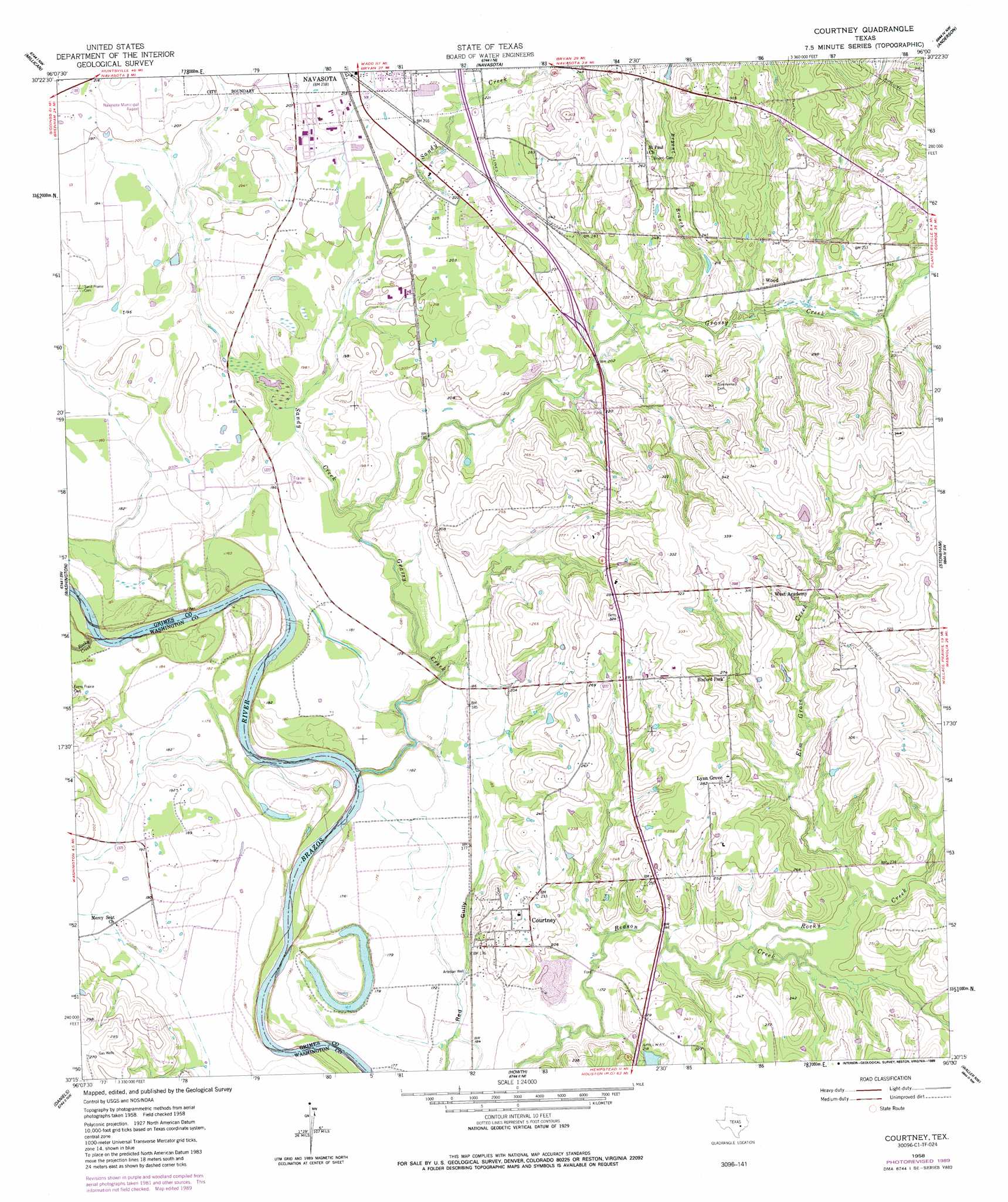
Courtney Topo Map Texas
To zoom in, hover over the map of Courtney
USGS Topo Quad 30096c1 - 1:24,000 scale
| Topo Map Name: | Courtney |
| USGS Topo Quad ID: | 30096c1 |
| Print Size: | ca. 21 1/4" wide x 27" high |
| Southeast Coordinates: | 30.25° N latitude / 96° W longitude |
| Map Center Coordinates: | 30.3125° N latitude / 96.0625° W longitude |
| U.S. State: | TX |
| Filename: | o30096c1.jpg |
| Download Map JPG Image: | Courtney topo map 1:24,000 scale |
| Map Type: | Topographic |
| Topo Series: | 7.5´ |
| Map Scale: | 1:24,000 |
| Source of Map Images: | United States Geological Survey (USGS) |
| Alternate Map Versions: |
Courtney TX 1958, updated 1960 Download PDF Buy paper map Courtney TX 1958, updated 1968 Download PDF Buy paper map Courtney TX 1958, updated 1989 Download PDF Buy paper map Courtney TX 2010 Download PDF Buy paper map Courtney TX 2013 Download PDF Buy paper map Courtney TX 2016 Download PDF Buy paper map |
1:24,000 Topo Quads surrounding Courtney
Wellborn |
Ferguson Crossing |
Carlos |
Roans Prairie |
Richards |
Clay |
Millican |
Navasota |
Anderson |
Dacus |
Independence |
Washington |
Courtney |
Stoneham |
Plantersville |
Chappell Hill |
Daniels |
Howth |
Waller Nw |
Magnolia West |
Kenney |
Buckhorn |
Hempstead |
Waller |
Hockley |
> Back to 30096a1 at 1:100,000 scale
> Back to 30096a1 at 1:250,000 scale
> Back to U.S. Topo Maps home
Courtney topo map: Gazetteer
Courtney: Airports
Navasota Municipal Airport elevation 68m 223′Courtney: Dams
Los Robles Lake Dam elevation 67m 219′Weaver Lake Dam elevation 74m 242′
Courtney: Populated Places
Courtney elevation 70m 229′Lynn Grove elevation 86m 282′
Courtney: Reservoirs
Los Robles Lake elevation 67m 219′Weaver Lake elevation 74m 242′
Courtney: Streams
Bryant Branch elevation 61m 200′Elm Grove Creek elevation 57m 187′
Grassy Creek elevation 45m 147′
Rocky Creek elevation 45m 147′
Rocky Creek elevation 54m 177′
Sandy Creek elevation 51m 167′
Courtney digital topo map on disk
Buy this Courtney topo map showing relief, roads, GPS coordinates and other geographical features, as a high-resolution digital map file on DVD: