Gay Hill Topo Map Texas
To zoom in, hover over the map of Gay Hill
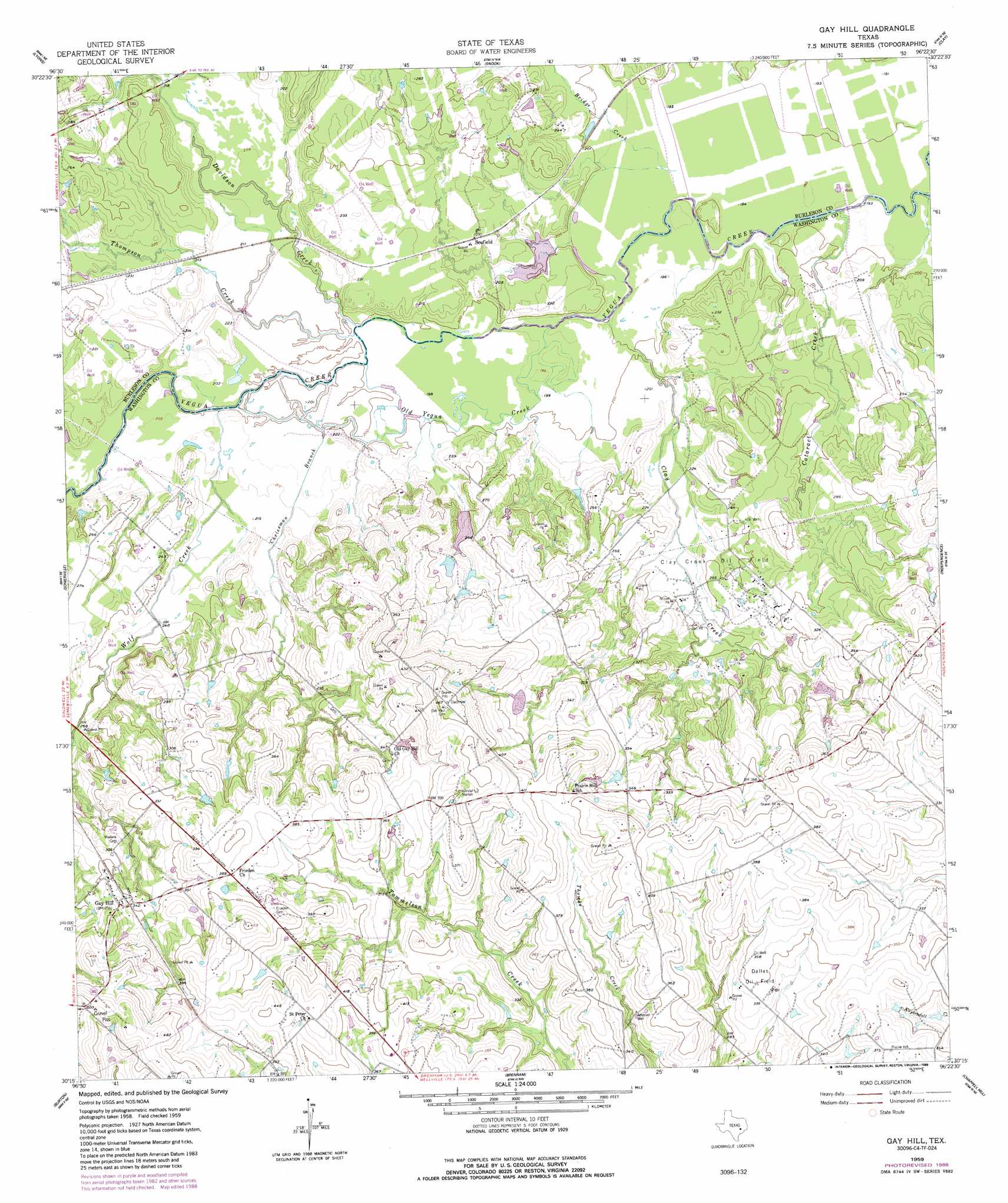
USGS Topo Quad 30096c4 - 1:24,000 scale
| Topo Map Name: | Gay Hill |
| USGS Topo Quad ID: | 30096c4 |
| Print Size: | ca. 21 1/4" wide x 27" high |
| Southeast Coordinates: | 30.25° N latitude / 96.375° W longitude |
| Map Center Coordinates: | 30.3125° N latitude / 96.4375° W longitude |
| U.S. State: | TX |
| Filename: | o30096c4.jpg |
| Download Map JPG Image: | Gay Hill topo map 1:24,000 scale |
| Map Type: | Topographic |
| Topo Series: | 7.5´ |
| Map Scale: | 1:24,000 |
| Source of Map Images: | United States Geological Survey (USGS) |
| Alternate Map Versions: |
Gay Hill TX 1959, updated 1960 Download PDF Buy paper map Gay Hill TX 1959, updated 1973 Download PDF Buy paper map Gay Hill TX 1959, updated 1989 Download PDF Buy paper map Gay Hill TX 2010 Download PDF Buy paper map Gay Hill TX 2013 Download PDF Buy paper map Gay Hill TX 2016 Download PDF Buy paper map |
1:24,000 Topo Quads surrounding Gay Hill
Caldwell |
Tunis |
Chances Store |
Wellborn |
Ferguson Crossing |
Frenstat |
Lyons |
Snook |
Clay |
Millican |
Flag Pond |
Somerville |
Gay Hill |
Independence |
Washington |
Carmine |
Burton |
Brenham |
Chappell Hill |
Daniels |
Round Top |
Greenvine |
Welcome |
Kenney |
Buckhorn |
> Back to 30096a1 at 1:100,000 scale
> Back to 30096a1 at 1:250,000 scale
> Back to U.S. Topo Maps home
Gay Hill topo map: Gazetteer
Gay Hill: Dams
Baker Lake Dam elevation 65m 213′Butler Lake Dam elevation 73m 239′
Johnson Lake Dam elevation 98m 321′
McCormick Lake Dam elevation 88m 288′
Gay Hill: Oilfields
Clay Creek Oil Field elevation 74m 242′Dallas Oil Field elevation 107m 351′
Gay Hill: Populated Places
Gay Hill elevation 113m 370′Scofield elevation 70m 229′
Gay Hill: Reservoirs
Baker Lake elevation 65m 213′Butler Lake elevation 73m 239′
Johnson Lake elevation 98m 321′
McCormick Lake elevation 88m 288′
Gay Hill: Streams
Bridge Creek elevation 59m 193′Cataract Creek elevation 57m 187′
Chriesman Branch elevation 61m 200′
Clay Creek elevation 60m 196′
Davidson Creek elevation 60m 196′
Old Yegua Creek elevation 59m 193′
Thompson Creek elevation 61m 200′
Wolf Creek elevation 60m 196′
Gay Hill digital topo map on disk
Buy this Gay Hill topo map showing relief, roads, GPS coordinates and other geographical features, as a high-resolution digital map file on DVD: