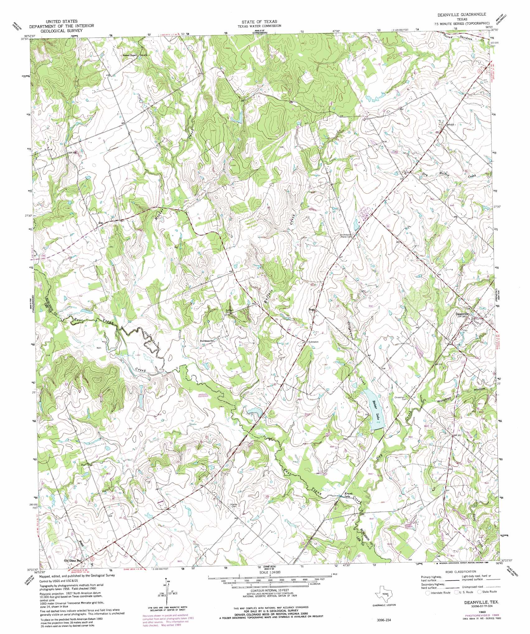
Deanville Topo Map Texas
To zoom in, hover over the map of Deanville
USGS Topo Quad 30096d7 - 1:24,000 scale
| Topo Map Name: | Deanville |
| USGS Topo Quad ID: | 30096d7 |
| Print Size: | ca. 21 1/4" wide x 27" high |
| Southeast Coordinates: | 30.375° N latitude / 96.75° W longitude |
| Map Center Coordinates: | 30.4375° N latitude / 96.8125° W longitude |
| U.S. State: | TX |
| Filename: | o30096d7.jpg |
| Download Map JPG Image: | Deanville topo map 1:24,000 scale |
| Map Type: | Topographic |
| Topo Series: | 7.5´ |
| Map Scale: | 1:24,000 |
| Source of Map Images: | United States Geological Survey (USGS) |
| Alternate Map Versions: |
Deanville TX 1960, updated 1963 Download PDF Buy paper map Deanville TX 1960, updated 1963 Download PDF Buy paper map Deanville TX 1960, updated 1989 Download PDF Buy paper map Deanville TX 2010 Download PDF Buy paper map Deanville TX 2013 Download PDF Buy paper map Deanville TX 2016 Download PDF Buy paper map |
1:24,000 Topo Quads surrounding Deanville
Rockdale West |
Rockdale East |
Milano |
Goodwill |
Mumford |
Alcoa Lake |
Hicks |
Chriesman |
Caldwell |
Tunis |
Lexington |
Tanglewood |
Deanville |
Frenstat |
Lyons |
Fedor |
Lincoln |
Dime Box |
Flag Pond |
Somerville |
Paige |
Giddings |
Ledbetter |
Carmine |
Burton |
> Back to 30096a1 at 1:100,000 scale
> Back to 30096a1 at 1:250,000 scale
> Back to U.S. Topo Maps home
Deanville topo map: Gazetteer
Deanville: Dams
Balcar Lake Dam elevation 92m 301′Mueller Lake Dam elevation 105m 344′
Deanville: Lakes
Krunk Lake elevation 87m 285′Deanville: Populated Places
Deanville elevation 117m 383′Gus elevation 121m 396′
Hogg elevation 125m 410′
Old Dime Box elevation 118m 387′
San Antonio Prairie elevation 132m 433′
Deanville: Reservoirs
Balcar Lake elevation 92m 301′Mueller Lake elevation 105m 344′
Deanville: Streams
Buffalo Creek elevation 90m 295′Cottonwood Creek elevation 87m 285′
Dry Creek elevation 85m 278′
Hooker Creek elevation 92m 301′
Porter Branch elevation 114m 374′
Deanville: Valleys
Wolphen Hollow elevation 93m 305′Deanville digital topo map on disk
Buy this Deanville topo map showing relief, roads, GPS coordinates and other geographical features, as a high-resolution digital map file on DVD: