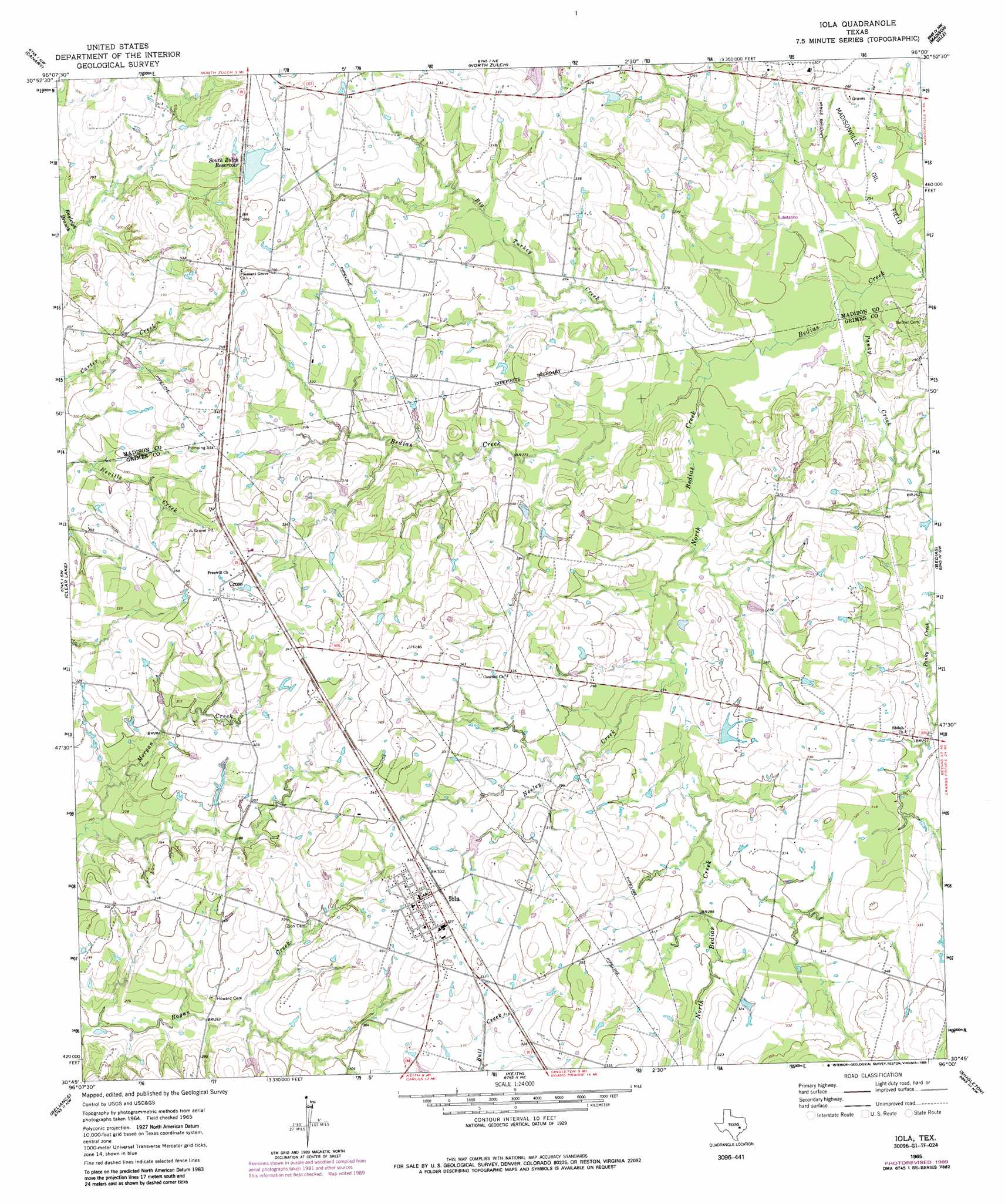
Iola Topo Map Texas
To zoom in, hover over the map of Iola
USGS Topo Quad 30096g1 - 1:24,000 scale
| Topo Map Name: | Iola |
| USGS Topo Quad ID: | 30096g1 |
| Print Size: | ca. 21 1/4" wide x 27" high |
| Southeast Coordinates: | 30.75° N latitude / 96° W longitude |
| Map Center Coordinates: | 30.8125° N latitude / 96.0625° W longitude |
| U.S. State: | TX |
| Filename: | o30096g1.jpg |
| Download Map JPG Image: | Iola topo map 1:24,000 scale |
| Map Type: | Topographic |
| Topo Series: | 7.5´ |
| Map Scale: | 1:24,000 |
| Source of Map Images: | United States Geological Survey (USGS) |
| Alternate Map Versions: |
Iola TX 1965, updated 1967 Download PDF Buy paper map Iola TX 1965, updated 1985 Download PDF Buy paper map Iola TX 1965, updated 1989 Download PDF Buy paper map Iola TX 2010 Download PDF Buy paper map Iola TX 2013 Download PDF Buy paper map Iola TX 2016 Download PDF Buy paper map |
1:24,000 Topo Quads surrounding Iola
Camp Creek Lake |
Hilltop Lakes |
Normangee |
Leona Sw |
Elwood |
Edge |
Canary |
North Zulch |
Madisonville |
Connor |
Kurten |
Clear Lake |
Iola |
Bedias |
Steep Branch |
Bryan East |
Reliance |
Keith |
Singleton |
Loma |
Wellborn |
Ferguson Crossing |
Carlos |
Roans Prairie |
Richards |
> Back to 30096e1 at 1:100,000 scale
> Back to 30096a1 at 1:250,000 scale
> Back to U.S. Topo Maps home
Iola topo map: Gazetteer
Iola: Dams
South Zulch Reservoir Dam elevation 101m 331′Walker Lake Dam elevation 85m 278′
Iola: Populated Places
Cross elevation 109m 357′Iola elevation 103m 337′
Iola: Reservoirs
South Zulch Reservoir elevation 99m 324′Walker Lake elevation 85m 278′
Iola: Streams
Big Turkey Creek elevation 76m 249′Neeley Creek elevation 79m 259′
North Bedias Creek elevation 76m 249′
Panky Creek elevation 72m 236′
Iola digital topo map on disk
Buy this Iola topo map showing relief, roads, GPS coordinates and other geographical features, as a high-resolution digital map file on DVD: