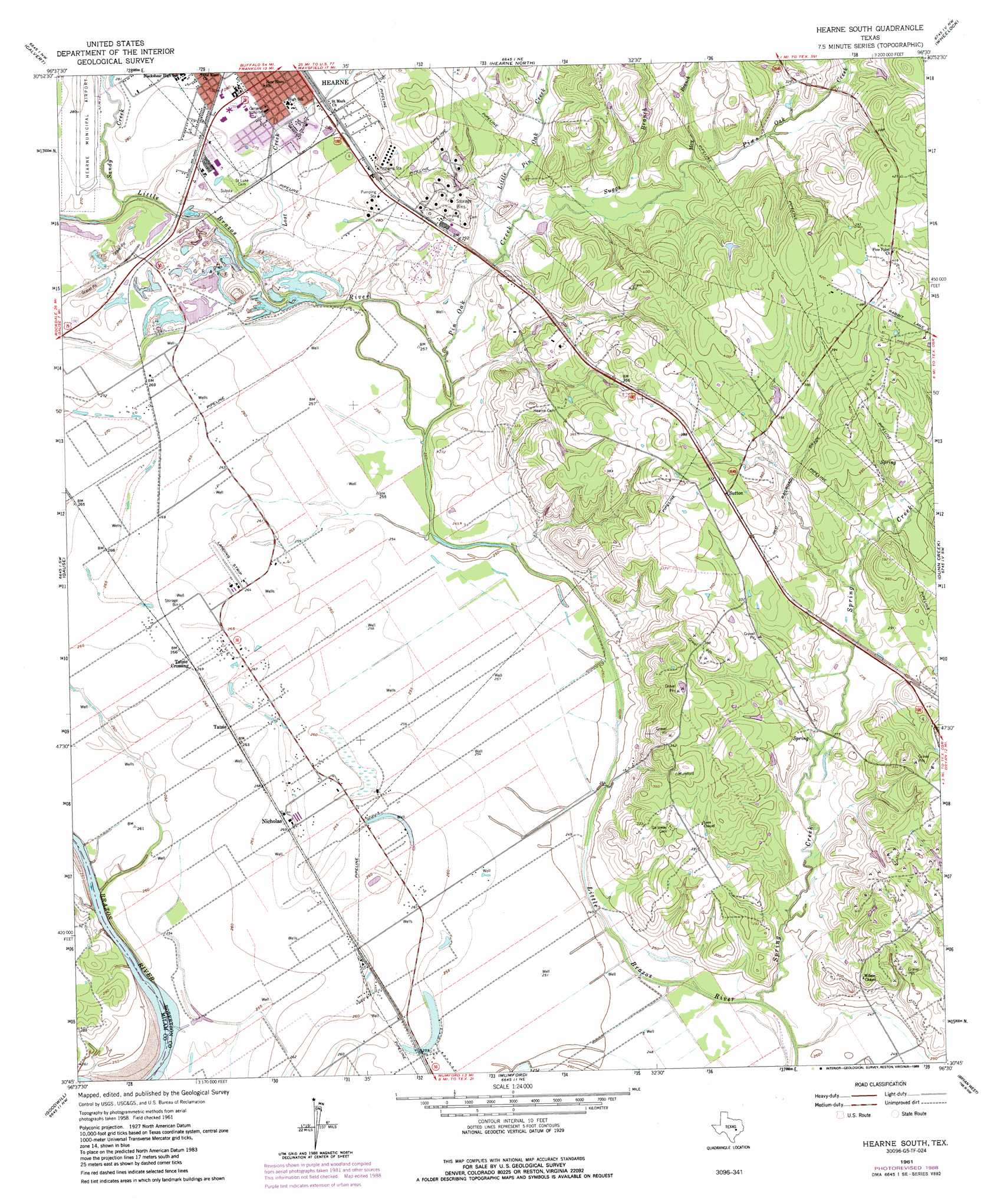
Hearne South Topo Map Texas
To zoom in, hover over the map of Hearne South
USGS Topo Quad 30096g5 - 1:24,000 scale
| Topo Map Name: | Hearne South |
| USGS Topo Quad ID: | 30096g5 |
| Print Size: | ca. 21 1/4" wide x 27" high |
| Southeast Coordinates: | 30.75° N latitude / 96.5° W longitude |
| Map Center Coordinates: | 30.8125° N latitude / 96.5625° W longitude |
| U.S. State: | TX |
| Filename: | o30096g5.jpg |
| Download Map JPG Image: | Hearne South topo map 1:24,000 scale |
| Map Type: | Topographic |
| Topo Series: | 7.5´ |
| Map Scale: | 1:24,000 |
| Source of Map Images: | United States Geological Survey (USGS) |
| Alternate Map Versions: |
Hearne South TX 1961, updated 1964 Download PDF Buy paper map Hearne South TX 1961, updated 1987 Download PDF Buy paper map Hearne South TX 1961, updated 1989 Download PDF Buy paper map Hearne South TX 2010 Download PDF Buy paper map Hearne South TX 2013 Download PDF Buy paper map Hearne South TX 2016 Download PDF Buy paper map |
1:24,000 Topo Quads surrounding Hearne South
Baileyville |
Hammond |
Owensville |
Franklin |
Camp Creek Lake |
Maysfield |
Calvert |
Hearne North |
Wheelock |
Edge |
Hanover |
Gause |
Hearne South |
Dunn Creek |
Kurten |
Milano |
Goodwill |
Mumford |
Bryan West |
Bryan East |
Chriesman |
Caldwell |
Tunis |
Chances Store |
Wellborn |
> Back to 30096e1 at 1:100,000 scale
> Back to 30096a1 at 1:250,000 scale
> Back to U.S. Topo Maps home
Hearne South topo map: Gazetteer
Hearne South: Airports
Corpora Airport elevation 79m 259′Hearne Municipal Airport elevation 84m 275′
Hearne South: Populated Places
Nicholas elevation 81m 265′Sutton elevation 113m 370′
Tatsie elevation 81m 265′
Tatsie Crossing elevation 81m 265′
Hearne South: Streams
Dunn Creek elevation 89m 291′Hay Branch elevation 90m 295′
Little Pin Oak Creek elevation 81m 265′
Lost Creek elevation 79m 259′
Pin Oak Creek elevation 78m 255′
Sandy Creek elevation 77m 252′
Spring Creek elevation 73m 239′
Suggs Branch elevation 82m 269′
Hearne South digital topo map on disk
Buy this Hearne South topo map showing relief, roads, GPS coordinates and other geographical features, as a high-resolution digital map file on DVD: