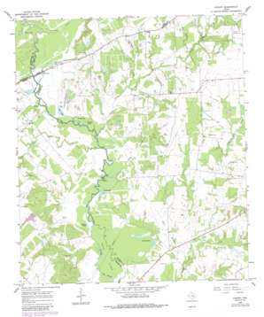
Canary Topo Map Texas
To zoom in, hover over the map of Canary
USGS Topo Quad 30096h2 - 1:24,000 scale
| Topo Map Name: | Canary |
| USGS Topo Quad ID: | 30096h2 |
| Print Size: | ca. 21 1/4" wide x 27" high |
| Southeast Coordinates: | 30.875° N latitude / 96.125° W longitude |
| Map Center Coordinates: | 30.9375° N latitude / 96.1875° W longitude |
| U.S. State: | TX |
| Filename: | o30096h2.jpg |
| Download Map JPG Image: | Canary topo map 1:24,000 scale |
| Map Type: | Topographic |
| Topo Series: | 7.5´ |
| Map Scale: | 1:24,000 |
| Source of Map Images: | United States Geological Survey (USGS) |
| Alternate Map Versions: |
Canary TX 1965, updated 1968 Download PDF Buy paper map Canary TX 1965, updated 1989 Download PDF Buy paper map Canary TX 2010 Download PDF Buy paper map Canary TX 2013 Download PDF Buy paper map Canary TX 2016 Download PDF Buy paper map |
1:24,000 Topo Quads surrounding Canary
> Back to 30096e1 at 1:100,000 scale
> Back to 30096a1 at 1:250,000 scale
> Back to U.S. Topo Maps home
Canary topo map: Gazetteer
Canary: Dams
Pasture Lake Dam elevation 85m 278′Stillwagon Lake Dam elevation 88m 288′
Wager Lake Dam elevation 93m 305′
Weaver Lake Dam elevation 77m 252′
Canary: Guts
Big Slough elevation 70m 229′Canary: Islands
Caney Island elevation 71m 232′Canary: Lakes
Carr Lake elevation 77m 252′Davis Lake elevation 81m 265′
Donahoe Lake elevation 76m 249′
Duck Lake elevation 74m 242′
Middle Lake elevation 76m 249′
Mud Lake elevation 78m 255′
San Antonio Lake elevation 78m 255′
Sweet Lake elevation 73m 239′
Wilson Lake elevation 74m 242′
Canary: Populated Places
Bundy Crossing elevation 70m 229′Canary elevation 113m 370′
Canary: Reservoirs
Pasture Lake elevation 85m 278′Stillwagon Lake elevation 88m 288′
Wager Lake elevation 93m 305′
Weaver Lake elevation 77m 252′
Canary: Streams
Carryall Creek elevation 91m 298′Cottonwood Creek elevation 82m 269′
Dry Creek elevation 79m 259′
Little Cedar Creek elevation 76m 249′
McDonald Creek elevation 82m 269′
Red Bank Creek elevation 88m 288′
Running Creek elevation 77m 252′
Sand Branch elevation 76m 249′
West Caney Creek elevation 75m 246′
Canary: Valleys
Long Hollow elevation 76m 249′Canary digital topo map on disk
Buy this Canary topo map showing relief, roads, GPS coordinates and other geographical features, as a high-resolution digital map file on DVD:


