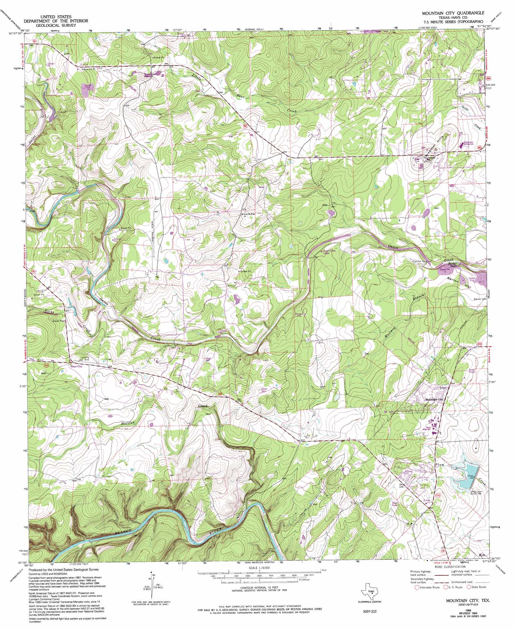
Mountain City Topo Map Texas
To zoom in, hover over the map of Mountain City
USGS Topo Quad 30097a8 - 1:24,000 scale
| Topo Map Name: | Mountain City |
| USGS Topo Quad ID: | 30097a8 |
| Print Size: | ca. 21 1/4" wide x 27" high |
| Southeast Coordinates: | 30° N latitude / 97.875° W longitude |
| Map Center Coordinates: | 30.0625° N latitude / 97.9375° W longitude |
| U.S. State: | TX |
| Filename: | o30097a8.jpg |
| Download Map JPG Image: | Mountain City topo map 1:24,000 scale |
| Map Type: | Topographic |
| Topo Series: | 7.5´ |
| Map Scale: | 1:24,000 |
| Source of Map Images: | United States Geological Survey (USGS) |
| Alternate Map Versions: |
Mountain City TX 1968, updated 1971 Download PDF Buy paper map Mountain City TX 1968, updated 1974 Download PDF Buy paper map Mountain City TX 1968, updated 1986 Download PDF Buy paper map Mountain City TX 1968, updated 1994 Download PDF Buy paper map Mountain City TX 2010 Download PDF Buy paper map Mountain City TX 2013 Download PDF Buy paper map Mountain City TX 2016 Download PDF Buy paper map |
1:24,000 Topo Quads surrounding Mountain City
Hammetts Crossing |
Shingle Hills |
Bee Cave |
Austin West |
Austin East |
Henly |
Dripping Springs |
Signal Hill |
Oak Hill |
Montopolis |
Rough Hollow |
Driftwood |
Mountain City |
Buda |
Creedmoor |
Devils Backbone |
Wimberley |
San Marcos North |
Uhland |
Lockhart North |
Sattler |
Hunter |
San Marcos South |
Martindale |
Lockhart South |
> Back to 30097a1 at 1:100,000 scale
> Back to 30096a1 at 1:250,000 scale
> Back to U.S. Topo Maps home
Mountain City topo map: Gazetteer
Mountain City: Airports
Rutherford Ranch Airport elevation 295m 967′Mountain City: Dams
Brown Ranch Dam elevation 284m 931′Lutranger Lake Dam elevation 258m 846′
Soil Conservation Service Site 1 Dam elevation 230m 754′
Mountain City: Falls
Barber Falls elevation 217m 711′Mountain City: Parks
Bob Shelton Stadium elevation 246m 807′Mountain City: Populated Places
Flatrock Ford elevation 222m 728′Hays City elevation 294m 964′
Mountain City elevation 251m 823′
Mountain City: Reservoirs
Lutranger Lake elevation 258m 846′Rattlesnake Lake elevation 284m 931′
Soil Conservation Service Site 1 Reservoir elevation 230m 754′
Mountain City: Streams
Halifax Creek elevation 203m 666′Yorks Creek elevation 253m 830′
Mountain City: Summits
Barton Hill elevation 233m 764′Carpenter Hills elevation 269m 882′
Mountain City digital topo map on disk
Buy this Mountain City topo map showing relief, roads, GPS coordinates and other geographical features, as a high-resolution digital map file on DVD: