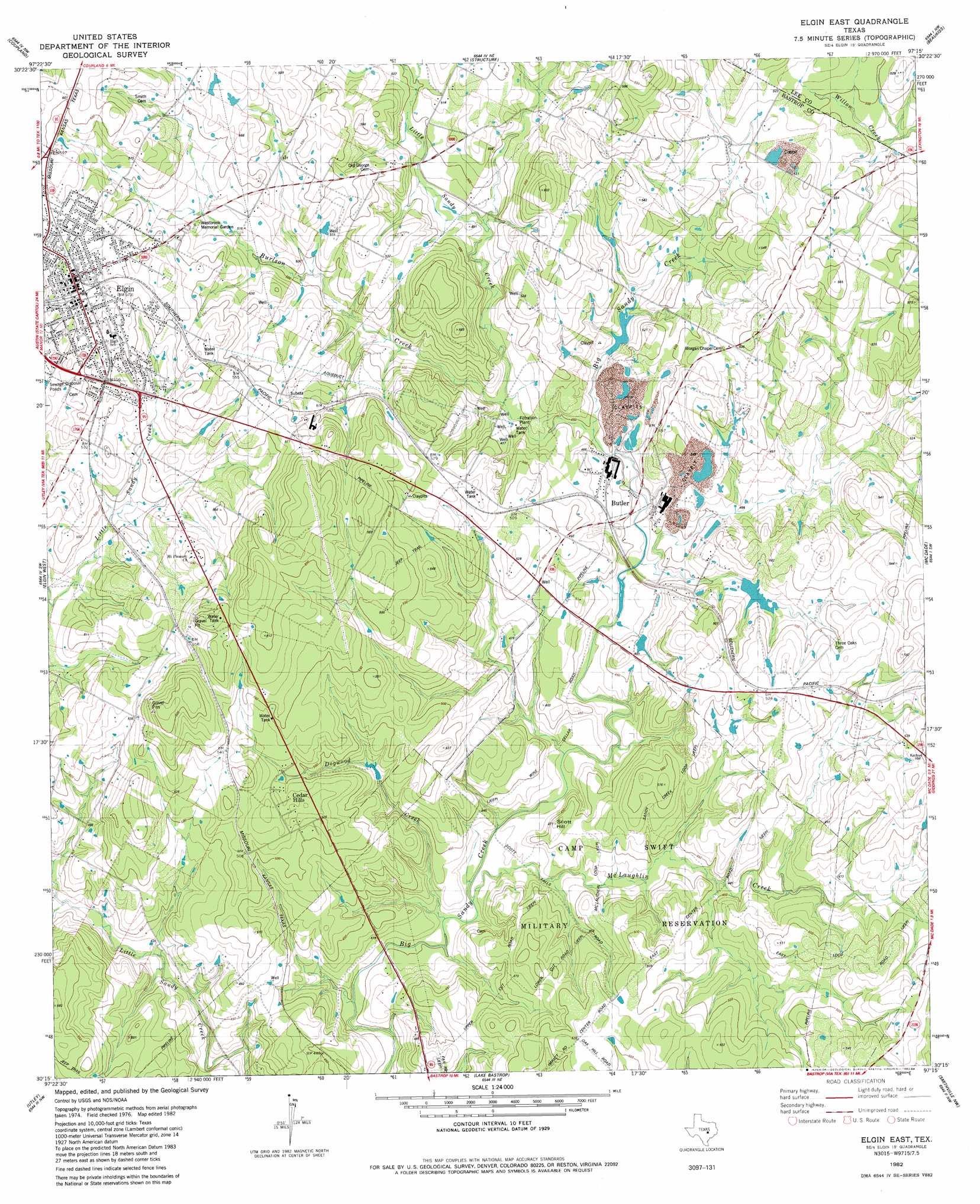
Elgin East Topo Map Texas
To zoom in, hover over the map of Elgin East
USGS Topo Quad 30097c3 - 1:24,000 scale
| Topo Map Name: | Elgin East |
| USGS Topo Quad ID: | 30097c3 |
| Print Size: | ca. 21 1/4" wide x 27" high |
| Southeast Coordinates: | 30.25° N latitude / 97.25° W longitude |
| Map Center Coordinates: | 30.3125° N latitude / 97.3125° W longitude |
| U.S. State: | TX |
| Filename: | o30097c3.jpg |
| Download Map JPG Image: | Elgin East topo map 1:24,000 scale |
| Map Type: | Topographic |
| Topo Series: | 7.5´ |
| Map Scale: | 1:24,000 |
| Source of Map Images: | United States Geological Survey (USGS) |
| Alternate Map Versions: |
Elgin East TX 1982, updated 1982 Download PDF Buy paper map Elgin East TX 1982, updated 1984 Download PDF Buy paper map Elgin East TX 2010 Download PDF Buy paper map Elgin East TX 2012 Download PDF Buy paper map Elgin East TX 2016 Download PDF Buy paper map |
1:24,000 Topo Quads surrounding Elgin East
Hutto |
Taylor |
Thrall |
Thorndale |
Alcoa Lake |
Pflugerville East |
Coupland |
Structure |
Beaukiss |
Lexington |
Manor |
Elgin West |
Elgin East |
Mcdade |
Fedor |
Webberville |
Utley |
Lake Bastrop |
Smithville Nw |
Paige |
Lytton Springs |
Bastrop Sw |
Bastrap |
Smithville |
Winchester |
> Back to 30097a1 at 1:100,000 scale
> Back to 30096a1 at 1:250,000 scale
> Back to U.S. Topo Maps home
Elgin East topo map: Gazetteer
Elgin East: Airports
Elgin Intracontinental Airport elevation 171m 561′Hawken Air One Airport elevation 152m 498′
Elgin East: Dams
Smith Lake Dam elevation 141m 462′Elgin East: Populated Places
Butler elevation 143m 469′Elgin elevation 177m 580′
Elgin East: Reservoirs
Smith Lake elevation 141m 462′Elgin East: Streams
Burlson Creek elevation 140m 459′Dogwood Creek elevation 123m 403′
Little Sandy Creek elevation 136m 446′
McLaughlin Creek elevation 124m 406′
Elgin East digital topo map on disk
Buy this Elgin East topo map showing relief, roads, GPS coordinates and other geographical features, as a high-resolution digital map file on DVD: