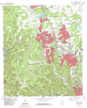
Jollyville Topo Map Texas
To zoom in, hover over the map of Jollyville
USGS Topo Quad 30097d7 - 1:24,000 scale
| Topo Map Name: | Jollyville |
| USGS Topo Quad ID: | 30097d7 |
| Print Size: | ca. 21 1/4" wide x 27" high |
| Southeast Coordinates: | 30.375° N latitude / 97.75° W longitude |
| Map Center Coordinates: | 30.4375° N latitude / 97.8125° W longitude |
| U.S. State: | TX |
| Filename: | o30097d7.jpg |
| Download Map JPG Image: | Jollyville topo map 1:24,000 scale |
| Map Type: | Topographic |
| Topo Series: | 7.5´ |
| Map Scale: | 1:24,000 |
| Source of Map Images: | United States Geological Survey (USGS) |
| Alternate Map Versions: |
Jollyville TX 1968, updated 1971 Download PDF Buy paper map Jollyville TX 1968, updated 1974 Download PDF Buy paper map Jollyville TX 1968, updated 1981 Download PDF Buy paper map Jollyville TX 1987, updated 1987 Download PDF Buy paper map Jollyville TX 2010 Download PDF Buy paper map Jollyville TX 2013 Download PDF Buy paper map Jollyville TX 2016 Download PDF Buy paper map |
1:24,000 Topo Quads surrounding Jollyville
> Back to 30097a1 at 1:100,000 scale
> Back to 30096a1 at 1:250,000 scale
> Back to U.S. Topo Maps home
Jollyville topo map: Gazetteer
Jollyville: Dams
Balcones Country Club Lake Dam elevation 250m 820′Soil Conservation Service Site 6 Dam elevation 271m 889′
Jollyville: Parks
Bull Creek Greenbelt Park elevation 245m 803′Canyon Vista Pool elevation 259m 849′
Cypress Creek Park elevation 218m 715′
Hilltop Christian Academy Football Stadium elevation 271m 889′
Oak Forest Park elevation 290m 951′
Oak View Park elevation 288m 944′
Old Stage Park elevation 277m 908′
Pecan Park elevation 286m 938′
Round Rock Independent School District Athletic Complex elevation 276m 905′
Steck Valley Park elevation 208m 682′
West Bull Creek Preserve elevation 208m 682′
Jollyville: Plains
Jollyville Plateau elevation 323m 1059′Jollyville: Populated Places
Anderson Mill elevation 292m 958′Four Points elevation 318m 1043′
Jollyville elevation 286m 938′
Pond Springs elevation 288m 944′
Jollyville: Post Offices
Balcones Post Office elevation 274m 898′Jollyville: Reservoirs
Balcones Country Club Lake elevation 250m 820′Soil Conservation Service Site 6 Reservoir elevation 271m 889′
Jollyville: Springs
House Springs elevation 259m 849′Swimming Spring elevation 262m 859′
Tanglewood Spring elevation 257m 843′
Jollyville: Streams
Buttercup Creek elevation 271m 889′Cluck Creek elevation 258m 846′
Cypress Creek elevation 218m 715′
Furtado Creek elevation 177m 580′
Laurel Oaks Creek elevation 223m 731′
Mayfield Creek elevation 201m 659′
Jollyville: Trails
Creek Trail elevation 217m 711′Great Hills Park Trail elevation 221m 725′
Hill Trail elevation 206m 675′
Rattan Creek Trail elevation 267m 875′
Talleyran Park Trail elevation 247m 810′
Trailhead Park Trail elevation 270m 885′
Jollyville: Valleys
Bullick Hollow elevation 208m 682′Jollyville digital topo map on disk
Buy this Jollyville topo map showing relief, roads, GPS coordinates and other geographical features, as a high-resolution digital map file on DVD:


