Thrall Topo Map Texas
To zoom in, hover over the map of Thrall
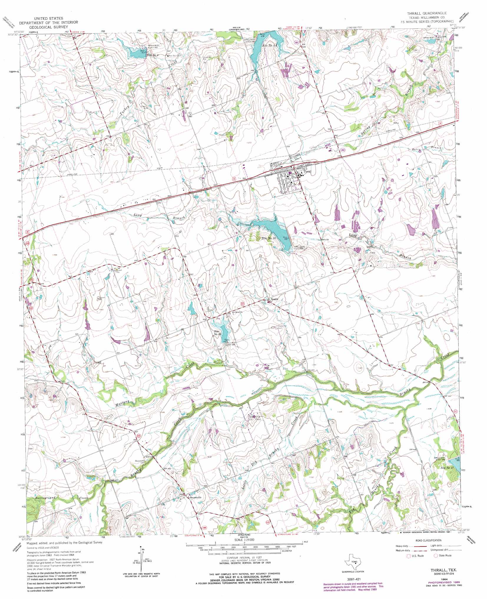
USGS Topo Quad 30097e3 - 1:24,000 scale
| Topo Map Name: | Thrall |
| USGS Topo Quad ID: | 30097e3 |
| Print Size: | ca. 21 1/4" wide x 27" high |
| Southeast Coordinates: | 30.5° N latitude / 97.25° W longitude |
| Map Center Coordinates: | 30.5625° N latitude / 97.3125° W longitude |
| U.S. State: | TX |
| Filename: | o30097e3.jpg |
| Download Map JPG Image: | Thrall topo map 1:24,000 scale |
| Map Type: | Topographic |
| Topo Series: | 7.5´ |
| Map Scale: | 1:24,000 |
| Source of Map Images: | United States Geological Survey (USGS) |
| Alternate Map Versions: |
Thrall TX 1964, updated 1966 Download PDF Buy paper map Thrall TX 1964, updated 1989 Download PDF Buy paper map Thrall TX 2010 Download PDF Buy paper map Thrall TX 2012 Download PDF Buy paper map Thrall TX 2016 Download PDF Buy paper map |
1:24,000 Topo Quads surrounding Thrall
Jarrell |
Bartlett |
Davilla |
Sharp |
Pettibone |
Weir |
Granger |
Friendship |
San Gabriel |
Rockdale West |
Hutto |
Taylor |
Thrall |
Thorndale |
Alcoa Lake |
Pflugerville East |
Coupland |
Structure |
Beaukiss |
Lexington |
Manor |
Elgin West |
Elgin East |
Mcdade |
Fedor |
> Back to 30097e1 at 1:100,000 scale
> Back to 30096a1 at 1:250,000 scale
> Back to U.S. Topo Maps home
Thrall topo map: Gazetteer
Thrall: Dams
Bland Lake Dam elevation 161m 528′Malish Lake Dam elevation 155m 508′
Soil Conservation Service Site 17 Dam elevation 142m 465′
Soil Conservation Service Site 18 Dam elevation 155m 508′
Soil Conservation Service Site 2 Dam elevation 154m 505′
Soil Conservation Service Site 33 Dam elevation 148m 485′
Winterrowd Lake Dam elevation 142m 465′
Thrall: Oilfields
Beyersville Oil Field elevation 143m 469′Noack Oil Field elevation 136m 446′
Thrall Oil Field elevation 149m 488′
Thrall: Populated Places
Beyersville elevation 160m 524′Noack elevation 153m 501′
Thrall elevation 171m 561′
Thrall: Reservoirs
Bland Lake elevation 161m 528′Malish Lake elevation 155m 508′
Site Number Eighteen elevation 148m 485′
Site Number Four A elevation 147m 482′
Site Number Seventeen elevation 142m 465′
Site Number Thirtythree elevation 148m 485′
Site Number Two elevation 159m 521′
Soil Conservation Service Site 17 Reservoir elevation 142m 465′
Soil Conservation Service Site 18 Reservoir elevation 155m 508′
Soil Conservation Service Site 2 Reservoir elevation 154m 505′
Soil Conservation Service Site 33 Reservoir elevation 148m 485′
Winterrowd Lake elevation 142m 465′
Thrall: Streams
Battleground Creek elevation 140m 459′Dry Brushy Creek elevation 130m 426′
Little Dry Brushy Creek elevation 131m 429′
Mustang Creek elevation 131m 429′
Thrall digital topo map on disk
Buy this Thrall topo map showing relief, roads, GPS coordinates and other geographical features, as a high-resolution digital map file on DVD: