Taylor Topo Map Texas
To zoom in, hover over the map of Taylor
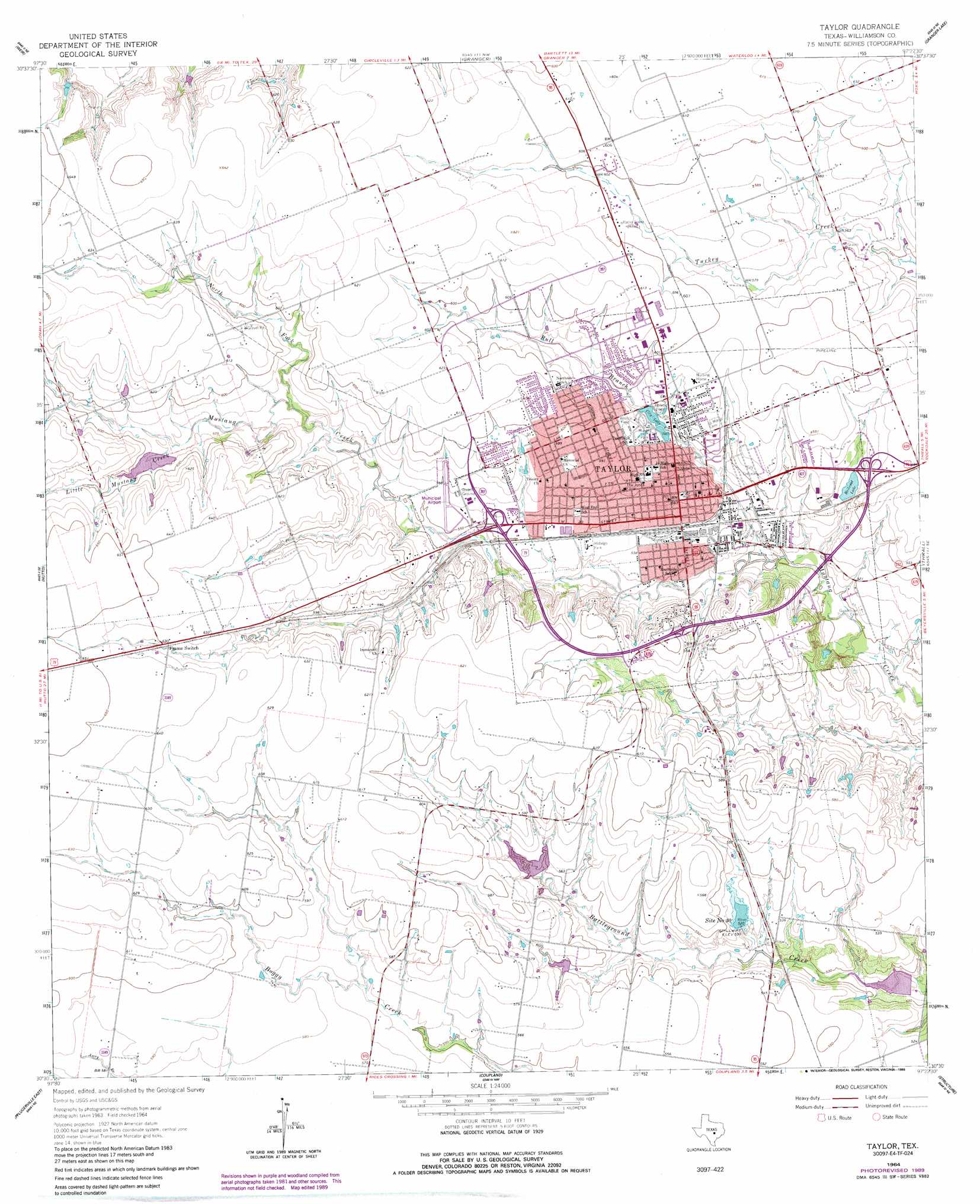
USGS Topo Quad 30097e4 - 1:24,000 scale
| Topo Map Name: | Taylor |
| USGS Topo Quad ID: | 30097e4 |
| Print Size: | ca. 21 1/4" wide x 27" high |
| Southeast Coordinates: | 30.5° N latitude / 97.375° W longitude |
| Map Center Coordinates: | 30.5625° N latitude / 97.4375° W longitude |
| U.S. State: | TX |
| Filename: | o30097e4.jpg |
| Download Map JPG Image: | Taylor topo map 1:24,000 scale |
| Map Type: | Topographic |
| Topo Series: | 7.5´ |
| Map Scale: | 1:24,000 |
| Source of Map Images: | United States Geological Survey (USGS) |
| Alternate Map Versions: |
Taylor TX 1964, updated 1966 Download PDF Buy paper map Taylor TX 1964, updated 1986 Download PDF Buy paper map Taylor TX 1964, updated 1989 Download PDF Buy paper map Taylor TX 2010 Download PDF Buy paper map Taylor TX 2013 Download PDF Buy paper map Taylor TX 2016 Download PDF Buy paper map |
1:24,000 Topo Quads surrounding Taylor
Cobbs Cavern |
Jarrell |
Bartlett |
Davilla |
Sharp |
Georgetown |
Weir |
Granger |
Friendship |
San Gabriel |
Round Rock |
Hutto |
Taylor |
Thrall |
Thorndale |
Pflugerville West |
Pflugerville East |
Coupland |
Structure |
Beaukiss |
Austin East |
Manor |
Elgin West |
Elgin East |
Mcdade |
> Back to 30097e1 at 1:100,000 scale
> Back to 30096a1 at 1:250,000 scale
> Back to U.S. Topo Maps home
Taylor topo map: Gazetteer
Taylor: Airports
Taylor Municipal Airport elevation 171m 561′Taylor: Dams
Allison Lake Dam elevation 163m 534′Soil Conservation Service Site 25 Dam elevation 177m 580′
Soil Conservation Service Site 29 Dam elevation 170m 557′
Soil Conservation Service Site 30 Dam elevation 160m 524′
Soil Conservation Service Site 31 Dam elevation 152m 498′
Taylor: Parks
Hidalgo Park elevation 166m 544′Murphy Park elevation 174m 570′
Robinson Park elevation 156m 511′
Taylor: Populated Places
Frame Switch elevation 187m 613′Taylor elevation 172m 564′
Taylor: Reservoirs
Allison Lake elevation 163m 534′City Lake elevation 168m 551′
Railroad Lake elevation 170m 557′
Site Number Thirty elevation 162m 531′
Soil Conservation Service Site 25 Reservoir elevation 177m 580′
Soil Conservation Service Site 29 Reservoir elevation 170m 557′
Soil Conservation Service Site 30 Reservoir elevation 160m 524′
Soil Conservation Service Site 31 Reservoir elevation 152m 498′
Taylor: Springs
Wilson Spring elevation 190m 623′Taylor: Streams
Bull Branch elevation 152m 498′Little Mustang Creek elevation 174m 570′
North Fork Mustang Creek elevation 171m 561′
Taylor digital topo map on disk
Buy this Taylor topo map showing relief, roads, GPS coordinates and other geographical features, as a high-resolution digital map file on DVD: