Bartlett Topo Map Texas
To zoom in, hover over the map of Bartlett
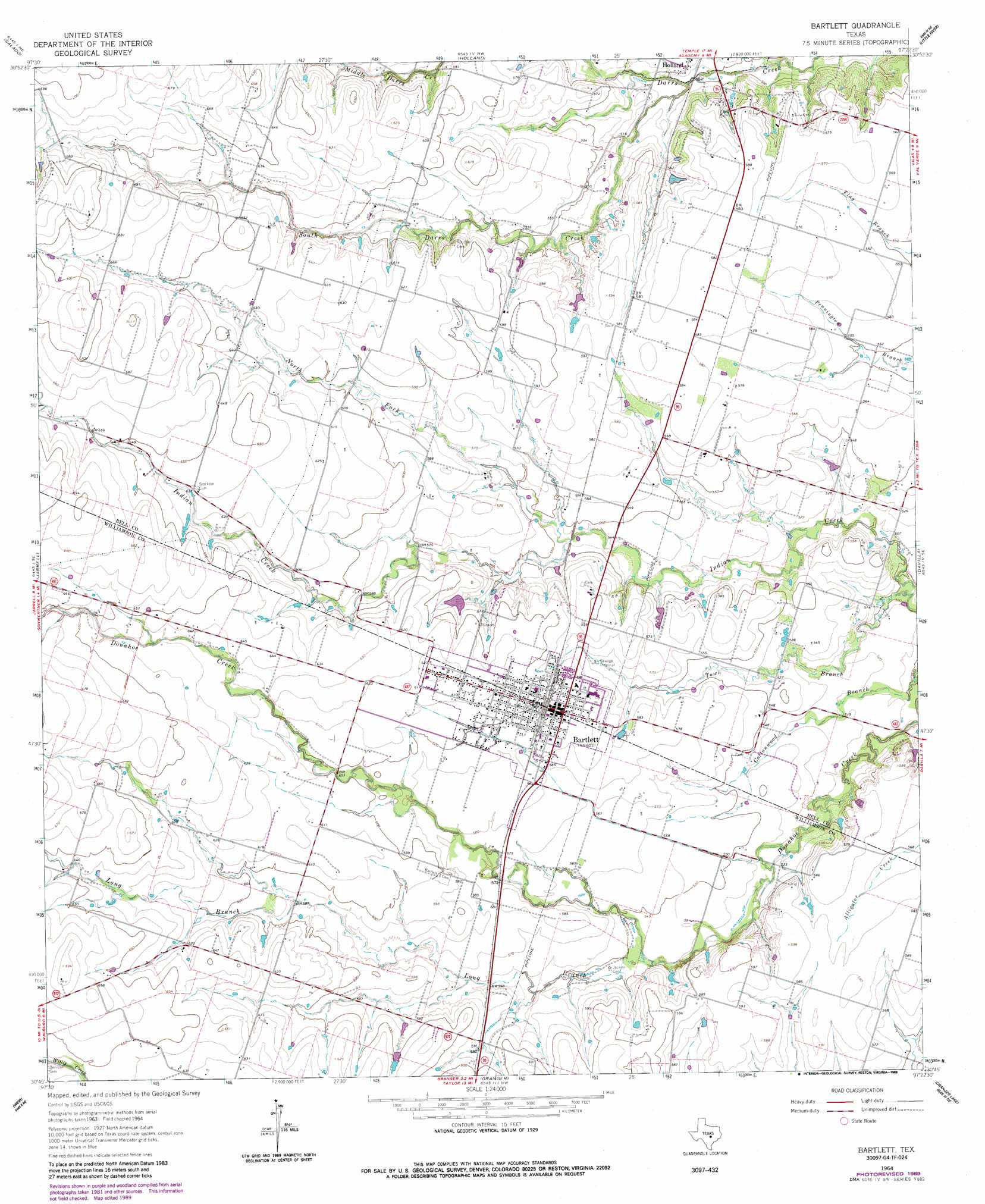
USGS Topo Quad 30097g4 - 1:24,000 scale
| Topo Map Name: | Bartlett |
| USGS Topo Quad ID: | 30097g4 |
| Print Size: | ca. 21 1/4" wide x 27" high |
| Southeast Coordinates: | 30.75° N latitude / 97.375° W longitude |
| Map Center Coordinates: | 30.8125° N latitude / 97.4375° W longitude |
| U.S. State: | TX |
| Filename: | o30097g4.jpg |
| Download Map JPG Image: | Bartlett topo map 1:24,000 scale |
| Map Type: | Topographic |
| Topo Series: | 7.5´ |
| Map Scale: | 1:24,000 |
| Source of Map Images: | United States Geological Survey (USGS) |
| Alternate Map Versions: |
Bartlett TX 1964, updated 1966 Download PDF Buy paper map Bartlett TX 1964, updated 1989 Download PDF Buy paper map Bartlett TX 2010 Download PDF Buy paper map Bartlett TX 2012 Download PDF Buy paper map Bartlett TX 2016 Download PDF Buy paper map |
1:24,000 Topo Quads surrounding Bartlett
Killeen |
Nolanville |
Belton |
Temple |
Seaton |
Youngsport |
Salado |
Holland |
Little River |
Rogers |
Cobbs Cavern |
Jarrell |
Bartlett |
Davilla |
Sharp |
Georgetown |
Weir |
Granger |
Friendship |
San Gabriel |
Round Rock |
Hutto |
Taylor |
Thrall |
Thorndale |
> Back to 30097e1 at 1:100,000 scale
> Back to 30096a1 at 1:250,000 scale
> Back to U.S. Topo Maps home
Bartlett topo map: Gazetteer
Bartlett: Populated Places
Bartlett elevation 182m 597′Bartlett: Streams
Cottonwood Branch elevation 150m 492′Long Branch elevation 165m 541′
North Fork Indian Creek elevation 162m 531′
South Darrs Creek elevation 152m 498′
Town Branch elevation 150m 492′
Bartlett digital topo map on disk
Buy this Bartlett topo map showing relief, roads, GPS coordinates and other geographical features, as a high-resolution digital map file on DVD: